
LESSON COVERS
What longitude and latitude is and how it can be used to locate countries. The different characteristics of countries including biomes, temperature and other features.
LESSON SUMMARY
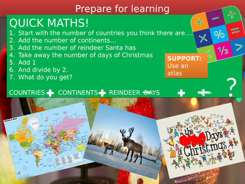
Lesson starts with a “quick maths” task where students are asked to come up with various numbers (no.of reindeer, continents etc) and add/subtract them to come up with an answer (closest wins as they rarely get it right, but have fun trying).
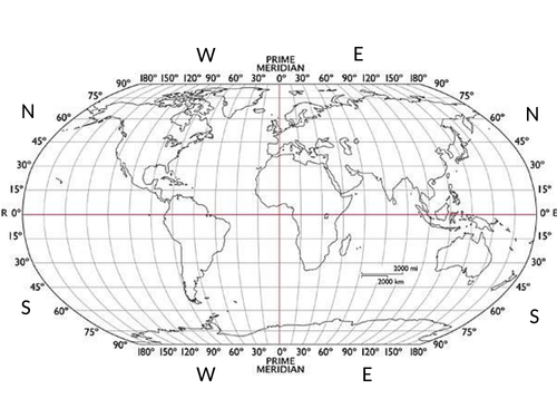
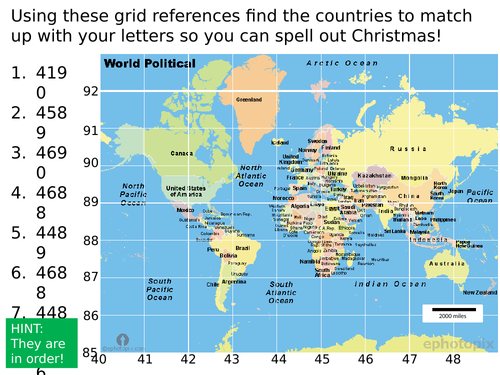
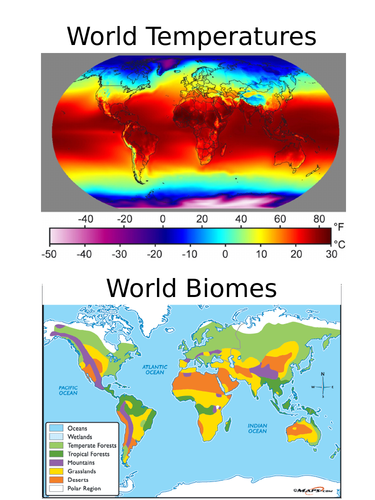
First main task introduces Longitude and Latitude using a very catchy video, and then gives students a chance to locate countries using these coordinates. The second main task asks students to use their list of countries to plot Santa’s trip and describe the places he visits using information maps (biomes, temperature and other features, as well as your own atlas if you wish).
The lesson is Christmassy themed throughout, with extension and differentiation, and there is a grid reference support task for those who are struggling with longitude and latitude.
LESSON RESOURCES
For the video click on the word “video when it is in slide show mode”. Students need to use the map template in conjunction with an atlas to work out which countries they land on (if you don’t have atlases you can print world maps from the internet). The information maps can be put up on the board if you’d rather not print in colour, equally you could ignore them altogether and use your own biome maps, or other information from your own atlases.
Something went wrong, please try again later.
This resource hasn't been reviewed yet
To ensure quality for our reviews, only customers who have purchased this resource can review it
Report this resourceto let us know if it violates our terms and conditions.
Our customer service team will review your report and will be in touch.
£3.00