

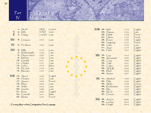
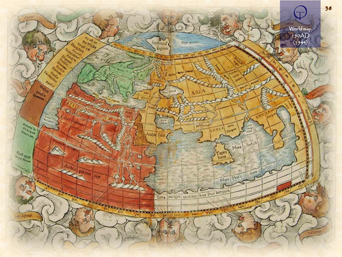
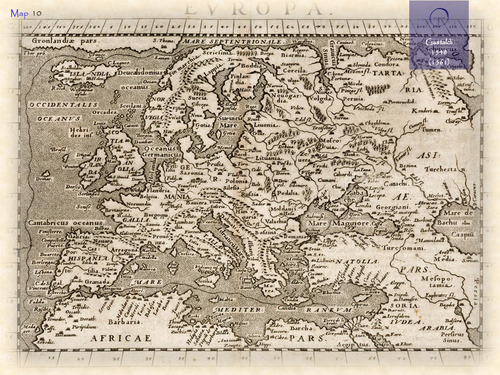
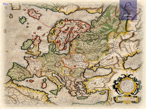
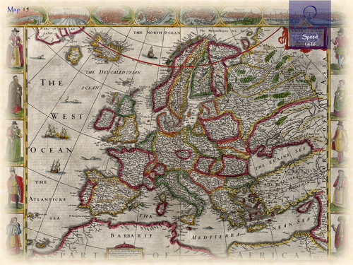
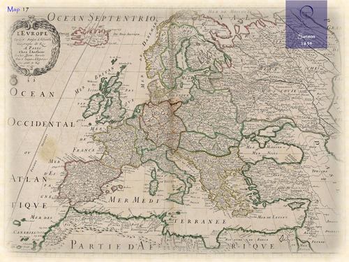
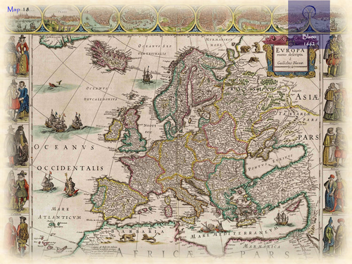
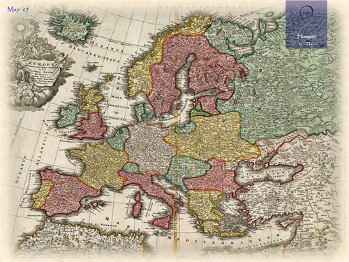
In classical Greek mythology, Europe (Europa) is the name of either a queen of Crete or Phoenician princess. It means “wide-gazing” or “broad of aspect”. Europe was already described by classical Greek scholars; e.g. Ptolemy in his Geographia (150AD). The accompanying maps were worked out again by European cartographers at the end of the 15th century. It is also depicted on the T-O based Mappa Mundi of the middle ages, being one of the 3 then known ‘old’ continents (besides Asia and Africa). The first (printed) separate maps of Europe appeared in the early 16th century. Numerous maps made by famous cartographers would follow: e.g. Gastaldi (Italy), Mercator (Belgium), Speed (England), Sanson (France), Blaeu (Netherlands) and Homann (Germany).
Something went wrong, please try again later.
This resource hasn't been reviewed yet
To ensure quality for our reviews, only customers who have purchased this resource can review it
Report this resourceto let us know if it violates our terms and conditions.
Our customer service team will review your report and will be in touch.
£5.00