

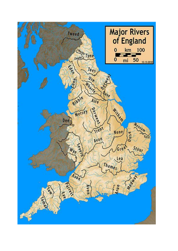

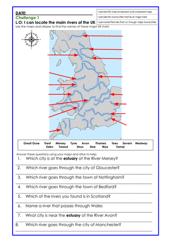
A lesson on mapwork for Y3/4 in which pupils locate and name the major rivers of the UK and some of the major towns and cities that lie along their courses. 4 river/waterway maps are included but it is highly recommended you put out a class set of good quality atlases with detailed mapping of the UK in them. Pupils will need to use their skills of comparing features across different maps in order to label the major UK rivers and answer the questions below. The activity is differentiated three ways.
Something went wrong, please try again later.
This resource hasn't been reviewed yet
To ensure quality for our reviews, only customers who have purchased this resource can review it
Report this resourceto let us know if it violates our terms and conditions.
Our customer service team will review your report and will be in touch.
£5.00