Countries of Europe Geography LessonQuick View
TeachallenjoyTeachallenjoy

Countries of Europe Geography Lesson

(0)
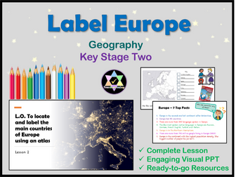
A complete geography lesson teaching the countries of Europe. Includes a thorough teaching PowerPoint, interactive activities, worksheets, answers, extensions and videos. Follow the ready-to-go PowerPoint to teach about using an atlas, Europe, European languages and flags. Use the differentiated map worksheets to enable success for every child. Extensions are provided for fast finishers and those hungry for even more. Highlights: Interactive Ready-to-go Answers on PPT Editable Teach as part of a geography unit on Europe. Check out the other lessons: Where is Europe? Compare Cities of Europe Climate of Europe Mountains of Europe Rivers of Europe
Geography - Weather and climate lessonsQuick View
CharlotteBrimerCharlotteBrimer

Geography - Weather and climate lessons

(1)
7 fully resourced lessons suitable for KS3 Geography. A wide range of activities included e.g. crosswords, odd one out tasks, exam questions, worksheets etc. Main activities are differentiated. Lessons include: What is weather and climate? How do we measure weather? How can weather data be presented? What are clouds and why does it rain? What are depressions and anticyclones? What is the climate of the UK? How does climate vary across the world?
Christmas Atlas Skills - GeographyQuick View
AcornTeachingResourcesAcornTeachingResources

Christmas Atlas Skills - Geography

(3)
Fun and visually attractive, this Christmas themed atlas work sheet is great for end of term group activities. All you need is an atlas. A double sided Christmas themed activity sheet. Activities include: finding capital cities, finding countries, locating oceans, using data sets, drawing flags and using geographic language to describe locations - most with a festive theme. Also: draw a snowman, draw a Christmas tree and name all nine of Santa's reindeer. Included is a display slide with learning objectives and outcomes, an activity slide with instructions, teacher notes and a lesson plan. This resource was featured by the TES in their blog last year, and recieved a 5* review.
Geography Mapping Skills Work BookletQuick View
kstrick92kstrick92

Geography Mapping Skills Work Booklet

(0)
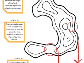
This work booklet guides pupils through vital mapping skills by giving them a ‘how to guide’ as well as a chance to practise their new skills in a variety of questions and tasks. The booklet is aimed at children in upper KS2 and lower KS3 and can be easily adapted to suit. The booklet can be given at the end of a unit of work or spread out across several lessons. The mapping skills included in this work booklet include: 4 Figure Grid References 6 Figure Grid References Compass Directions Contour Lines Calculating Scale Each topic above includes a one-page ‘how to guide’ and well as a corresponding 'activity sheet.' Download is in pdf format.
Geography The UK KS1Quick View
hollyjack1hollyjack1

Geography The UK KS1

(0)
Geography activities for year 1 and year 2. Teaching Power Point and print and go activities to teach The UK unit in KS1. **This product includes: ** Planning and resources for 2 weeks worth of lessons. A power point for each lesson, plus an end of lesson quiz. Printable activities for each lesson. Lesson 1 Name and locate the 7 continents and 5 oceans Choice of 4 worksheets Lesson 2 Name, locate and identify characteristics of the 4 UK countries and capital cities Activities - Colour UK Countries, label capital cities, label seas and oceans, UK landmarks cut and stick Lesson 3 Use basic geographical language Match words and pictures Label the locations Geographical questions Lesson 4 and 5 Identify physical and human features Local walk worksheet, Where I live, Draw a map, draw/label/sort physical and human features. Lesson 6 Use simple compass directions Label a map, directions, my school Lesson 7 Understand geographical differences and similarities Compare locations, compare countries, Lesson 8 Identify daily and seasonal weather patterns in the UK Daily weather charts Seasonal sorting Lesson 9 Identify hot and cold areas of the world Hot and cold climates of the world sorting Lesson 10 Assessment Quiz
Egypt Geography PlanQuick View
sophiebee34sophiebee34

Egypt Geography Plan

(1)
A Year 4 Egypt geography plan. There is potential to adapt this plan for cross curricular links. Has the plan for around last about 6 weeks, include detailed and differentiated activities. Easily adaptable for other year groups. Plan only included option to purchase plan and all resources for £3 is available. Week 1 - Locate Egypt on a map Week 2 - Features of a river Week 3 - Why was the River Nile important? Week 4 - Importance of farming in Egypt Week 5 - Identify the main cities in Egypt Week 6 - Creating a travel brochure
Geography UK KS2Quick View
hollyjack1hollyjack1

Geography UK KS2

(0)
UK Geography unit for KS2 48 pages + 56 page PPT and planning. Suitable for year 3, year 4 Are you a year 3 or 4 teacher? This UK Geography product includes everything you will need to teach this unit. Life couldn’t be easier with these print and go activities. Includes: 2 weeks easy to follow planning. A 56 page power point to use as part of your teaching. Each lesson on the power point includes an end of lesson quiz to use as a plenary. Lesson 1 - Countries and capital cities of UK - colour countries, label cities ( differentiated 2 ways) Lesson 2 - Regions and counties of UK - Label regions, Label counties (10) (each differentiated 2 ways) Regions Quiz Lesson 3 - Rivers and seas - label rivers and seas 2 x differentiated Lesson 4 - UK Landmarks - famous landmarks cut and stick activity - 2 x differentiated drawing activity - 2 x differentiated Lesson 5 - Physical and Human Features - cut and stick activity - 2 x differentiated drawing physical features x 2 diff, drawing human features x 2 diff Lesson 6 - Topographic features - cut and stick activity x 2 diff Lesson 7 - Land use - 2 x diff activity Lesson 8 - Vocabulary - vocab and definition matching activity Lesson 9 - Aspects of UK - Comprehension and questions Lesson 10 - End of Unit Assessment Quiz
Scandinavia Geography Unit KS2Quick View
TeachallenjoyTeachallenjoy

Scandinavia Geography Unit KS2

7 Resources
7 Quality lessons covering all aspects of life in Scandinavia and National Curriculum Geography learning objectives. Powerful images, video links, resources, detailed plans and no preparation needed. Enjoy my other Scandinavian Units: Scandinavian Art Unit Writing Scandinavian Christmas Stories Check out my other popular Geography units: Yosemite Europe
Year 2 Geography Assembly ScriptQuick View
StephanieCapperStephanieCapper

Year 2 Geography Assembly Script

(0)
This is a fun Geography assembly for year 2. It has 2 catchy songs with youtube links and one hymn for if you work in a Catholic or C of E school. It covers continents, oceans and compass directions. There are so many opportunities for fun acting and miming in this script too depending on the ability of your class. Hopefully it saves you some time for planning your own assemblies.
The Middle East - Geography Knowledge Organiser!Quick View
TandLGuruTandLGuru

The Middle East - Geography Knowledge Organiser!

(0)
This clear, detailed and visually-appealing resource offers a complete reference point for students revising knowledge relating to the Middle East, as a part of their study of physical and human geography. It contains comprehensive sections on: Overview and map; Regions and Countries of the Middle East; Longest Rivers; Highest Mountains; Human Geography Features; Physical Geography Features; Key Vocabulary. The resource is designed to be printed onto either A4 or A3, and is provided as both a PDF and a Word version (so that you can edit if you want to). All images used are licensed for commercial use and are cited on a separate document (included). The resource is most suitable for students in KS3 (or potentially upper KS2).
Rivers of the UK - KS2 GeographyQuick View
tejlandertejlander

Rivers of the UK - KS2 Geography

(0)
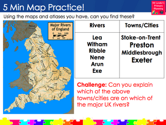
A lesson on mapwork for Y3/4 in which pupils locate and name the major rivers of the UK and some of the major towns and cities that lie along their courses. 4 river/waterway maps are included but it is highly recommended you put out a class set of good quality atlases with detailed mapping of the UK in them. Pupils will need to use their skills of comparing features across different maps in order to label the major UK rivers and answer the questions below. The activity is differentiated three ways.
Mexico GeographyQuick View
princess_samprincess_sam

Mexico Geography

(0)
A series of 4 lessons and resources designed for upper KS2 that focus on the Geography of Mexico. Lessons explore: Geographical location The chiuauan desert Human geography and population Can be used in line with Cornerstones Curriculum ‘Hola! Mexico’
KS3 Geography Hazards SOWQuick View
vhammond1vhammond1

KS3 Geography Hazards SOW

(1)
A fully resourced SOW covering hazards aimed at KS3 Geography pupils. Covers structure of earth, tectonics, earthquakes, tsunamis and volancanoes. Includes responsive and progressive assessments witha knowledge check test at the end.
Comparison of the UK and Greece - Geography Knowledge Organiser!Quick View
TandLGuruTandLGuru

Comparison of the UK and Greece - Geography Knowledge Organiser!

(0)
This clear, detailed and visually-appealing resource offers a complete reference point for students revising knowledge relating to the UK and Greece, as a part of their study of their KS2 place, human and physical geography. It contains comprehensive sections on: Key Facts Overview and Maps; Physical Geography Comparison; Human Geography Comparison; 10 Key Comparison Facts; Key Vocabulary. The organiser is designed to help children to learn the relevant place, human and physical geography knowledge from the KS2 Geography National Curriculum: -‘understand geographical similarities and differences through the study of human and physical geography of a region of the United Kingdom and a region in a European country.’ -‘physical geography, including: climate zones, rivers, mountains, volcanoes and earthquakes’ -‘human geography, including: types of settlement and land use, economic activity including trade links, and the distribution of natural resources including energy.’ The resource is designed to be printed onto A3, and is provided as both a PDF and a Word version (so that you can edit if you want to). All images used are licensed for commercial use and are cited on a separate document (included).
Climate of Europe Geography Lesson KS2Quick View
TeachallenjoyTeachallenjoy

Climate of Europe Geography Lesson KS2

(0)
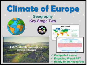
A complete lesson on the climate of Europe, focusing on map skills and locational knowledge. Includes a thorough teaching PowerPoint, video links, interactive activities, worksheets, answers, extensions and challenges. This lesson is ready-to-go, written for a year 3 class, so suitable for years 3 and 4, but easily adaptable for years 5 and 6 (the extension tasks are suitably challenging). Highlights: Differentiated Higher level questioning Modelling Scaffolding Easy to mark Written as part of a unit on Europe. Check out my other popular Geography lessons on Europe: Where is Europe? Label Countries of Europe Lesson Compare Cities in Europe Mountains of Europe Rivers of Europe All reviews welcome.
Mountains of Europe Geography Lesson KS2Quick View
TeachallenjoyTeachallenjoy

Mountains of Europe Geography Lesson KS2

(0)
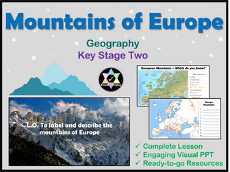
A complete geography lesson on the mountains of Europe. Includes a thorough teaching PowerPoint, interactive activities, worksheets, video, extensions and games. Follow the ready-to-go PowerPoint to teach about the mountain ranges of Europe. Cover: Formation Map work Climate Vegetation Facts Famous peaks Planned for years 3 or 4, easily adaptable for years 5 and 6. Differentiated recording tasks provided with two extensions. Highlights: Photo analysis starter activity Activities for all styles of learners Scaffolded learning Check out my other popular Geography lessons on Europe: Where is Europe? lesson pack Countries of Europe lesson pack Compare Cities of Europe lesson pack Climate of Europe lesson pack Rivers of Europe lesson pack
Geography - TornadoesQuick View
carlfarrant88carlfarrant88

Geography - Tornadoes

(0)
A task sheet and QR code link to differentiated videos describing how tornadoes are formed. Lesson is linked with literacy whereby pupils record notes whilst watching the videos. Videos have been created by users on YouTube.
Map Skills Homework Booklet - GeographyQuick View
sbladensbladen

Map Skills Homework Booklet - Geography

(32)
A map skills homework booklet for use with KS3 Geography classes. An amalgamation of worksheets I have gathered over the years to create a comprehensive and easy to mark Map Skills Homework Booklet!
What is Geography?Quick View
Mr_HumanitiesMr_Humanities

What is Geography?

(1)
A fully editable lesson introducing students into what is Geography? The lesson includes: Circle map task Defintions Categorising types of Geography Plenary- categorising elements of Geography through images