

**WALT: Explain the seasonal variations in temperature, pressure and wind belts by linking the influence of latitude and land/sea variations **
Lesson focuses on the following parts of the syllabus;
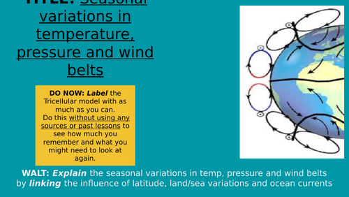
Global distribution of surface temperature and pressure
Use a world map to show the distribution of isotherms for summer and winter,
Use a world map to show the distribution of isobars for summer and winter
Learners identify similarities and differences across the globe
Planned tightly in line with the CIE syllabus.
The lesson is ready to teach.
This lesson was made during online learning but would not be time consuming to adapt for any environment.
I hope you find this useful and consider purchasing future lessons for this unit which I will make available soon. Feedback welcome and please leave a review!
Something went wrong, please try again later.
Great resource. Engaging and informative. Follows the specification well.
Report this resourceto let us know if it violates our terms and conditions.
Our customer service team will review your report and will be in touch.
£2.50