
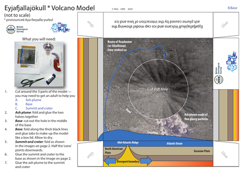
A simple schematic model from the British Geological Survey of the Eyjafjallajökull volcano summit, crater and ash plume, Iceland, as seen on Blue Peter’s Make It. It is intended as a simple guide to understanding how volcanoes such as Eyjafjallajökull are influenced by tectonic plate activity along the Mid-Atlantic Ridge. It also shows the route of the floodwater from melted glacier ice to the sea. The height of the volcano is highly exaggerated.
Requires scissors and glue.
For more geoscience information and resources for learners visit Discovering Geology from the British Geological Survey https://www.bgs.ac.uk/discovering-geology/
Something went wrong, please try again later.
Excellent resource. Thank you very much. Excellent task for Friday period 5.
Colourful and clear model, particularly useful for students who may struggle to make models from scratch. The factsheets on the website are fantastic supporting material for students to use.
Report this resourceto let us know if it violates our terms and conditions.
Our customer service team will review your report and will be in touch.
£0.00