


This is a comprehensive set of activities to work on geography about 14 European countries. It is possible to change the selection of countries by adding extra passports, flags and numbers on the board.
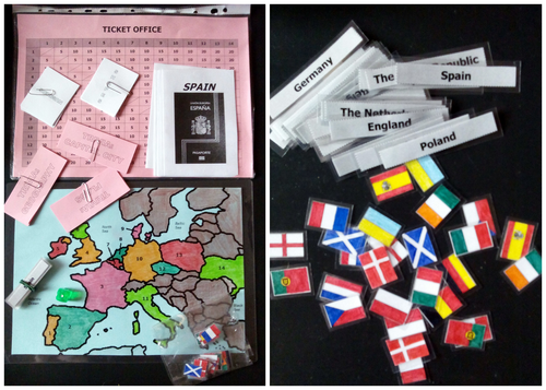
You can view most of the game components in this picture: https://goo.gl/JkQUgf
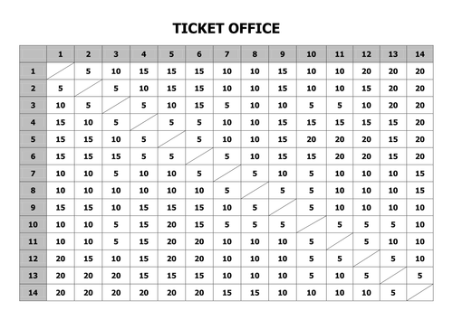
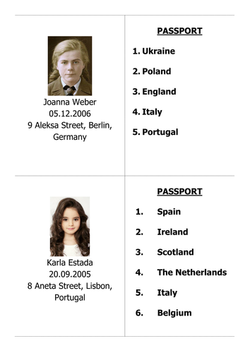
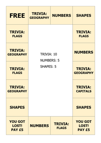
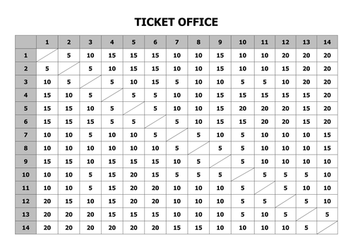
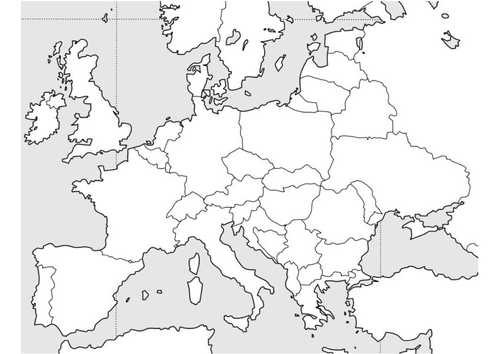
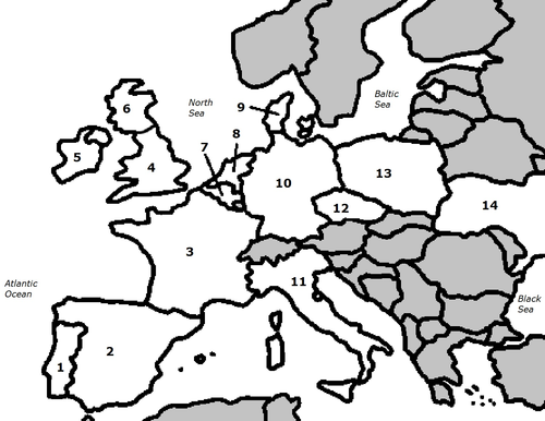
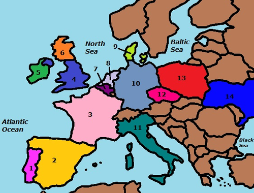
The main game is about taking a trip around Europe. Players each select a passport which contains the identity of a child who they will become during the game. The passport also contains a list of countries to which they must travel in order to win the game. To be fair, each passport will require the same total amount in order to win. To travel, players must earn money by answering trivia questions about these 14 countries, which can then be spent on flights to different countries on their list. Trivia questions include physical geography (location and shape), flags and capital cities. All game components are provided in PDF and DOCX format for ease of printing and also to allow you to customise the game to include different countries and/or different trivia questions.
This game is suitable for lower primary pupils or older ESL or SEN children. Full rules are provided in PDF form in the download.
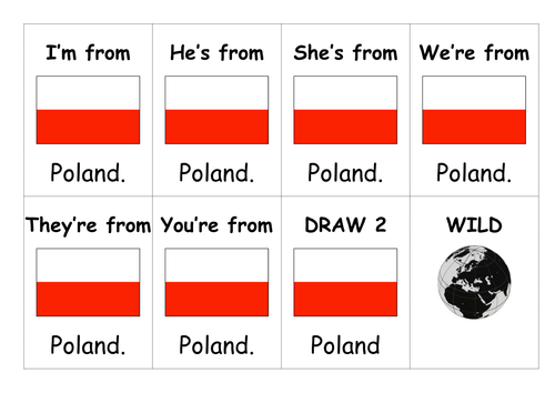
The secondary game provided is basically UNO, except uses flags. It is intended to help children practice correct forms of 'be' in the present simple and recognise some flags. Game play is identical to UNO.
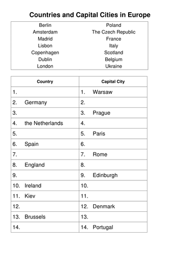
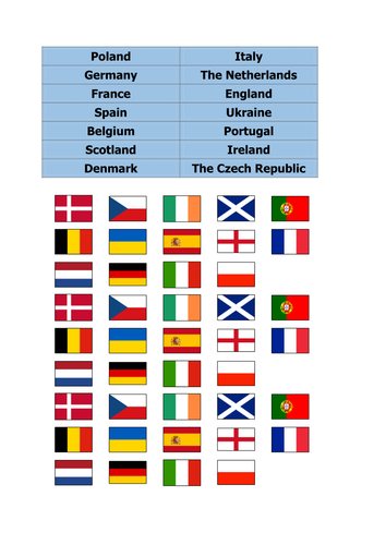
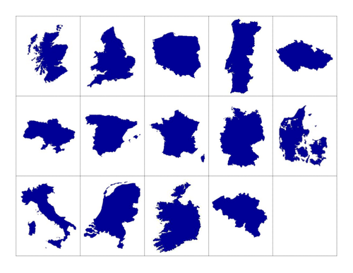
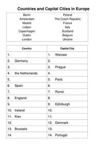
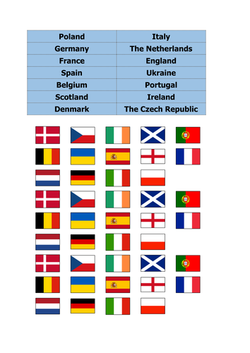
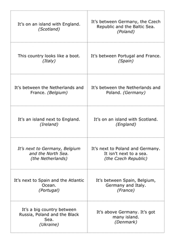
Also provided are corresponding cut outs and worksheets about these countries. Cut outs can be used to practice capital cities, then further practiced on the worksheets. Another worksheet has pupils colour the flags according to a description.
You can view most of the game components in this picture: https://goo.gl/JkQUgf
The main game is about taking a trip around Europe. Players each select a passport which contains the identity of a child who they will become during the game. The passport also contains a list of countries to which they must travel in order to win the game. To be fair, each passport will require the same total amount in order to win. To travel, players must earn money by answering trivia questions about these 14 countries, which can then be spent on flights to different countries on their list. Trivia questions include physical geography (location and shape), flags and capital cities. All game components are provided in PDF and DOCX format for ease of printing and also to allow you to customise the game to include different countries and/or different trivia questions.
This game is suitable for lower primary pupils or older ESL or SEN children. Full rules are provided in PDF form in the download.
The secondary game provided is basically UNO, except uses flags. It is intended to help children practice correct forms of 'be' in the present simple and recognise some flags. Game play is identical to UNO.
Also provided are corresponding cut outs and worksheets about these countries. Cut outs can be used to practice capital cities, then further practiced on the worksheets. Another worksheet has pupils colour the flags according to a description.
Get this resource as part of a bundle and save up to 65%
A bundle is a package of resources grouped together to teach a particular topic, or a series of lessons, in one place.
Something went wrong, please try again later.
This resource hasn't been reviewed yet
To ensure quality for our reviews, only customers who have purchased this resource can review it
Report this resourceto let us know if it violates our terms and conditions.
Our customer service team will review your report and will be in touch.
£4.00