
A set of 30 cards great for use as a popular game at the start or end of lessons.
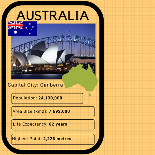
Great for laminating to use in lessons or as part of an eye-catching display board. Each country card includes, the capital city, population, area of the country, life expectancy and highest point (altitude).
This high-quality pdf resource consists of a copy of a selection of countries from each colour-coded) continent, including:
Oceania (Australia, New Zealand, Fiji, Papua New Guinea
Asia (China, Thailand, Japan, South Korea, India, Saudi Arabia)
Europe (UK, France, Spain, Germany, Italy, Switzerland)
Africa (Egypt, Tanzania, South Africa, Morocco, Zimbabwe, Ivory Coast)
North America (Canada, Mexico, USA, Cuba)
South America (Brazil, Argentina, Colombia, Ecuador)
Something went wrong, please try again later.
This resource hasn't been reviewed yet
To ensure quality for our reviews, only customers who have purchased this resource can review it
Report this resourceto let us know if it violates our terms and conditions.
Our customer service team will review your report and will be in touch.
£1.50