Suitable for SEN, Early Years, Primary, Preschoolers.
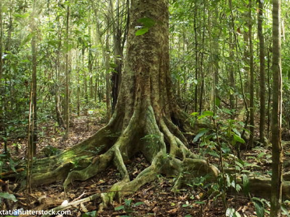
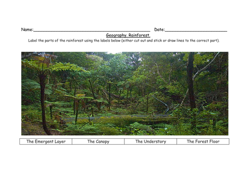
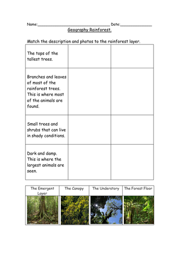
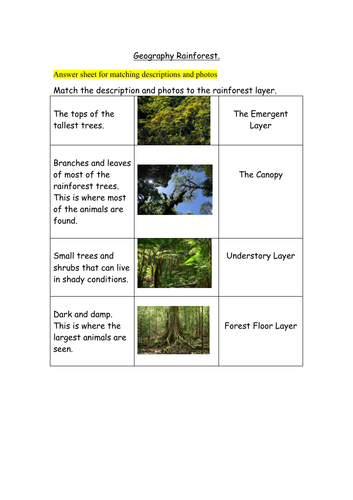
Label the 4 different layers of the Rainforest.
Match the description with the correct photo and label.
Suitable for all abilities.
Lower abilities- cut out labels and stick in correct places.
Middle abilities- cut out photos and stick. Copy labels.
Higher abilities- cut out photos and stick. Write own labels.
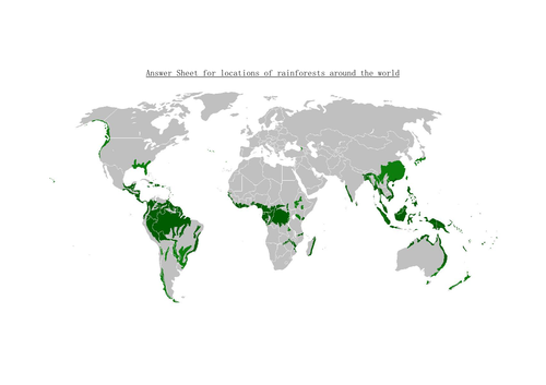
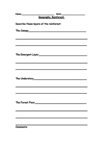
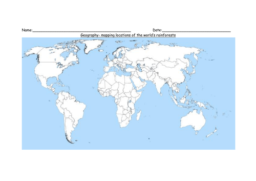
Includes an extension worksheet for students to write their own descriptions of the 4 layers of the rainforest and a mapping exercise for students to find where rainforests are located around the world and colour in on the map (map be best if printed on A3).
Get this resource as part of a bundle and save up to 30%
A bundle is a package of resources grouped together to teach a particular topic, or a series of lessons, in one place.
Bundle
Geography Deforestation, Rainforest and Weather Chart SEN, Early Years, Primary and Preschoolers
**Deforestation** unit of work. No prep required. Worksheets: what is deforestation? (students match pictures to before, during and after). Why deforestation occurs (students cut and stick to show which are natural disasters and which are human causes of deforestation). Where is deforestation happening (map showing where forests were, and what is left- students label named areas). How it happens (students cut and stick to show areas of deforestation caused by slash and burn or clear cutting). Impact on different areas (students match terms and descriptions). Reducing deforestation (students select from a choice, and are encouraged to come up with their own examples). Revision/ Test- contains a question from each area to check understanding and to revise the topic. Choice of answers for some questions, while others need a bullet point or sentence to be written (lower abilities may need a scribe for this). Label the 4 different layers of the **Rainforest.** Match the description with the correct photo and label. Lower abilities- cut out labels and stick in correct places. Middle abilities- cut out photos and stick. Copy labels. Higher abilities- cut out photos and stick. Write own labels. Includes an extension worksheet for students to write their own descriptions of the 4 layers of the rainforest and a mapping exercise for students to find where rainforests are located around the world and colour in on the map (map be best if printed on A3). **Weather** Use the **chart (print in A3)** to record the weather for 6 weeks in your local area, or use the 2nd chart to compare 2 places or countries. Includes 2 question worksheets for higher abilities, 1 being a recap and summary worksheet of their findings comparing 2 places/countries. For lower ability levels- includes pictures of sunshine, clouds, snow, rain, storm, fog, frost, rainbow, and wind to help with understanding. Allows them to observe the days weather and think about what the weather will be like next week. For higher ability levels- space to write the weather they can see and allows them to predict what they think the weather will be next week. Children could also take their own photos of the weather and stick them on the chart. A clip from BBC weather showing the latest weather forecast could be shown during the lesson, and children could be encouraged to look at different areas of the UK or another country to compare the weather in different regions. Use the 2 worksheets to compare understanding before carrying out the observations and after to check learning and understanding.
£4.00
Bundle
Maps, Environmental Awareness, Weather, Rainforest for SEN, Early Years
Maps and coordinates, Environmental Awareness (natural and manmade) Weather Chart (prediction, observation and comparing 2 different areas or regions).], Rainforest labelling and matching descriptions.<br /> <br /> Geography Environmental Awareness (natural and manmade)<br /> 3 differentiated worksheets for natural and manmade environments, plus another to check learning.<br /> <br /> Geography- map and coordinates. <br /> Includes 18 images to cut out and stick on a grid with basic coordinates (A1- E5). Works best if map grid is printed on A3.<br /> Higher abilities can draw their own island, then select and stick on the images of the places that they want on their island. There is also a worksheet for students to then find and write the coordinates of each image.<br /> <br /> Geography Weather Chart (prediction, observation and comparing)<br /> Use the chart to record the weather for 6 weeks in your local area, or use the 2nd chart to compare 2 places or countries. Includes 2 question worksheets for higher abilities, 1 being a recap and summary worksheet of their findings comparing 2 places/countries.<br /> A clip from BBC weather showing the latest weather forecast could be shown during the lesson, and children could be encouraged to look at different areas of the UK or another country to compare the weather in different regions. Use the 2 worksheets to compare understanding before carrying out the observations and after to check learning and understanding.<br /> <br /> Geography Rainforest labelling and matching descriptions.<br /> Label the 4 different layers of the Rainforest.<br /> Match the description with the correct photo and label.<br /> Includes an extension worksheet for students to write their own descriptions of the 4 layers of the rainforest and a mapping exercise for students to find where rainforests are located around the world and colour in on the map (map be best if printed on A3).
£4.49
Something went wrong, please try again later.
This resource hasn't been reviewed yet
To ensure quality for our reviews, only customers who have purchased this resource can review it
Report this resourceto let us know if it violates our terms and conditions.
Our customer service team will review your report and will be in touch.
£1.50