


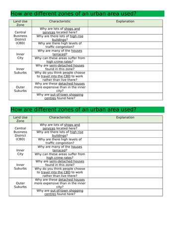
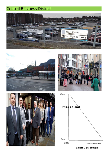
This contains a fully resourced, differentiated lesson on how land is used in urban areas, paying particular attention to the Burgess Model. The main part of the lesson involves students drawing a sketch of the Burgess Model accompanied by a written paragraph describing what it shows, then working in pairs to study visual information sheets of each zone (CBD, Inner City, Inner Suburbs, Outer Suburbs) to explain the characteristics of each zone - this involves a very enquiry based approach and a heavy emphasis on them having to justify their answers based on the visual evidence provided).
Learning Objectives: To describe the different zones that can be found in urban areas. To explain how these zones can be used and why they are located there.
Get this resource as part of a bundle and save up to 46%
A bundle is a package of resources grouped together to teach a particular topic, or a series of lessons, in one place.
Something went wrong, please try again later.
This resource hasn't been reviewed yet
To ensure quality for our reviews, only customers who have purchased this resource can review it
Report this resourceto let us know if it violates our terms and conditions.
Our customer service team will review your report and will be in touch.
£4.00