
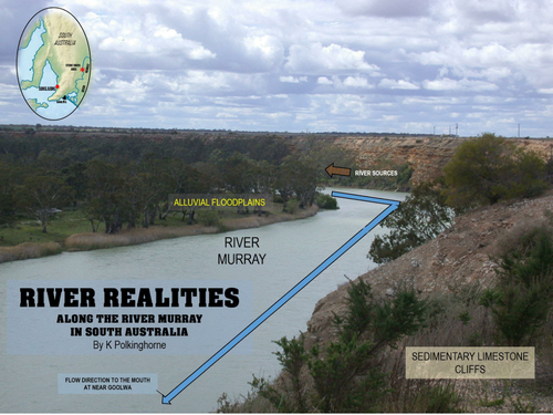
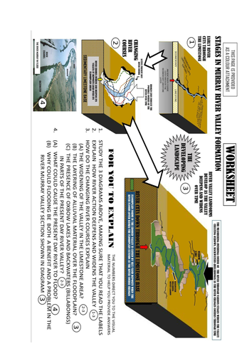
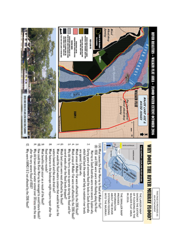
Although this unit has an Australian focus the processes and landforms are valid for general river studies. This unit begins with the photograph of the Walker Flat area of the River Murray. It then broadens into a n investigation of formation (sedimentary limestone) and the action of river activity resulting in the deepening and widening of the valley. Human uses of the different parts of the map area broaden the study. Students can work out the erosional and depositional processes in the landscape. A worksheet and question/interpretation sheets (in colour and black and white are provided for duplication and handouts. A related final page is given to show the interconnection between Cyclone Debbie and the flooding of Queensland/Northern New South Wales coastal rivers (March/April 2017)
Something went wrong, please try again later.
This resource hasn't been reviewed yet
To ensure quality for our reviews, only customers who have downloaded this resource can review it
Report this resourceto let us know if it violates our terms and conditions.
Our customer service team will review your report and will be in touch.
£0.00