

Tour the Golden Gate Bridge with Google Earth (03:29)
Make a virtual field trip to one of North America’s most famous landmarks; the Golden Gate Bridge. You will be using Google Earth to watch a pre-recorded tour of the famous bridge that crosses the Golden Gate.
The product includes a document of 16 talking points and interesting facts about one of the seven wonders of the modern world.
It also provides a pdf that describes what you are seeing based on the corresponding minutes in the video. This is so you can pause the tour at the given time stamp and let the class know what they are looking at.
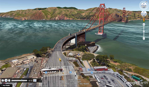
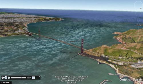
For example, the document says at the 52 second mark, “:52 – 1:05 - This angle provides a good view of how the Golden Gate connects the Pacific Ocean and the San Francisco Bay. The Golden Gate is the strait of water the bridge crosses. The tiny island in the middle of the bay is home to Alcatraz, the infamous prison.”
The tour begins with a view of North America from outer space. You are then zoomed in to the site’s location to see it from a few different viewpoints. The angles are chosen so the students can get a good idea of the bridge’s location in the San Francisco Bay area and how the strait connects the Pacific Ocean to the bay. Next, the camera comes in closer for some viewpoints of the bridge from San Francisco and Marin County. Then, the tour goes to the middle of the bridge in street view. Once in street view, the camera rotates 360 degrees around. Finally, you are taken back out to a long shot of North America.
To watch, all you have to do is click on the file, Google Earth will open and the tour will begin. * Your computer must have Google Earth to watch these tours.
Feel free to visit some other famous landmarks in North America.
1. The Grand Canyon (1:37)
2. The Golden Gate Bridge (3:29)
3. Chichen Itza (1:36)
4. Niagara Falls (1:21)
5. Panama Canal (3:02)
6. Statue of Liberty (2:07)
7. Ole Faithful in Yellowstone National Park (1:26)
8. Gateway Arch in St. Louis, Missouri (1:06)
Here are a few links to some helpful tutorials on how to use Google Earth.
How to Use Google Earth For Beginners – by Rick Castellini on YouTube - https://www.youtube.com/watch?v=bgjMSBXsFZQ
Beginner Google Earth Tutorial Videos by Google - https://www.google.com.ni/earth/learn/beginner.html
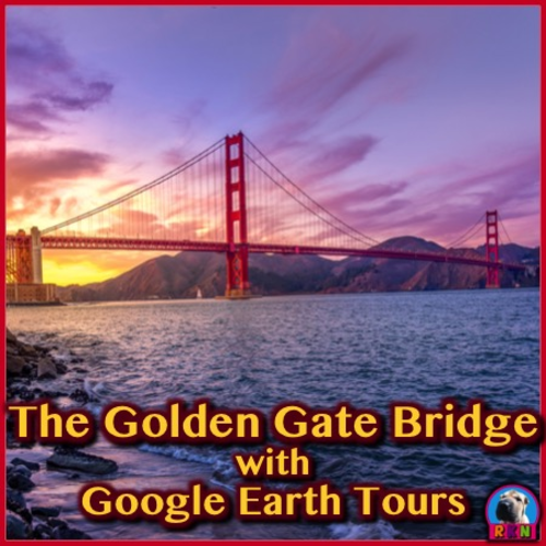
The cover photo is a Creative Commons Attribution 2.0 photo by Umer Sayyam- found at this link. - https://unsplash.com/photos/SHP1t8EduMY
Google Earth Tour Map Attribution
Map Data: Google, Image Landsat / Copernicus
Data SIO, NOAA, U.S. Navy, NGA, GEBCO
Image IBCAO
Image U.S. Geological Survey
US DEPT of State Geographer
Data LDEO-Columbia, NSF
Data MBARI
Data CSUMB SFML CA OPC
© 2017 Google
Make a virtual field trip to one of North America’s most famous landmarks; the Golden Gate Bridge. You will be using Google Earth to watch a pre-recorded tour of the famous bridge that crosses the Golden Gate.
The product includes a document of 16 talking points and interesting facts about one of the seven wonders of the modern world.
It also provides a pdf that describes what you are seeing based on the corresponding minutes in the video. This is so you can pause the tour at the given time stamp and let the class know what they are looking at.
For example, the document says at the 52 second mark, “:52 – 1:05 - This angle provides a good view of how the Golden Gate connects the Pacific Ocean and the San Francisco Bay. The Golden Gate is the strait of water the bridge crosses. The tiny island in the middle of the bay is home to Alcatraz, the infamous prison.”
The tour begins with a view of North America from outer space. You are then zoomed in to the site’s location to see it from a few different viewpoints. The angles are chosen so the students can get a good idea of the bridge’s location in the San Francisco Bay area and how the strait connects the Pacific Ocean to the bay. Next, the camera comes in closer for some viewpoints of the bridge from San Francisco and Marin County. Then, the tour goes to the middle of the bridge in street view. Once in street view, the camera rotates 360 degrees around. Finally, you are taken back out to a long shot of North America.
To watch, all you have to do is click on the file, Google Earth will open and the tour will begin. * Your computer must have Google Earth to watch these tours.
Feel free to visit some other famous landmarks in North America.
1. The Grand Canyon (1:37)
2. The Golden Gate Bridge (3:29)
3. Chichen Itza (1:36)
4. Niagara Falls (1:21)
5. Panama Canal (3:02)
6. Statue of Liberty (2:07)
7. Ole Faithful in Yellowstone National Park (1:26)
8. Gateway Arch in St. Louis, Missouri (1:06)
Here are a few links to some helpful tutorials on how to use Google Earth.
How to Use Google Earth For Beginners – by Rick Castellini on YouTube - https://www.youtube.com/watch?v=bgjMSBXsFZQ
Beginner Google Earth Tutorial Videos by Google - https://www.google.com.ni/earth/learn/beginner.html
The cover photo is a Creative Commons Attribution 2.0 photo by Umer Sayyam- found at this link. - https://unsplash.com/photos/SHP1t8EduMY
Google Earth Tour Map Attribution
Map Data: Google, Image Landsat / Copernicus
Data SIO, NOAA, U.S. Navy, NGA, GEBCO
Image IBCAO
Image U.S. Geological Survey
US DEPT of State Geographer
Data LDEO-Columbia, NSF
Data MBARI
Data CSUMB SFML CA OPC
© 2017 Google
Something went wrong, please try again later.
This resource hasn't been reviewed yet
To ensure quality for our reviews, only customers who have purchased this resource can review it
Report this resourceto let us know if it violates our terms and conditions.
Our customer service team will review your report and will be in touch.
$3.99