
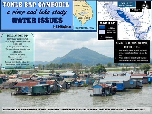
Potentially this unit has multiple uses across age ranges from primary to secondary levels in geography and environmental studies. The lake and connecting river have rather unique hydrology in significant variations in water level and reverses flows of the Tonle Sap River linking the lake with the Mekong River. One suggested approach is to use this as an information gathering tutorial so that students can fill-in the worksheet (at the end of the unit) as the pages are screened. This unit supports the Australian geography curriculum at senior levels - Unit 1 - Natural and ecological hazards (flooding); Unit 2 - Sustainable places - Year 6 - Asia - geographical diversity; Year 10 Asia - Inland water study. The very large Tonle Sap Lake is the largest freshwater lake in SE Asia and supports about 2 million people around its perimeter. It also has historical significance because the presence of this lake and the in-flowing Siem Reap River had relevance for the locating of the large sandstone cities within the Angkor region during the development of the Khmer Empire. Join the trip along the Tonle Sap River. Cross the Tonle Sap Lake and gain some understanding of the importance of this inland water system for the people of Cambodia. The attached worksheets in general and pdf form are essential additions if you choose to treat this resource material as a tutorial.
Something went wrong, please try again later.
This resource hasn't been reviewed yet
To ensure quality for our reviews, only customers who have downloaded this resource can review it
Report this resourceto let us know if it violates our terms and conditions.
Our customer service team will review your report and will be in touch.
£0.00