Use this resource to help pupils discover locations of UK mountain ranges. It is differentiated in to two levels for higher and lower ability pupils.
The resource comes with the lesson outlined on powerpoint, with word worksheet files all ready to print out and use with your class.
It was initally designed for a Year 7 class but could equally be used right down to KS1.
There are two main exercises in this lesson.
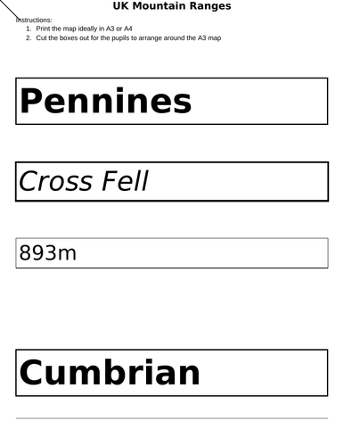
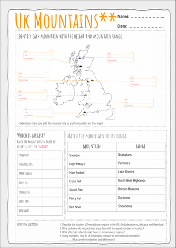
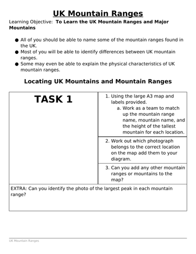
Activity 1. - A collaborative group exercise where the pupils organise a UK map of mountain ranges and decide between the group, the appropriate labels and heights. This is a great exercise to visualise the mountains, and not merely view them on a map without any understanding of the vegetation or relief of the land.
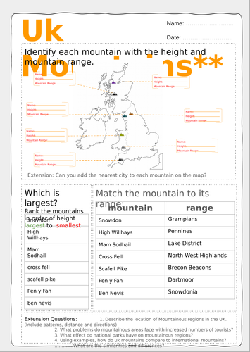
Activity 2. This activity consists of differentiated worksheets with and extension task and some higher order thinking questions that provide enough extension for pupils.
The whole lesson comes with a Powerpoint to guide you and the class through the lesson.
Something went wrong, please try again later.
This resource hasn't been reviewed yet
To ensure quality for our reviews, only customers who have purchased this resource can review it
Report this resourceto let us know if it violates our terms and conditions.
Our customer service team will review your report and will be in touch.
£1.50