Investigating Rivers - KS2Quick View
TeachItForwardTeachItForward

Investigating Rivers - KS2

7 Resources
Investigating Rivers is a Geography unit suitable for KS2 (Y4-6). The planning overview and topic title page can be downloaded for free here. Lessons include: L1 - Understanding the water cycle L2 - Identifying features of a river system L3 - Identifying characteristics of the three stages of a river L4 - Investigating features of the River Thames L5 - Thinking about the different ways we use water L6 - Understanding the impacts of floods and droughts Each lesson includes a presentation and differentiated activities/worksheets. If you like this resource, we would appreciate a review! We will happily send you a free resource in return for a review or useful suggestions/feedback. Contact us at ed@teachitforward.co.uk.
Geography Christmas QuizQuick View
mrshopehistorymrshopehistory

Geography Christmas Quiz

(1)
Celebrate Christmas this winter with your secondary Geography students with this 54 question xmas quiz for 2023 themed around the event complete with answers in both quick and question by question format. This resource is 54 question Xmas quiz spread across 5 different rounds. It is created on Microsoft Powerpoint and suitable for KS3 and KS4 secondary students. Whats included? Within this resource there are 54 questions spanning 5 rounds. A mixture of multiple choice, general knowledge and picture quiz questions. Topics range from Christmas traditions from around the world, flag picture round, capital city and country matchups, Christmas themed Geographical knowledge in addition to skyline picture round.Your learners will have so much fun engaging with this quiz. Delivery and timings The answers can then shared as a class by going through each question individually (ensure you are in present mode for the correct answer to colour yellow and the transitions to work) for students to peer or self mark. Additionally, answers to each individual question can be found on the notes section of each individual PowerPoint slide. If you choose to deliver this in a single session - it could take upto (but not in excess of) an hour to complete depending on how much thinking time you decide to give your students. However, the rounds have been sectioned off within the Powerpoint so that you could potentially delivered a round or two at a time with your classes or tutor groups over the period of a week or two. I really hope you enjoy this quiz activity. If you get the time, please leave a review - for a limited time I am offering a FREE copy of my Christmas Dingbats resource for every review left. So please leave your email address in the review so I can be sure to get this across to you! Looking for more Christmas resources? Check out this Christmas anagram worksheet activity Christmas 2023 Tutor time Quiz Christmas Dingbats resource FREE Seek and Find Christmas resource #geography #christmas #christmasquiz #xmas #xmasquiz #geographyquiz
ALL OF MY KS3 GEOGRAPHY RESOURCES!!! 7x SoW/75+ lessons! Rivers, rainforests, biomes, deserts, weather AND UK landscapes all for £12.99!Quick View
ukjoshkelly94ukjoshkelly94

ALL OF MY KS3 GEOGRAPHY RESOURCES!!! 7x SoW/75+ lessons! Rivers, rainforests, biomes, deserts, weather AND UK landscapes all for £12.99!

17 Resources
GET ALL OF MY PAID KS3 RESOURCES FOR JUST £12.99!!! 75+ lessons for under £13 or less than 10p a lesson… Bargain! **Seven Key Stage 3 Schemes of work, enough teaching content for almost two years! ** All of my lessons are well planned, engaging, differentiated and fun! Download one of my free ones if you aren´t sure and try before you buy! The following Schemes of work are included WITH assessments: *** World biomes (11 lessons)** • Lesson 1: Ecosystems • Lesson 2: Food webs • Lesson 3: Global biomes introduction • Lesson 4: Mediterranean biome • Lesson 5: Coral Reefs • Lesson 6: Bamboo forests • Lesson 7: Tropical Rainforests • Lesson 8: Hot deserts • Lesson 9: Polar biomes • Lesson 10: Assessment lesson • Lesson 11: Peer feedback/marking lesson River landscapes of the UK (7 lessons) • Lesson 1: Where are the UK’s rivers? • Lesson 2: What are the UK’s rivers like? • Lesson 3: What processes happen inside a river? • Lesson 4: How do waterfalls form? • Lesson 5: Meanders… they’re forever changing • Lesson 6: The Landforms of the Lower Course • Lesson 7: The Somerset levels floods 2014 • Lesson 8: How can we our manage rivers? • Lesson 9: Rivers Assessment lesson *** Weather and climate of the UK (9 lessons)*** • Lesson 1: What is weather and climate? • Lesson 2: Recording the Weather • Lesson 3: Who cares about the weather? • Lesson 4: Where does the UK’s weather come from? • Lesson 5: The Beast from the East • Lesson 6: How can the UK use it’s wind? • Lesson 7: Does the UK need so much rain? • Lesson 8: What are Urban Micro climates and how do they affect London? • Lesson 9: Assessment and feedback Tropical Rainforests (12 lessons) • Lesson 1: What and where are our rainforests? • Lesson 2: What is the structure of the Rainforests? • Lesson 3: What is the climate like in the Rainforest? • Lesson 4: How are plants and animals adapted to the rainforest? • Lesson 5: How do we benefit from the Rainforest? • Lesson 6: What is Deforestation? • Lesson 7: What are the effects of Deforestation? • Lesson 8: How can we use the rainforest sustainably? • Lesson 9: Saving the Rainforest! • Lesson 10: Assessment lesson • Lesson 11: Assessment feedback and peer marking lesson. • Lesson 12: Extended project: Researching a rainforest. *** UK landscapes and processes (7 lessons) ** • Lesson 1: introduction to UK landscapes • Lesson 2: How does geology shape the UK? • Lesson 3: Chemical weathering and limestone plateaus • Lesson 4: Mountains in the UK: Their birth and erosion • Lesson 5: Forests in the UK • Lesson 6: Map reading and tourist developments in the lake district. • Lesson 7: Assessment lesson with feedback PPT. Hot deserts (9 lessons) Lesson 1: What is a hot desert and where are they found? Lesson 2: Drawing a climate graph for hot deserts Lesson 3: How can animals and plants survive in hot deserts? Lesson 4: What is desertification and why is it happening? Lesson 5: Can desertification be stopped? Lesson 6: Tourism in a hot desert far far away… Lesson 7: Can you navigate through a hot desert? Lesson 8: Assessment lesson Lesson 9: Peer marking and assessment feedback **Globalisation 12 lessons: ** Lesson 1: An introduction to globalisation Lesson 2: How has globalisation happned? Lesson 3: Why do companies go global? Mcdonalds Lesson 4: What is a TNC and why do they work in so many countries? Lesson 5: The pros and cons of globalisation Lesson 6: The dark side of globalisation Lesson 7: A TNC in Nigeria: Shell Lesson 8: How is globalisation helpful? NGOs Lesson 9: IGOs: WHO will stop Malaria? Lesson 10: Assessment lesson Lesson 11: Peer marking and assessment feedback Lesson 12: Optional project on a TNC extras! This includes ALL of my lessons, quizzes, and six full schemes of work with over 75 lessons in total!!! (some stand alone lessons are omitted as they are repeated/included in SoW) Please check out all of my FREE school resources and Geography lessons on my shop where you´ll also find full schemes of work for just £3 and lots of other useful resources… Or purchase all of my KS3 resources for just £12.99! I would really appreciate it if you could leave me a review, thanks! https://www.tes.com/teaching-resources/shop/ukjoshkelly94 Questions or issues: ukjoshkelly@yahoo.co.uk
Geography Christmas QuizQuick View
Cre8tive_ResourcesCre8tive_Resources

Geography Christmas Quiz

(3)
Geography Christmas Quiz – Christmas 50+ Questions for that perfect end of term subject based lesson. This Christmas quiz has a mixture of questions and rounds and skills. Some of the rounds will be subject based with subject based knowledge whilst others will be Christmas themed giving that perfect mix for an end of term Christmas lesson. This resource will last a full 50 minutes to 1 hour. This Geography resource contains: 1x PowerPoint with questions and answers 1x Student Answer Sheet double sided out of /54+ Marks 3 sets of Editable Team Certificates (1st place, 2nd place and 3rd place) Skills reflection slide Personal reflection questions What does the Geography Christmas quiz comprise of? Round 1: Identify winter inspired images Round 2: True or False - good variety of themed questions **Round 3: ** Matching and strategy can you find the correct links and eliminate all others Round 4: Linking Round - be able to make the correct links between left and right lists Round 5: Numbers Round -all the answers will involve numbers. Round 6: Jumbled up Round - Unravel these to find the answer staring directly back at you Round 7: Multiple Choice theory - Put your team to the test Round 8: Observation Round - Look at the image , remember everything you see…. Round 9: Wordsearch Round - Locate the words before time runs out… **Round 10: ** Tie Breaker - Design it but use all your team’s creative abilities This will last a full hour for the full quiz by the time you get students into small teams and run through the quiz and the interactive way the answers appear. This informative, fun and engaging quiz will be a great way to celebrate the end of term and Christmas. Search ‘Cre8tive Resources’ for support with our library of resources or send us an email. Leave a review and email TheCre8tiveResources@gmail.com for a free resource as a thank you!! Explore all our resources on TES
Mountain Environments - KS2Quick View
TeachItForwardTeachItForward

Mountain Environments - KS2

8 Resources
Mountain Environments is a Geography unit suitable for KS2 (Y4-6) and has everything you need for covering a mountains topic. The planning overview, topic title page and vocabulary page can be downloaded for free here. Lessons include: L1 – Identifying the key features of mountains L2 – Identifying the world’s major mountain ranges L3 – Locating the world’s famous mountains using latitude and longitude L4 – Understanding how fold mountains are formed L5 – Investigating the structure of a volcano (FREE) L6 – Researching famous world mountains (FREE) L7 – Investigating mountain climates Each lesson includes a presentation and differentiated activities/worksheets. If you like this resource, we would appreciate a review! We will happily send you a free resource in return for a review or useful suggestions/feedback. Contact us at ed@teachitforward.co.uk.
Identifying the key features of mountains - KS2Quick View
TeachItForwardTeachItForward

Identifying the key features of mountains - KS2

(3)
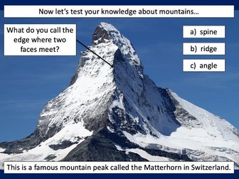
This is the first lesson in Mountain Environments, a Geography unit designed for students in upper KS2 (Y4-6). First the presentation introduces students to the topic and looks at some of the activities people do in mountains. It then introduces the key features of a mountain range. The activity challenges students to identify the key features of a mountain environment. It is differentiated three ways: Easier – Students identify 8 key features of mountains. Medium – Students identify 10 key features of mountains. Harder – Students label the key features of mountains in their exercise book. Extension – Students match mountain vocabulary to their definitions. If you like this resource, we would appreciate a review! We will happily send you a free resource in return for a review or useful suggestions/feedback. Contact us at ed@teachitforward.co.uk.
Rivers: Drainage BasinsQuick View
markthegeographermarkthegeographer

Rivers: Drainage Basins

(2)
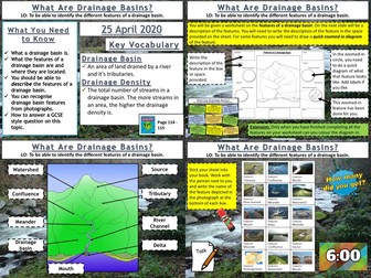
AQA GCSE Geography lesson for the new specification Unit 1C: In this lesson we look at drainage basins and what types of features you find within them. We start with a photo mystery starter, the pupils only see fragments of a map of the drainage basins of the UK and Ireland. The pupils try to guess what the complete picture might be. This leads onto a discussion about drainage basins and the Amazon Basin in particular. Next we look at the features within a drainage basin. The pupils will work from a worksheet and are given a description of a feature. They must find the feature on the diagram, write the description, and then for some features they draw their own zoomed-in picture of the feature. Following this the pupils get a grid of photographs of the various features and they need to work out what the feature is. The board is editable so they can play bingo as well if you want to create bingo cards. We finish with a simple post-it plenary based on a GCSE-style question. In a nutshell lesson includes: Geographical gallery of contemporary art starter Worksheet activities on the features of a drainage basin Photo grid of the features of a drainage basin. Post-it plenary. Hope this saves you some valuable planning time. https://www.tes.com/teaching-resources/shop/markthegeographer
C11 The Earth's Atmosphere (AQA 1-9 Combined Trilogy)Quick View
OuttheBoxScienceOuttheBoxScience

C11 The Earth's Atmosphere (AQA 1-9 Combined Trilogy)

5 Resources
New for the AQA GCSE 1-9 Combined Trilogy Unit ‘C11 The Earth’s Atmosphere’. Full lessons ready to use straight ‘out of the box’. Lessons meet the full criteria for this unit Similar structure to my other power points following the input - activity - review phasing Plenary sections for progress checking Clear learning objectives and outcomes Modern and engaging layout Little adaptation needed Each lesson covers at least an hour of lesson time LESSONS: L1 History of Our Atmosphere (FREE) L2 Our Evolving Atmosphere L3 Greehouse Gases L4 Global Climate Change L5 Atmospheric Pollutants Please leave constructive feedback :D
Layers of the soil KS2 science foldable activity for rocks and soilsQuick View
Gdwaters1Gdwaters1

Layers of the soil KS2 science foldable activity for rocks and soils

(0)
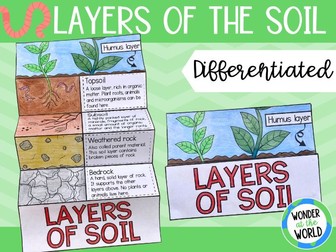
The activity Review the layers of the soil beneath our feet with this differentiated foldable activity. This fun alternative to a worksheet allows pupils to order the layers in the soil profile with either descriptions or name labels. There’s also an option for pupils to write descriptions in the boxes. The templates There are 3 template options to choose from in this PDF: Colour the layers of soil, cut out the names or descriptions of the layers, glue, cut, and fold. Colour the layers of soil, cut out the pictures of the layers with their descriptions, arrange them on the template, glue, cut, and fold. Colour the layers of soil, write descriptions for each layer, cut, and fold. No glue is required for this option. Curriculum links Lower KS2 Science (Year 3 Rocks and Soils) ‘Recognise that soils are made from rocks and organic matter’. US and UK paper sizes are included. Please note that this is not an editable resource. Layers of the soil are not presented to scale.
Identifying the world's major mountain ranges - KS2Quick View
TeachItForwardTeachItForward

Identifying the world's major mountain ranges - KS2

(3)
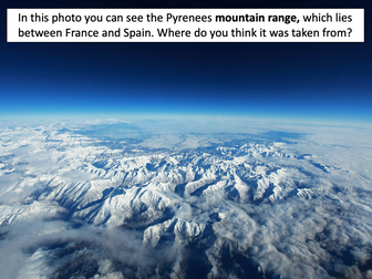
This lesson is part of Mountain Environments, a Geography unit designed for students in upper KS2 (Y4-6). First the presentation introduces some of the most famous mountain ranges from around the world. The differentiated activity then challenges students to locate the world’s mountain ranges and encourages them to use and explore atlases. It is recommended that students do the activity in pairs. Easier – Students identify the world’s famous mountain ranges (less writing). Medium – Students identify the world’s famous mountain ranges (first letter clues) Harder – Students identify the world’s famous mountain ranges (no clues) If you like this resource, we would appreciate a review! We will happily send you a free resource in return for a review or useful suggestions/feedback. Contact us at ed@teachitforward.co.uk.
Locating the world's famous volcanoes - KS2Quick View
TeachItForwardTeachItForward

Locating the world's famous volcanoes - KS2

(4)
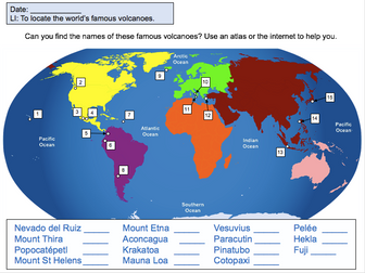
This lesson is designed for KS2 students. It can be taught as a stand alone lesson but is also available as part of two wider units, both of which are available on TES: -Volcanoes -Volcanoes & Earthquakes First the presentation introduces some of the world’s most famous volcanoes and classes them as active, dormant or extinct. The activity then challenges students to locate volcanoes using an atlas or the internet (e.g. Google maps). Alternatively, a map of famous world volcanoes is also provided. Easier – Students locate volcanoes using the map of famous volcanoes (writing numbers). Medium – Students locate volcanoes using the map of famous volcanoes (writing volcano names). Harder – Students locate volcanoes using an atlas. (N.B. It is recommended you check the atlas has the relevant maps prior doing the activity.) If you like this resource, we would appreciate a review! We will happily send you a free resource in return for a review or useful suggestions/feedback. Contact us at ed@teachitforward.co.uk.
GCSE Coasts: All LessonsQuick View
markthegeographermarkthegeographer

GCSE Coasts: All Lessons

13 Resources
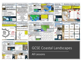
A bundle of all my coasts lessons prepared for the AQA specification, but still useful for other specifications. Lesson titles in order are: Types of Waves Weathering and Mass Movement Processes of Erosion and Transportation Headlands and Bays Wave Cut-Notches & Platforms, Stacks, Stumps and Arches Longshore Drift and Deposition Beaches and Sand Dunes Spits and Bars Coastal Landforms at Swanage Hard Engineering Soft Engineering Managed Retreat https://www.tes.com/teaching-resources/shop/markthegeographer
Paper 1 AQA GCSE Geography Revision BundleQuick View
teachgeogblogteachgeogblog

Paper 1 AQA GCSE Geography Revision Bundle

(0)
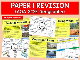
Full series of revision lessons and Resources Session 1: Natural Hazards Revision Revision Clock Blockbuster Session 2: Living World Revision Revision Clock Blockbuster Session 3: Coasts and Rivers Revision Revision Clock Blockbuster
Biomes Ecosystems & Vegetation BeltsQuick View
LovelearninggeographyLovelearninggeography

Biomes Ecosystems & Vegetation Belts

(0)
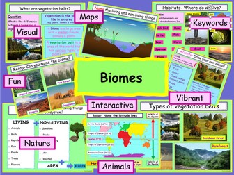
Biomes Ecosystems & Vegetation Belts. This lesson is about BIOMES and is suitable for KS2 and foundation KS3 students… The power point information is easy to follow and is suitable for a non-specialist teachers/parents. The resources are vibrant, interesting and have fun activities. The resources will help support student’s learning, development, and attainment. Student’s will gain more confidence and develop their geographical knowledge and skills. The power point can be used on a white board or with a projector. It has animations and moving objects. To help SEN students, I have included a variety of learning styles. All font is in Comic sans, to support dyslexic learners. The power points can be easily adapted to meet the needs of higher-level learners. Ask your school to purchase this ready to use ppt now and take control of your workload. What will your students learn: • Name different animal homes • Recap longitude and latitude lines • Recap climate zones • What is a habitat? • What is an ecosystem? • Non living and living things in an ecosystem • What is a biome? • What are vegetation belts? Includes: • An Interactive PowerPoint presentation • Student Work Sheets • Sources: Pixabay (unless stated) • ©Love Learning Geography Part of the Physical KS2 geography pack. See a preview on my Facebook & Instagram page- link in bio Thank you for looking at my resources. If you download or purchase any of my resources, I would really appreciate the feedback. I would love to hear from you! *I hope your students love learning geography :) * T&C By purchasing my resources, you are agreeing that the contents are the property of Love Learning Geography and licensed to you only for classroom/personal use as a single user. I retain copyright and reserve all rights to this product. You are not permitted to resell or share this item. You may not share it anywhere online (except on secure platforms with your own students).
Coasts: Weathering and Mass MovementQuick View
markthegeographermarkthegeographer

Coasts: Weathering and Mass Movement

(2)
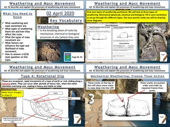
AQA GCSE Geography lesson for the new specification Unit 1C: In this lesson we look at the different types of weathering and mass movement. We start with a true or false retrieval practice quiz on wave types from the previous lesson. We then introduce the concept of weathering and proceed to look at mechanical, biological and chemical weathering. The pupils have a variety of annotation, drawing and question tasks to complete on the worksheet. Moving on to mass movement, the pupils get a second worksheet with 4 different slopes on. The pupils then are given information on each type of mass movement. They sketch the type of mass movement onto their slope and add labels. We finish with a simple GCSE-style question which I get the pupils to answer on a post-it note. In a nutshell lesson includes: True or False starter on wave types Weathering activity sheet with diagrams and questions. Mass movement ‘change the slope’ activity sheet. Video clips where appropriate GCSE-style question plenary Hope this saves you some valuable planning time. https://www.tes.com/teaching-resources/shop/markthegeographer
Rivers: Waterfalls and GorgesQuick View
markthegeographermarkthegeographer

Rivers: Waterfalls and Gorges

(1)
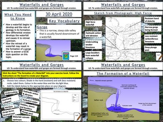
AQA GCSE Geography lesson for the new specification Unit 1C: In this lesson we look at waterfalls and gorges and how they are formed through the processes of erosion. The starter is a retrieval practice grid filled in for the rivers work so far, but it’s editable. We then look at how underlying geology plays and important part in the formation of waterfalls, the pupils have some questions to answer and I sometimes get a pupil to teach this bit. We then look at how waterfalls develop, after some teacher exposition the pupils will have an outline diagram of a waterfall with some tasks to complete on the diagram. We then look at the formation of gorges and how they relate to waterfalls. This time the pupils use the diagram on the board to create one themselves. We finish with a sketch from photograph of High Force. After we have introduced the waterfall and given some detail on its formation the pupils will create a field sketch either in a blank box, or using a feint outline, which they can draw over the top of. They then label features etc. We finish with a 6-mark question similar to the 2019 May exam on physical processes and waterfalls/gorges. There is advice and guidance should the pupils need it. In a nutshell lesson includes: Retrieval practice grid starter. Question answer session on how a waterfall starts to form. Blank outline actvity on the development of waterfalls over time. Diagram activity on the formation of a gorge. Worksheet activty on sketching High Force from a photograph. 6-mark GCSE question with guidance. Hope this saves you some valuable planning time. https://www.tes.com/teaching-resources/shop/markthegeographer
Waterfall Formation WorksheetQuick View
bharrybbharryb

Waterfall Formation Worksheet

(0)
3 versions of the same worksheet (inc. higher ability and lower ability versions) on the formation of waterfalls. Blank and labelled diagrams plus space to write a description for 6 stages. Key words highlighted. ANSWER SHEETS INCLUDED.
The Water CycleQuick View
oceanic-dolphinoceanic-dolphin

The Water Cycle

(60)
An animated and child-friendly Power point to help children learn about the water cycle. Hope this is useful :) For Twitter updates for my new resources, please follow: @TheStorySeed For more free resources: www.TheStorySeed.com
Types of rocksQuick View
suz1230suz1230

Types of rocks

(1)
A simplified revision aid used to show the three types of rocks (sedimentary, metamorphic and igneous) with the properties, uses, diagram of formation and how the rock is formed.
Rock types and rock CycleQuick View
R DallyR Dally

Rock types and rock Cycle

(10)
Information based on the rock types found in Pembrokeshire. Links to interactive rock cycles and contains class activities.