Investigating Rivers - KS2Quick View
TeachItForwardTeachItForward

Investigating Rivers - KS2

7 Resources
Investigating Rivers is a Geography unit suitable for KS2 (Y4-6). The planning overview and topic title page can be downloaded for free here. Lessons include: L1 - Understanding the water cycle L2 - Identifying features of a river system L3 - Identifying characteristics of the three stages of a river L4 - Investigating features of the River Thames L5 - Thinking about the different ways we use water L6 - Understanding the impacts of floods and droughts Each lesson includes a presentation and differentiated activities/worksheets. If you like this resource, we would appreciate a review! We will happily send you a free resource in return for a review or useful suggestions/feedback. Contact us at ed@teachitforward.co.uk.
Paper 1 AQA GCSE Geography Revision BundleQuick View
teachgeogblogteachgeogblog

Paper 1 AQA GCSE Geography Revision Bundle

(0)
Full series of revision lessons and Resources Session 1: Natural Hazards Revision Revision Clock Blockbuster Session 2: Living World Revision Revision Clock Blockbuster Session 3: Coasts and Rivers Revision Revision Clock Blockbuster
Extreme Weather In The UKQuick View
markthegeographermarkthegeographer

Extreme Weather In The UK

(0)
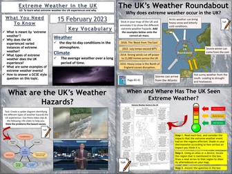
AQA GCSE Geography lesson for the new specification Unit 1A: In this lesson we look at what extreme weather is, what type of extreme weather the UK experiences and whether the UK may experience more in the future. The lesson has a retrieval practice starter where the pupils choose the places or the circumstances where tropical storms can be found. We then look at the definition of extreme weather. The students complete a map exercise which helps to explain why the UK’s geographical location allows a variety of extreme weather to be experienced. The students then complete a spider diagram on the types of extreme weather, there are some video clips and information slides to help with this which could be a carousel activity. We then complete a map exercise where the students use an atlas to locate where the extreme weather impacted and evaluate how severe the weather event was. We finish with a GCSE-style practice question with some guidance and structure provided for the students. Hope this saves you some valuable planning time. https://www.tes.com/teaching-resources/shop/markthegeographer
Tectonic Hazards: AQA GCSE Geography 6  Lesson BundleQuick View
markthegeographermarkthegeographer

Tectonic Hazards: AQA GCSE Geography 6 Lesson Bundle

6 Resources
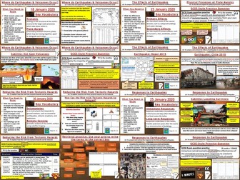
Some activities in this bundle require the blue Oxford AQA GCSE textbook for the new 2016 specification This bundle has all the lessons required to teach the Tectonic Hazards section of unit 1A. The activities are varied and differentiated. Each lesson has a GCSE-style exam question with guidance for the students if needed. All worksheets in a format ready for printing. Some lessons do use the Oxford textbook as I have found this is the best way to teach it. Hope this saves you some valuable planning time. Order of the lessons is :- The Distribution of Earthquakes and Volcanoes Physical Processes at Plate Boundaries The Effects of Earthquakes Responses to Earthquakes Living With The Risk From Tectonic Hazards Reducing the Risk From Tectonic Hazards https://www.tes.com/teaching-resources/shop/markthegeographer
Mountain Environments - KS2Quick View
TeachItForwardTeachItForward

Mountain Environments - KS2

8 Resources
Mountain Environments is a Geography unit suitable for KS2 (Y4-6) and has everything you need for covering a mountains topic. The planning overview, topic title page and vocabulary page can be downloaded for free here. Lessons include: L1 – Identifying the key features of mountains L2 – Identifying the world’s major mountain ranges L3 – Locating the world’s famous mountains using latitude and longitude L4 – Understanding how fold mountains are formed L5 – Investigating the structure of a volcano (FREE) L6 – Researching famous world mountains (FREE) L7 – Investigating mountain climates Each lesson includes a presentation and differentiated activities/worksheets. If you like this resource, we would appreciate a review! We will happily send you a free resource in return for a review or useful suggestions/feedback. Contact us at ed@teachitforward.co.uk.
Earthquakes - KS2Quick View
TeachItForwardTeachItForward

Earthquakes - KS2

8 Resources
Earthquakes is an exciting Geography unit designed for students in KS2. The planning overview, topic title page and vocabulary page can be downloaded for free here. Lessons include: L1 – Understanding the structure of the Earth L2 – Understanding tectonic plates L3 – Understanding the causes of earthquakes L4 – Investigating the five deadly features of an earthquake L5 – Researching earthquakes using Wikipedia L6 – Locating the world’s biggest earthquakes using latitude & longitude L7 – Writing a fact file about a famous earthquake Each lesson includes a presentation and differentiated activities/worksheets. If you like this resource, we would appreciate a review! We will happily send you a free resource in return for a review or useful suggestions/feedback. Contact us at ed@teachitforward.co.uk.
Volcanoes & Earthquakes - KS2Quick View
TeachItForwardTeachItForward

Volcanoes & Earthquakes - KS2

14 Resources
Volcanoes & Earthquakes is an exciting extended Geography unit designed for students in KS2. The planning overview, topic title page and vocabulary page can be downloaded for free here. Lessons include: L1 – Understanding the structure of the Earth L2 – Investigating the structure of a volcano (FREE) L3 – Locating the world’s famous volcanoes L4 – Investigating the five deadly features of a volcanic eruption L5 – Understanding tectonic plates L6 – Exploring the effects of volcanic eruptions on Montserrat L7 – Why do people live near volcanoes? L8 – Understanding the causes of earthquakes L9 – Investigating the five deadly features of an earthquake L10 – Researching earthquakes using Wikipedia L11 – Locating the world’s biggest earthquakes using latitude & longitude L12 – Writing a fact file about a famous earthquake Each lesson includes a presentation and differentiated activities/worksheets. A FREE newspaper report template is also included in this unit. If you like this resource, we would appreciate a review! We will happily send you a free resource in return for a review or useful suggestions/feedback. Contact us at ed@teachitforward.co.uk.
AQA Geography GCSE - Paper 1 revision work bookletsQuick View
CharlotteBrimerCharlotteBrimer

AQA Geography GCSE - Paper 1 revision work booklets

(1)
Included in each booket: Knowledge tests after each section of specification content A wide range of different exam questions Structure strips for the 9 mark questions Detailed case study sheets Various activities all linked to the specification to aid students revision Space for DIRT/FIT work Can be set as homework or in class revision
Why do people live near volcanoes? - KS2Quick View
TeachItForwardTeachItForward

Why do people live near volcanoes? - KS2

(1)
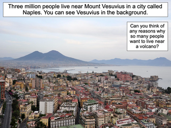
This lesson is designed for KS2 students. It can be taught as a stand alone lesson but is also available as part of two wider units, both of which are available on TES: -Volcanoes -Volcanoes & Earthquakes First the presentation looks at Mount Etna and Mount Vesuvius in Italy and asks why people choose to live so close to volcanoes. The activities then challenges students to think about the advantages and disadvantages of living near a volcano: Partner Activity: Students sort statements and photos into advantages and disadvantages of living near a volcano. Writing Activity: Students write about the advantages and disadvantages of living near a volcano. Stickers and a vocabulary prompt are provided for this activity. If you like this resource, we would appreciate a review! We will happily send you a free resource in return for a review or useful suggestions/feedback. Contact us at ed@teachitforward.co.uk.
Reducing the Effects of Tropical StormsQuick View
markthegeographermarkthegeographer

Reducing the Effects of Tropical Storms

(1)
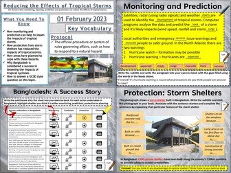
AQA GCSE Geography lesson for the new specification Unit 1A: In this lesson we look at monitoring, prediction, planning and protection in regards to tropical storms. The lesson has a tropical stormed themed retrieval practice starter. We firstly introduce the importance of monitoring to aid prediction with measurements of SST’s. There is a cloze writing exercise on monitoring of hurricanes. A video clip from American tv provides a useful example of how tropical storms are monitored and their paths predicted even on mainstream television. There are some questions for the clip. We then look at protection, specifically storm shelters in Bangladesh, the pupils will have to label the storm shelter and annotate why these features of the storm shelter were needed. We then look at how building in vulnerable areas has made the risks of tropical storms and storm surges more severe. We then look at Bangladesh as a success story of monitoring, predicting, planning and protection, the students have a grid with the actions that have been undertaken by Bangladesh, they have to categorise them accordingly. We finish with a GCSE-style practice question with some guidance and structure provided for the students. Hope this saves you some valuable planning time. https://www.tes.com/teaching-resources/shop/markthegeographer
New AQA A level Geography model answers for 20 mark essays.Quick View
pnmasonukpnmasonuk

New AQA A level Geography model answers for 20 mark essays.

18 Resources
A collection of essays to support revision & teaching of the new AQA Geography A level. This download contains a collection of eighteen model answers as well as some shorter answer questions and support activities. Marks schemes have been used to help ensure model answers access the higher band for each question. These create excellent support resources for your teaching of the new AQA Geography A level and will save you many hours in preparation time. These essays would also support the teaching of other A level Geography specifications. Essays included: 0 3 . 4 “Flooding and erosion is set to increase to unprecedented levels along coastlines across the world. In response, mitigation and adaptation by coastal managers will ensure that people and places are not affected.” 03.4 Assess the relative importance of weathering and erosion in the development of coastal landscapes. (20) Assess the extent to which predicted climate change will present challenges for sustainable management of a local scale environment that you have studied. (20 marks). “Human activity affects coasts globally. This interference with coastal processes is the key determining factor in shaping coastal landscapes.” To what extent do you agree with this opinion? (20 marks) 026 ‘Sustainable approaches to coastal management will become more important than traditional approaches in dealing with the impacts of climate change.’ 20 marks Explain the formation of a saltmarsh environment. (4 marks) Assess the role of vegetation in the development of a sand dune landscape. (6 marks) Camber Sands teaching resource. To what extent do the advantages of globalisation outweigh the disadvantages? [20] (or 25 marks under WJEC) Transnational corporations (TNCs) are the most significant factor in creating unequal flows of people and money within global systems.’ 20 marks. Analyse the roles of international government organisations and NGOs in the governance of Antarctica and assess their effectiveness. 20 marks 01.4 Assess the potential cause and impacts of changes in the water balance within a tropical rainforest that you have studied. 20 marks Assess the extent to which rising global temperatures may result in a positive feedback cycle of yet higher carbon content in the atmosphere. (20 marks) With reference to a river catchment that you have studied, assess the potential impact of human activity upon the drainage basin. (20 marks) Assess the extent to which there are interrelationships between processes in water cycle and factors driving change in the carbon cycle. (20 marks) With reference to a local scale of a specific place in a hazardous setting, assess the extent to which the physical nature of hazards can shape the character of a community and its ability to respond to risk. (20 marks) To what extent have global institutions helped to promote growth and stability within global systems? (20 marks) To what extent can wildfires be caused, intensified and mitigated by human activity? 20 marks. ‘The Disaster Response Curve (The Park Model) has contributed to improved understanding and therefore management of the impact of tectonic hazards.’ To what extent do you agree with this view? [20 marks] An additional AS short essay: Assess the extent that coastlines of submergence are created by sea level change. (9 Marks)
ALL OF MY KS3 GEOGRAPHY RESOURCES!!! 7x SoW/75+ lessons! Rivers, rainforests, biomes, deserts, weather AND UK landscapes all for £12.99!Quick View
ukjoshkelly94ukjoshkelly94

ALL OF MY KS3 GEOGRAPHY RESOURCES!!! 7x SoW/75+ lessons! Rivers, rainforests, biomes, deserts, weather AND UK landscapes all for £12.99!

17 Resources
GET ALL OF MY PAID KS3 RESOURCES FOR JUST £12.99!!! 75+ lessons for under £13 or less than 10p a lesson… Bargain! **Seven Key Stage 3 Schemes of work, enough teaching content for almost two years! ** All of my lessons are well planned, engaging, differentiated and fun! Download one of my free ones if you aren´t sure and try before you buy! The following Schemes of work are included WITH assessments: *** World biomes (11 lessons)** • Lesson 1: Ecosystems • Lesson 2: Food webs • Lesson 3: Global biomes introduction • Lesson 4: Mediterranean biome • Lesson 5: Coral Reefs • Lesson 6: Bamboo forests • Lesson 7: Tropical Rainforests • Lesson 8: Hot deserts • Lesson 9: Polar biomes • Lesson 10: Assessment lesson • Lesson 11: Peer feedback/marking lesson River landscapes of the UK (7 lessons) • Lesson 1: Where are the UK’s rivers? • Lesson 2: What are the UK’s rivers like? • Lesson 3: What processes happen inside a river? • Lesson 4: How do waterfalls form? • Lesson 5: Meanders… they’re forever changing • Lesson 6: The Landforms of the Lower Course • Lesson 7: The Somerset levels floods 2014 • Lesson 8: How can we our manage rivers? • Lesson 9: Rivers Assessment lesson *** Weather and climate of the UK (9 lessons)*** • Lesson 1: What is weather and climate? • Lesson 2: Recording the Weather • Lesson 3: Who cares about the weather? • Lesson 4: Where does the UK’s weather come from? • Lesson 5: The Beast from the East • Lesson 6: How can the UK use it’s wind? • Lesson 7: Does the UK need so much rain? • Lesson 8: What are Urban Micro climates and how do they affect London? • Lesson 9: Assessment and feedback Tropical Rainforests (12 lessons) • Lesson 1: What and where are our rainforests? • Lesson 2: What is the structure of the Rainforests? • Lesson 3: What is the climate like in the Rainforest? • Lesson 4: How are plants and animals adapted to the rainforest? • Lesson 5: How do we benefit from the Rainforest? • Lesson 6: What is Deforestation? • Lesson 7: What are the effects of Deforestation? • Lesson 8: How can we use the rainforest sustainably? • Lesson 9: Saving the Rainforest! • Lesson 10: Assessment lesson • Lesson 11: Assessment feedback and peer marking lesson. • Lesson 12: Extended project: Researching a rainforest. *** UK landscapes and processes (7 lessons) ** • Lesson 1: introduction to UK landscapes • Lesson 2: How does geology shape the UK? • Lesson 3: Chemical weathering and limestone plateaus • Lesson 4: Mountains in the UK: Their birth and erosion • Lesson 5: Forests in the UK • Lesson 6: Map reading and tourist developments in the lake district. • Lesson 7: Assessment lesson with feedback PPT. Hot deserts (9 lessons) Lesson 1: What is a hot desert and where are they found? Lesson 2: Drawing a climate graph for hot deserts Lesson 3: How can animals and plants survive in hot deserts? Lesson 4: What is desertification and why is it happening? Lesson 5: Can desertification be stopped? Lesson 6: Tourism in a hot desert far far away… Lesson 7: Can you navigate through a hot desert? Lesson 8: Assessment lesson Lesson 9: Peer marking and assessment feedback **Globalisation 12 lessons: ** Lesson 1: An introduction to globalisation Lesson 2: How has globalisation happned? Lesson 3: Why do companies go global? Mcdonalds Lesson 4: What is a TNC and why do they work in so many countries? Lesson 5: The pros and cons of globalisation Lesson 6: The dark side of globalisation Lesson 7: A TNC in Nigeria: Shell Lesson 8: How is globalisation helpful? NGOs Lesson 9: IGOs: WHO will stop Malaria? Lesson 10: Assessment lesson Lesson 11: Peer marking and assessment feedback Lesson 12: Optional project on a TNC extras! This includes ALL of my lessons, quizzes, and six full schemes of work with over 75 lessons in total!!! (some stand alone lessons are omitted as they are repeated/included in SoW) Please check out all of my FREE school resources and Geography lessons on my shop where you´ll also find full schemes of work for just £3 and lots of other useful resources… Or purchase all of my KS3 resources for just £12.99! I would really appreciate it if you could leave me a review, thanks! https://www.tes.com/teaching-resources/shop/ukjoshkelly94 Questions or issues: ukjoshkelly@yahoo.co.uk
The Somerset Levels Floods: 2014Quick View
markthegeographermarkthegeographer

The Somerset Levels Floods: 2014

(0)
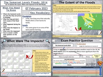
AQA GCSE Geography lesson for the new specification Unit 1A: In this lesson we look at the causes, effects of and responses to the Somerset Levels floods of 2014. The lesson has a multiple choice retrieval practice starter. We firstly introduce the location of the Somerset Levels and the pupils consider why the area may be prone to flooding, this could be just a discussion or they could annotate the map. They use sentence fragments to write a description of the location. We then look at the causes of the floods, for this the students complete a cloze exercise and highlight long and short term causes. There is a video clip to watch on what happened during the floods. The students then create a map to show the extent of the floods by colouring by numbers on a worksheet. They then look at the impacts and categorise them into social, economic and environmental. We then briefly look at dredging with an optional video clip before the students sort the responses out into immediate and long-term responses on a worksheet. We finish with a GCSE-style practice question with some guidance and structure provided for the students, there is also marking guidance provided. Hope this saves you some valuable planning time. https://www.tes.com/teaching-resources/shop/markthegeographer
Locating the world's famous volcanoes - KS2Quick View
TeachItForwardTeachItForward

Locating the world's famous volcanoes - KS2

(4)
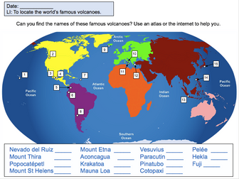
This lesson is designed for KS2 students. It can be taught as a stand alone lesson but is also available as part of two wider units, both of which are available on TES: -Volcanoes -Volcanoes & Earthquakes First the presentation introduces some of the world’s most famous volcanoes and classes them as active, dormant or extinct. The activity then challenges students to locate volcanoes using an atlas or the internet (e.g. Google maps). Alternatively, a map of famous world volcanoes is also provided. Easier – Students locate volcanoes using the map of famous volcanoes (writing numbers). Medium – Students locate volcanoes using the map of famous volcanoes (writing volcano names). Harder – Students locate volcanoes using an atlas. (N.B. It is recommended you check the atlas has the relevant maps prior doing the activity.) If you like this resource, we would appreciate a review! We will happily send you a free resource in return for a review or useful suggestions/feedback. Contact us at ed@teachitforward.co.uk.
Natural Disasters Assembly ScriptQuick View
vowellvowell

Natural Disasters Assembly Script

(1)
Fun and engaging script for LKS2, Year 3, Year 4 based on volcanoes and earthquakes. Includes link to song. References to Richter and Mercalli scale, tectonic plates, magma and lava. Link to song used: https://youtu.be/1HTx4v9RW_g
Locating volcanoes using latitude and longitudeQuick View
idjidj

Locating volcanoes using latitude and longitude

(12)
This activity looks at the location of famous volcanoes with the pupils having to locate them on a map using their lines of latitude and longitude. It is a colourful, child-friendly design. We did it in A4 which worked well although I can see how A3 would work well too.
Extreme weather lesson on TornadoesQuick View
victoriabennettvictoriabennett

Extreme weather lesson on Tornadoes

(9)
This is a full lesson looking at trends in extreme tornadoes and where they occur. Activities include a mapping activity , analysing data and a group facts race exercise, followed by a journalistic report. designed for 100 minutes. This resource has been brought to you by the author of the Amazon Kindle ebook ’ Time Smart Teaching: 8 Insider Tips to reduce your workload that Schools don’t tell you!. 100% free for Amazon Unlimited subscribers and available to download at the following link; https://www.amazon.co.uk/Time-Smart-Teaching-Insider-Workload-ebook/dp/B082ZBLFQQ/ref=sr_1_1?keywords=time+smart+teaching&qid=1577972903&s=digital-text&sr=1-1 The introductory chapters are FREE to read on my tes shop page.
Volcano WorksheetQuick View
occold25occold25

Volcano Worksheet

(41)
This worksheet covers the basics behind a volcano, namely covering its main components and key definitions. Volcano, Components, Magma Chamber, Lava, Magma