
103Uploads
138k+Views
51k+Downloads
Geography

Geography - Living in squatter settlement - Activity sheets
Two activity sheets intended to be used as part of a lesson. The theme of the lesson should be along the lines of ‘Life in a squatter settlement’, and could be taught with KS3 or KS4 students.
Resource 1: the effects on peoples lives
The main aim is for students to appreciate how the conditions / characteristics of a squatter settlement affect people’s lives.
The task is for students to complete the sheet in a few different ways.
There are nine problems / effects associated with living in a squatter settlement. For each effect, they must list the associated problems, and for several, also draw the problem. Ask the students the question – how would this affect your life if you lived there? There will be some repetition.
There are three blank cards as well, these are intended for higher ability students, or for the teacher to edit so as to include a problem which may be appropriate to the theme of their teaching.
Higher ability students can cut the cards out afterwards and glue them in their exercise books – this is an opportunity to identify links between the problems. There are several, and the whole activity is very open ended. Students could also sort their ideas into social, political and economic – they could use three different colours and a key to show this.
There are some answers on the next sheet, although there are many more.
Resource 2: the informal economy of a squatter settlement
The main aim is for students to appreciate how people can earn money within a squatter settlement. The focus should be on how the work is informal and doesn’t contribute to the tax base / official figures. This kind of work can be contained within a squatter settlement, but not necessarily so. This is an opportunity to draw a strong link to rural-urban migration; how the residents are often uneducated and unskilled, but wanting and needing to work.
The task is simple, for each form of employment, the student must draw an appropriate illustration. Model for lower ability, ask higher ability to include speech bubbles, or some form of written communication. Use as an opportunity to clear up any misunderstanding about what each term means.
All reviews for our paid resources have been 5/5* (as of March 19th 2017)

Geography Revision - AQA Geography A - Tourism Revision Sheet / Booklet
A double sided A3 revision sheet / A4 revision booklet with instruction slides to extend and consolidate learning from the Tourism (AQA Geography A) module. The end result is a concise revision tool.
Double sided A3 worksheet or 5 page A4 booklet > Built around the AQA Geography A specification > A range of activities > Does require exercise books / textbooks > Ideal for revision & cover lessons
The main aim is…
To revise and extend learning from the module by working through a structured revision sheet. The sheet has been built around the outgoing AQA geography A specification.
Key ideas and content…
The whole module!!
Tourism is a case study heavy module, so the revision material has ended up with a lot of tables to simplify the key ideas.
To differentiate…
Model examples and provide support.
Break down into timed sections to allow progress checks.
Students should be encouraged to draw links between sections.
Next steps…
I use this before the module exam.
Use to practise answering some exam questions.
www.acornteachingresources.com
All reviews for our premium resources have been 5/5* (as of 4th March 2017)
Geography - What is Geography?
An introduction to the subject – whole lesson. There are a range of activities which will show progress and develop vocabulary throughout the lesson.
The main aim is…
An introduction to the subject of geography.
To appreciate there are lots of topics within geography.
Key ideas and content…
Place is the main theme, and ties the subject together.
We study both the natural and the man made.
There are links and connections between the different topic areas.
To differentiate…
See lesson plan – red for lower and green for higher.
The acrostics could be used instead of the literacy activity.
Students could add to the word box as a pair or table.
To extend…
See lesson plan.
Students could research other topic areas and create their own activity.
This is intended as an introductory lesson – other activities could easily be included to further develop understanding.
To assess…
Use the literacy activity.
www.acornteachingresource.com
All reviews for our premium resources have been 5/5* (as of 3rd March 2017)

Geography - AQA 1-9 - The Living World - Protecting Cold Environments (Whole lesson)
Geography - AQA 1-9 - The Living World - Protecting Cold Environments (Whole lesson)
A whole lesson (possibly a double with lower ability groups) which enables students to explore how the balance between economic development, and conservation, can be managed in cold environments. There are a range of differentiated activities which teach students the strategies they're requires to know. Culminating in students developing a mark scheme and answering a GCSE style exam question.
Whole lesson > Key terms starter > Discussion prompts > Key ideas > Research activity > Exam style question with breakdown and structure > Class discussion > Learning evaluation > Summary activity > Homework > Lesson plan > Teacher notes > Fully resourced > Differentiated >
The main aim is…
To develop understanding of the issue between economic development and conservation.
To discuss the balance of economic development, sustainable development and the need to protect wilderness areas.
Key ideas and content…
There are four strategies we need to know.
There are advantages and disadvantages.
Different people will have different opinions.
To differentiate…
See lesson plan, the notes in red are suggestions for lower ability groups.
This lesson would certainly run over more than one session – for instance the exam style question work could be a lesson in itself with a lower ability group.
To extend…
See lesson plan, the notes in green are suggestions for higher ability groups.
Introduce a research aspect to the main activity – students can research an example for each strategy.
To assess…
The summary activity can be assessed.
The discussion points also provide assessment opportunities in lesson.
All reviews for our premium products have been 5/5* (As of 26th February 201&)
www.acornteachingresources.com


Geography - Settlement Shapes (Whole lesson)
Geography - Settlement Shapes (Whole lesson)
A whole lesson with a range of differentiated activities aimed at teaching students the features of, and differences between; linear, nucleated and dispersed settlement shapes.
Includes: snappy starter, animated explainers, key points, class discussion, differentiated activities, assessment opportunities, a homework task and lesson evaluation. All resources are included, along with a lesson plan and teacher notes.
The main aim is…
For students to learn the features of, and differences between linear, nucleated and dispersed settlement shapes.
Key ideas and content…
Nucleated, linear and dispersed are all settlement shapes.
Settlements grow in different shapes for different reasons.
Nucleated settlements will grow around a feature.
Linear settlements will grow along a feature.
To differentiate…
There is differentiation in the lesson.
Provide the essential words for the summary activity.
Students could work on the photo analysis together.
To extend…
Use the superstar activities.
Get the maps out / photocopy and cut out to pick out actual settlement shapes.
To assess…
The photo analysis and the summary activity allow progress to be demonstrated and assessed.
The homework could also be assessed.
All reviews for our premium products have been 5/5* (As of 21st February 2017)

Geography - push and pull factor card sort activity sheet
A migration themed push & pull factor card sort. Use in the teaching of migration / population / urbanisation. Two versions: colour code or cut-out. Answer sheet included.
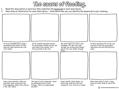
Geography - the causes of flooding worksheet
A simple activity to be included with teaching about the causes of flooding.
Students read the descriptions and draw a diagram for each one.
Ideal for lower ability groups.
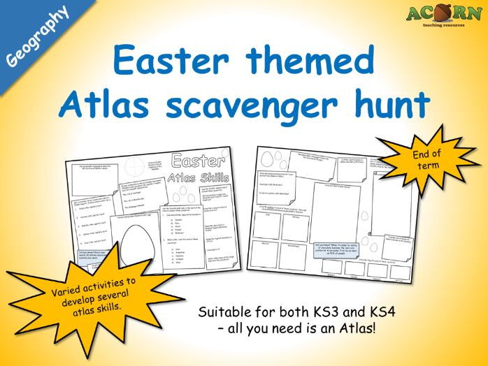
Geography - Easter Atlas Skills (scavenger hunt activity sheet)
Geography - Easter Atlas Skills (scavenger hunt activity sheet)
A double sided worksheet intended to use with pairs and small groups - all they need is an Atlas or two. Teacher notes are included with some suggestions. Basically, they are required to use an Atlas in several ways to find out a range of information (some of which is linked to Easter). There are a few other activities on the sheet (such as design an Easter egg).
Great for end of term activities, and will work with KS3 and KS4 students.
All reviews for our premium products have been 5/5* (As of February 21st 2017).
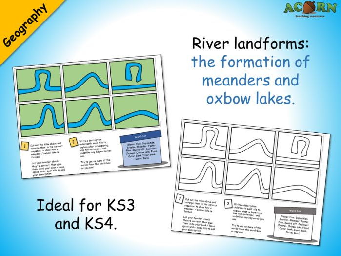
Geography - Meanders and oxbow lakes activity
Ideal for KS3 and KS4. Could be used to teach or consolidate.
Six tiles are jumbled up on the sheet - the students need to cut these out and arrange them in the correct sequence. The next task is to write a description underneath each tile - there is a word-box to help the students explain each stage. Prior knowledge / understanding will be needed to complete.
Could be used as a mystery – see if students can work out why the oxbow lake formed before you explain.
Two version are included; one in colour and one in outline black & white.
Every review we've had for a premium resource has been 5/5* (As of February 21st 2017)

River landforms - waterfall sequencing
Sequencing activity: River landforms - waterfalls
This is suited to KS3 but does work with KS4 - you'll need to add more detail (processes of erosion etc.).
There are four slides to help the teacher explain the processes involved and introduce the keywords.
The activity sheet requires students to complete three activities.
1. Cut out and arrange the tiles.
2. Add the labels from the sheet.
3. Add the descriptions from the sheet.
There is also an animated consolidation slide to allow teacher/students to check accuracy.
For higher ability - ask the students to underline the key terms, add more key terms and write their own descriptions.
Two version of the sheet are included; one in colour and one in outline black & white.
Every review we've received for a premium resource has been 5/5* (As of February 20th 2017)
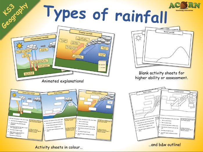
Types of rainfall (animations and activity sheets)
Types of rainfall (animations and activity sheets)
These are lesson elements intended to be used in the teaching of weather/climate and types of rainfall.
- Three colourful animations to introduce / teach convectional, frontal and relief rainfall.
- Three activity sheets with diagrams / written work.
- Three outline activity sheets which can be used with higher ability students, or to assess.
All reviews for our premium resources have been 5/5 (As of February 20th 2017)
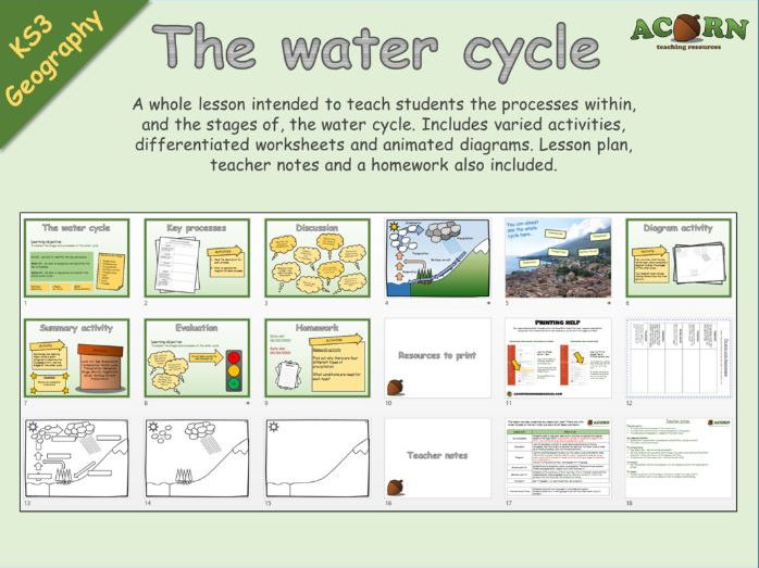
Geography - The Water Cycle
A whole lesson intended to teach students the processes within, and the stages of, the water cycle. Includes varied activities, differentiated worksheets and animated diagrams. Lesson plan, teacher notes and a homework also included.
The main aim is…
To understand the processes of the water cycle
To understand where and why these processes are taking place
To understand the sequence / stages of the water cycle
Key ideas and content…
Evaporation, transpiration, condensation, precipitation, surface run-off
The water cycle is continuous
To differentiate…
See lesson plan / use the varied worksheets
Get the students up in groups to talk through the water cycle using the PowerPoint animation – before moving on to the diagram activities
Students can act (see lesson plan – alternative activities)
To extend…
Set the summary activity as homework / or the research activity for higher ability groups
To assess…
Students could act out the stages – choose at random for higher ability.
Use the summary activity as a piece of work to assess understanding.
Every review we've received for a premium resource has been 5/5* (As of February 20th 2017)

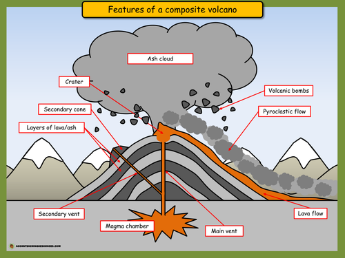
Geography - Coasts - Erosion - Coastal Landforms
Three labelled PPT diagrams to include in a lesson, to help when teaching...
- Cliffs and wave cut platforms
- Caves, arches, stacks and stumps
- Headlands and bays
Three worksheets to help students learn or demonstrate understanding. The worksheets have several tasks to help the students complete the diagram and link it to the processes of erosion.
As of the 20th January, every single review we've had for a premium resource has been 5/5*
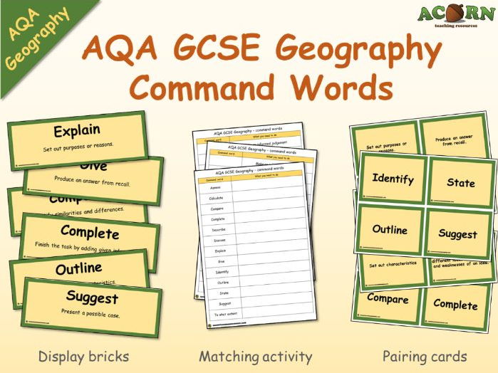
GCSE - AQA Geography - Command Words
Includes a set of display bricks, a set of pairing cards and a matching activity sheet for students to fill in. These are the command words as dictated by AQA for the new GCSE geography specification.
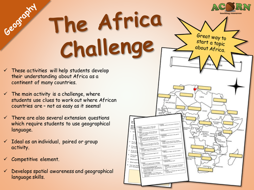
Geography - The Africa Challenge
Ideal for KS3, but could be used with KS4. Introduce the continent of Africa and develop their spatial awareness of this massive continent.
These activities will help students develop their understanding about Africa as a continent of many countries.
The main activity is a challenge, where students use clues to work out where African countries are – not as easy as it seems!
There are also several extension questions which require students to use geographical language.
Ideal as an individual, paired or group activity.
Competitive element.
Develops spatial awareness and geographical language skills.
As of the 16th February, all of our premium resources have received a 5/5* review.
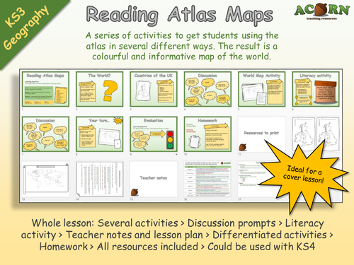
Geography - Reading Atlas Maps
*Requires an Atlas*
Originally aimed at KS3 but can be used with KS4. Ideal for cover, and getting to know groups. Gives lots of opportunity to talk about physical and human features around the world.
A series of activities to get students using the atlas in several different ways. The result is a colourful and informative map of the world.
Whole lesson: Several activities > Discussion prompts > Literacy activity > Teacher notes and lesson plan > Differentiated activities > Homework > All resources included > Could be used with KS4
The main aim is…
For students to use the atlas in several different ways to efficiently find information.
To complete a colourful and informative map of the world.
Every review we've had for a premium resource has been 5/5 (as of 2nd February 2017)

Geography - Map skills - The Island - Assessment
Whole lesson / assessment - could be used to teach map skills or use as a stand alone assessment to use at the end of a map skills topic.
The assessment requires students to read a list of instructions and complete a map of 'The Island'. Students can show and develop their skills with grid references, distance, direction and map symbols.
The assessment element will show the teacher and student progress made, and also inform the student as to what they need to do to get to the next level.
There is an extra activity which then allows students to show their understanding about human and physical features, this could also make a good link to a tourism topic and incorporates literacy. Teacher notes and a brief lesson plan included with extension and differentiation notes.
This whole lesson is ready to go. All of our paid resources have received a 5/5* review as of 29th January 2017.
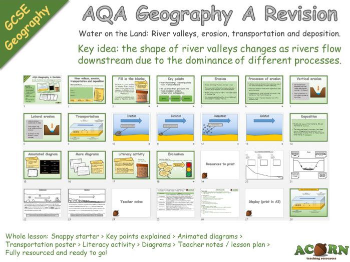
Whole lesson / Revision - Geography - AQA Geography A - Water on the Land
Whole lesson / Revision - Geography - AQA Geography A - Water on the Land
Long and cross profiles, erosion, transportation and deposition.
A revision lesson looking at - key idea: the shape of river valleys changes as rivers flow downstream due to the dominance of different processes.
Several activities which result in written work or annotated diagrams - perfect for revision!
Key points, diagrams and animations help explain / revisit learning.
Whole lesson: Snappy starter > Key points explained > Animated diagrams > Transportation poster > Literacy activity > Diagrams > Teacher notes / lesson plan > Fully resourced and ready to go!
All of our premium resources have received a 5/5* review as of 25th January 2017!
www.acornteachingresources.com