
103Uploads
138k+Views
51k+Downloads
Geography
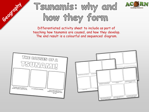
Geography - Natural Hazards - How tsunamis occur
Resource 1: Drawing activity to use when teaching the causes of tsunamis.
Resource 2: Differentiated activity sheet to include as part of teaching how tsunamis are caused, and how they develop. The end result is a colourful and sequenced diagram.
All of our premium teaching resources have received a 5/5 star review (As of 22nd January 2017)
www.acornteachingresources.com
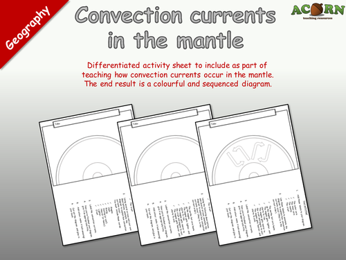
Geography - Natural hazards - Convection currents in the mantle
"Differentiated activity sheet to include as part of teaching how convection currents occur in the mantle. The end result is a colourful and sequenced diagram."
An activity requiring students to draw an annotated diagram to show how and why convection currents occur in the mantel.
The sheet has several activities built around this including; labeling the key features, adding arrows, explaining the processes, including a title and colouring it in.
There are three versions to suit higher, middle and lower ability groups / students.
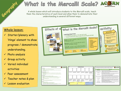
Geography - Natural Hazards - Earthquakes - Mercalli Scale drawing activity
A whole lesson which will introduce students to the Mercalli scale, teach them the characteristics of each level and allow them to demonstrate their understanding in several different ways.
Whole lesson:
Starter/plenary with ‘Hinge’ element to show progress / demonstrate understanding.
Photo analysis
Group activity
Varied individual activities
Peer assessment
Teacher notes & plan
Lesson evaluation
The main aim is…
For students to create an appropriate drawing for each level of the Mercalli scale, based on the descriptions.
For students to learn the main levels of the Mercalli scale.
For students to recognise how the scale changes between impacts on humans and impacts on the build environment.
To use / apply the Mercalli scale.
Key ideas and content…
The Mercalli scale has 12 levels.
The Mercalli scale measures the effects of an earthquake (and not the strength / energy like the Richter scale).
It is based on visual observations, and is split between effects felt by people and effects on the build environment.
To differentiate…
Help lower ability students by modelling some examples.
Underline the key terms in each description, and focus the drawings on these.
Encourage the use of thought bubbles and speech bubbles to add more depth and detail to the drawings.
Complete the drawing activity first, and then ask more able students to highlight main differences between each level.
To extend…
Play a Pictionary type game. Give the student a level from the scale which they then draw on the board. The class must then decide which level it is.
To assess…
Peer assessment included.
Check drawings for features unique to each level of the scale.
Use the Pictionary type game as a whole class assessment.
The photo analysis is intended as a Hinge for the learning, they come back to the original photo analysis and show / demonstrate their learning by filling in the post-it notes.
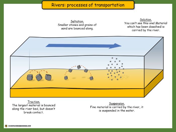
Geography - Rivers - Processes of transportation - Posters
2 posters in PDF intended for use as either a resource or classroom display. Print in A3.
www.acornteachingresources.com
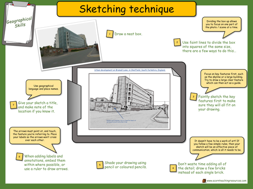
Geography - Geographical skills - Sketching wall display
Wall chart with a step by step guide to sketching - aimed at GCSE geography but appropriate to KS3 as well.
Print in A3.
The full lesson is available at:
https://www.tes.com/teaching-resource/geography-geographical-skills-sketching-field-and-from-photos-11486934
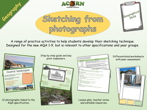
Geography - Geographical skills - Sketching (field and from photos)
A range of practice activities to help students develop their sketching technique. Designed for the new AQA 1-9, but is relevant to other specifications and year groups.
The lesson would be particularly useful to a GCSE group before they do their fieldwork, and will also be suitable for a KS3 class.
There are also detailed 'key points' so students understand why they need to know how to sketch, and what technique makes it effective. On top of the field sketching there is a focus on application of key terms.
The lesson has a range of visual resources, all relevant to the new 1-9 GCSE.
A free wallchart is available to download at https://www.tes.com/teaching-resource/geography-geographical-skills-sketching-wall-display-11486949
The main aim is…
To develop and practice field sketching / sketching from photographs technique.
To effectively annotate and label sketches to show understanding.
Key ideas and content…
This is a practical lesson which would benefit from lots of student interaction and discussion.
There are links to content, but it would work without – solely as a sketching lesson.
To differentiate…
Use the resources with the picture above a blank box for weaker groups.
Focus on the same photos.
Print the checklist.
Display the photos on the board and discuss as a class.
To extend…
This lesson could be used several times in the same format.
The teacher can add their own photos.
Take the class on a local visit to practice the technique.
Provide word banks for annotations.
To assess…
Peer assessment is woven into the main activity.
Teacher should be able to see visual progress with the quality of sketching and level of annotations.
All reviews for our premium resources have been 5/5 (as of 17th January 2017)
www.acornteachingresources.com
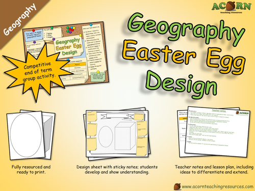
Geography - Design an Easter Egg (with a geographical theme)
End of term group activity to design an Easter egg with a geographical theme.
Will work as one lesson (with only the design proposal sheet completed) or two lessons (with completed designs on the templates).
Competitive element.
The group worksheet also has a 'Things we now know' to show progress'.
The teams have to work together to research and design an Easter egg with a geographical theme, this could be a place, landmark or something they've learned in lesson (more options given in lesson).
All resources are included. There is a pin board style slide to leave on the screen.
Laptops and atlases aren't essential, but will certainly help with the research (one per group).
www.acornteachingresources.com
All reviews for our paid products have been 5/5 (As of January 15th 2017).
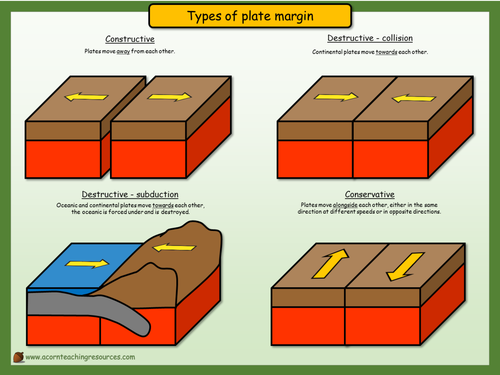
Geography - Display - Types of plate margin
Print in A3
A simple wall display to show the direction of plate movement.
www.acornteachingresources.com
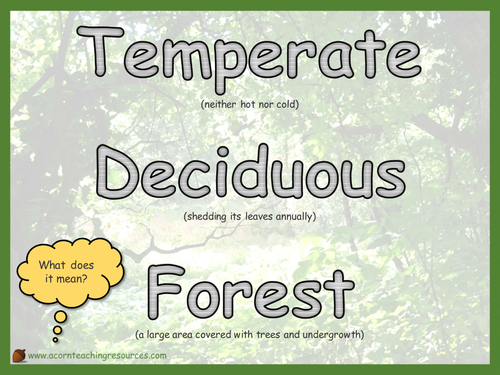
Geography - Display - Temperate Deciduous Forest definition
Print in A3 and stick on the wall somewhere.
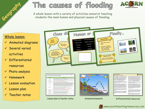
Geography - The causes of flooding - Whole lesson
Whole lesson - Geography - The causes of flooding
All reviews for our paid products have been 5/5 (As of January 5th 2017).
www.acornteachingresources.com
A whole lesson aimed at teaching students the main human and physical causes of flooding. Designed to be adaptable for KS3 and KS3, this lesson has a variety of differentiated activities and resources.
The main aim is…
For students to understand and explain the causes of flooding.
To differentiate between human and physical causes of flooding.
To link the causes to the processes of the river basin system – application of the key terms.
A secondary aim is for students to become familiar with the river basin system.
Key ideas and content…
There are both human and physical causes of flooding.
Events can happen in unique circumstances and in sequence to make flooding more likely.
Lesson includes:
Animated diagrams
Several varied activities
Differentiated resources
Photo analysis
Homework
Lesson evaluation
Lesson plan
Teacher notes
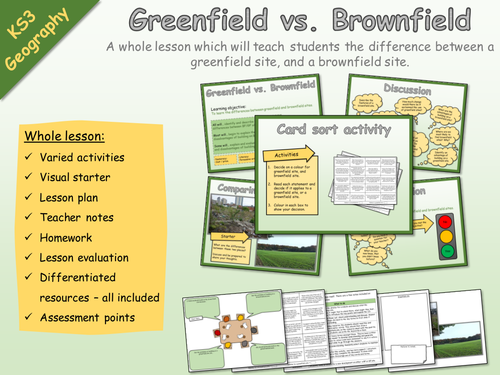
KS3 Geography - Settlement - Brownfield and greenfield sites
KS3 Geography - Settlement - Brownfield and greenfield sites
A whole lesson which will teach students the difference between a greenfield site, and a brownfield site.
Whole lesson:
Varied activities
Visual starter
Lesson plan
Teacher notes
Homework
Lesson evaluation
Differentiated resources – all included
Assessment points
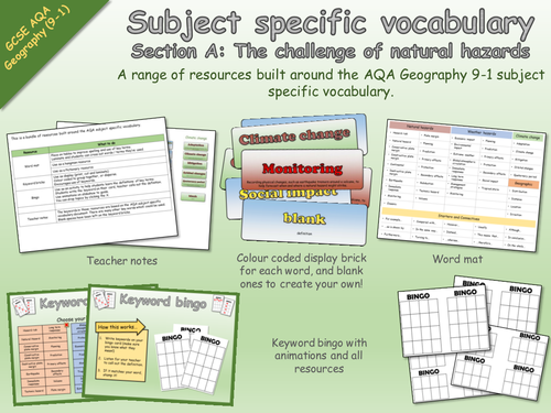
AQA Geography 9-1 Subject Specific Vocabulary - The challenge of natural hazards - Resources
Subject specific vocabulary resources
Section A: The challenge of natural hazards
A range of resources built around the AQA 9-1 Geography SSV for section A - The challenge of natural hazards.
Includes
- keyword bricks for display
- bingo game
- word mat
- teacher notes
All resources are included and are ready to print.
Keywords are grouped and colour coded.
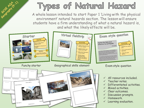
GCSE Geography - AQA - Living with the physical environment - Types of natural hazard
New 9-1 AQA Geography
Living with the physical environment
A whole lesson intended to start Paper 1 ‘Living with the physical environment’ natural hazards section. The lesson will ensure students have a firm understanding of what a natural hazard is, and what the likely effects will be.
All resources included.
Teacher notes.
Differentiated activities.
Mixed activities.
Clear outcomes.
Discussion prompts.
Homework.
Learning evaluation.
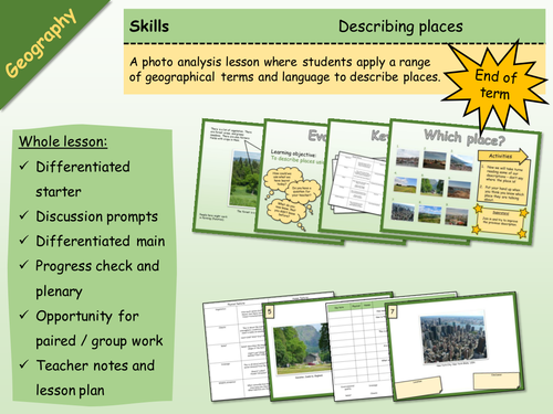
Geography - Skills - Describing Places
A big lesson with lots of opportunity for differentiation and engagement, as well as paired or group work.
Basically, students learn how to describe places, and then apply this skill. It would work well as a skills building lesson in KS3, or as an end of term type lesson with either KS3 or KS4.
There are differentiated resources for lower and higher, and a number of ways in which the activities could be undertaken (which are in the lesson plan). There are teacher notes and a lesson plan. The activities are clear, and there are Superstar extension activities.
---
The main aim is…
This is a big lesson which could be used as an end of term activity, or as a skills building lesson.
Students either learn or develop their geographical terminology and then apply / demonstrate using photos of actual places.
Key ideas and content…
We can describe places using geographical language.
It is more effective to use the correct key terms and descriptive language.
To differentiate…
Pass the sheets round on a timer, with the challenge of either adding more key terms or improving existing ones.
Stick the sheets on the wall around the room, give each student a different key term to look for. Students go round the room.
Insist on certain terms being applied.
To extend…
Insist on a description of features which aren’t necessarily visible.
Students find their own photos and analyse them.
Peer assessment.
There are some tricky terms in the key terms activity, use to stretch students.
To assess…
Discussion points.
The work produced.
Peer assessment opportunity.
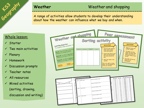
KS3 Geography - Weather & Climate - How weather influences shopping
A range of activities allow students to develop their understanding about how the weather can influence what we buy and when.
Whole lesson:
Starter
Two main activities
Plenary
Homework
Discussion prompts
Teacher notes
All resources
Mixed activities (sorting, drawing, discussion and writing)
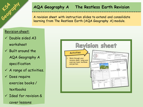
AQA Geography A - The Restless Earth - Revision Sheet
Double sided A3 revision sheet built around the AQA Geography A Restless Earth module.
The sheet is structured around the Key Ideas, and has a range of activities.
Essentially, they're just populating the sheet as a revision tool
Does require exercise books / internet / textbooks.
Ideal as module revision, exam revision or lesson cover.
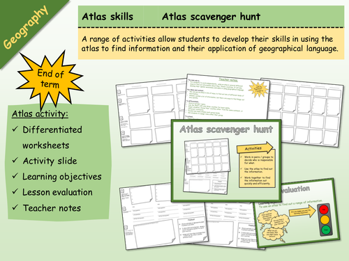
Geography - Atlas Scavenger Hunt 1
Whole lesson with instructions and teacher notes. Ideal for end of term.
The main aim is…
For students to work independently, using an atlas in several different ways to find out information about their chosen countries. It will also develop their spatial awareness, and skills in using geographical language.
Key ideas and content…
We can use an atlas in lots of ways, to find out lots of different kinds of information.
Atlases contain a lot of information, but there are ways to find things out very quickly.
Print in A3 - double sided.
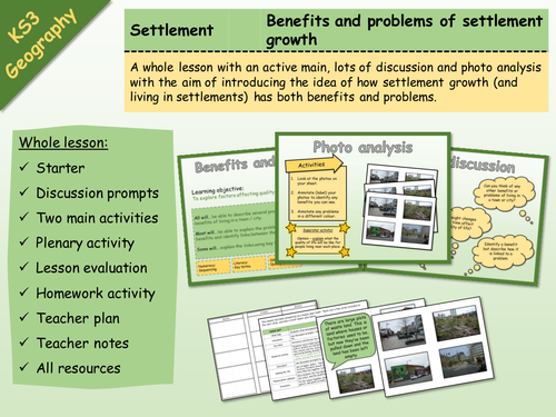
KS3 Geography - Settlement - Problems and benefits of settlement growth
Whole lesson with all resources included.
Learning objective: To explore factors affecting quality of life in large settlements.
Whole lesson:
Starter
Discussion prompts
Two main activities
Plenary activity
Lesson evaluation
Homework activity
Teacher plan
Teacher notes
All resources
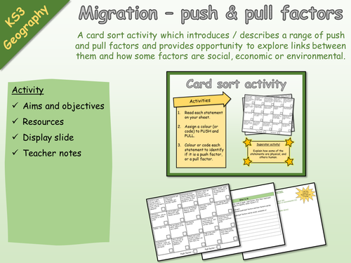
KS3 Geography - Activity - Migration - Push and pull factors
KS3 Geography - Activity - Migration - Push and pull factors
A card sort activity which introduces / describes a range of push and pull factors and provides opportunity to explore links between them and how some factors are social, economic or environmental.
Activity
Aims and objectives
Resources
Display slide
Teacher notes
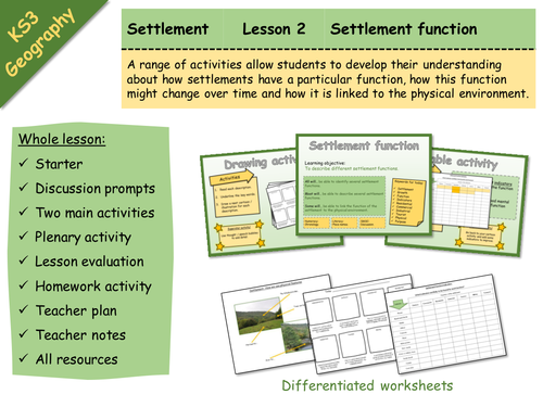
KS3 Geography - Settlement - 2 - Settlement function
Whole lesson with all resources included.
Learning objective: To describe different settlement functions.
A range of activities allow students to develop their understanding about how settlements have a particular function, how this function might change over time and how it is linked to the physical environment.
Whole lesson:
Starter
Discussion prompts
Two main activities
Plenary activity
Lesson evaluation
Homework activity
Teacher plan
Teacher notes
All resources - differentiated worksheets