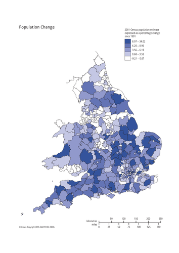
Uses images of England to encourage students to consider what England is like, includes plenary game 'A question of England'. Worksheet uses bi-polar analysis to investigate secondary images. Constructive comments please
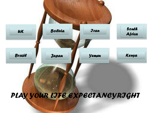
PowerPoint game based on play your cards right format, but for life expectancy. Students are shown life expectancy for first country and then have to work out, using prior knowledge, if the next country will be higher or lower. Great fun, has always worked well with classes and gets them thinking!
Comments welcomed!!
Uses BBC article to encourage students to look at the drought crisis in Africa, uses images from ActionAid. Asks if the UK is doing enough and what else can/should be done.
Feedback please
Uses worldmapper to consider countries with poor sanitation and water quality. Suggest split group into two families to work out which countries/regions firstly have best sanitation and secondly poorest water quality. Makes noises like Family Fortunes,but you will need a copy of the answers for your own information.
Feedback appreciated, thank you
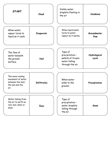
Key word dominoes - cut up and place in envelopes for students - start with START then match key words to definitions, finish with FINISH - simple really. (PS they go in alphabetical order). Feedback appreciated, thank you
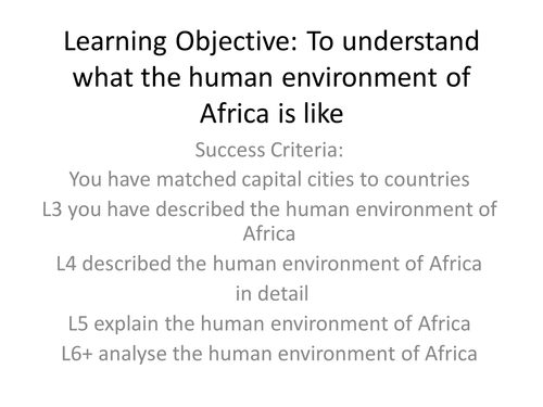
10 photographs showing capital cities of Africa and outline maps, works well if they are laminated and cut up in envelopes. Student use a map of Africa to match cities to countries before considering whether they are rich cities, poor cities and/or attractive to tourists. Comments appreciated please.
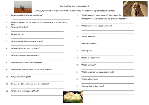
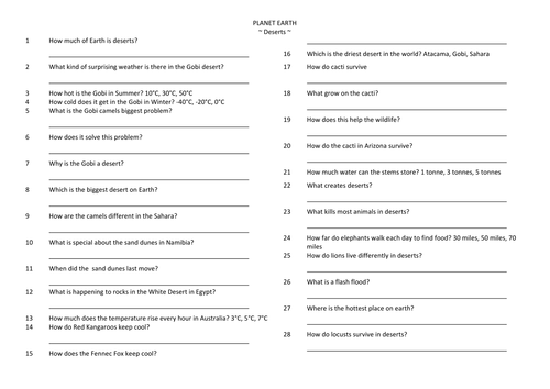
A question sheet to accompany the Deserts programme of BBC's Planet Earth. Backed with a prompt sheet to encourage students to consider how not all deserts are hot and sandy! Feedback appreciated please.
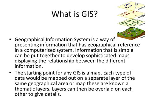
Prepared for AQA Geography B, a guide for students to use GIS to reseach Historic Hurricanes and accompanying PowerPoint. Task, for them to work in pairs to prepare a PowerPoint that uses GIS and explains why GIS is important in the preparation for Tropical Storms
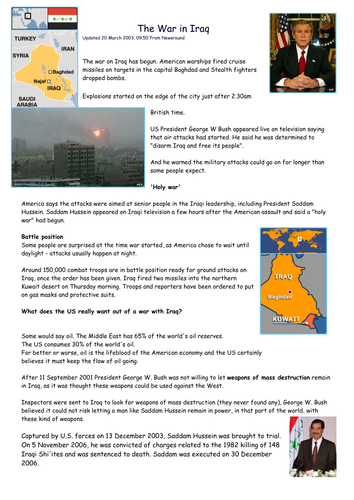
A DARTs (Directed Activity Related to Text) regarding the Earthquake and Tsunami on 11th March, uses CBBC Newsround. Suggest students then write a blog, some of ours went on the the school VLE.
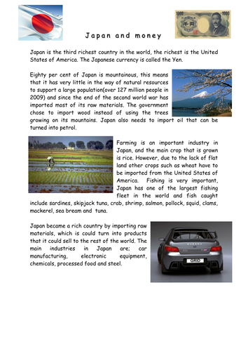
Starter of logos from Japanese companies. How did Japan become a rich country? Why has it slipped from 2nd to 3rd richest in the world? Article looks at who Japan exports to, who it imports from and some of what it imports and exports. Activities include graphs and comprehension, cloze passage for SEN students. Suggest you use my Crib Sheets for Success Criteria for graphs - see TES resources.
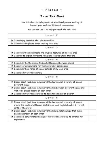
A teacher and student version of the Geography level descriptors. For students there is a tick sheet for each of the four strands and for teachers an overview. Very useful for writing differentiated success criteria and assessing pupils progress.
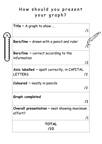
Updated crib Sheets to enable students to produce outstanding maps, graphs and fieldsketches. A 10/10 sheet to ensure they remember title, key etc. A useful reminder for students and another method for ensuring your lesson has success criteria!
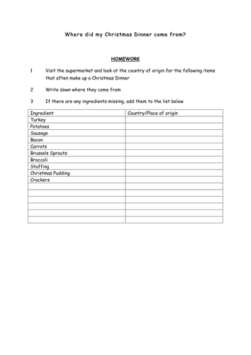
Encourages students to consider food miles and once they have gathered information, locations can be mapped and the food miles of their Christmas dinner calculated
Uses the Top Trump format to get children to make cards about Christmas. I tend to encourage a range of secular and religious figures - and a range of categories; present giving powers, ability to fly and relevance in the Christmas story
Uses the format of a recipe to encourage children to think about what makes a perfect Christmas, includes my suggestions, but open to being extended. Surprising how many children forget Christmas is a religious festival!