I am a Geography specialist who has also been teaching GCSE history for the past few years. I have uploaded some lessons for History and Geography. I hope people find them useful.
I am a Geography specialist who has also been teaching GCSE history for the past few years. I have uploaded some lessons for History and Geography. I hope people find them useful.
AQA GCSE Geography lesson for the 2016 specification Unit 1C: In this lesson we look at soft engineering methods of flood management.
We start with a retrieval practice grid game based around the work we have undertaken in the rivers unit of work so far. The students then complete a cloze exercise to create a definition of what soft engineering is. The students then investigate flood warnings as issued by the Environment Agency and preparations by completing a guided reading exercise. We then look at three soft engineering strategies in turn: River restoration, flood plain zoning and afforestation. For each method, the students write a description, sort out the advantages and disadvantages and complete a task involving a diagram. There is a short video task on rover restoration. We finish with a 6-mark GCSE style question and there is some guidance for students who need it on how to answer it.
Hope this saves you some valuable planning time.
https://www.tes.com/teaching-resources/shop/markthegeographer
AQA GCSE Geography lesson for the new specification Unit 1A: In this lesson we look at what extreme weather is, what type of extreme weather the UK experiences and whether the UK may experience more in the future.
The lesson has a retrieval practice starter where the pupils choose the places or the circumstances where tropical storms can be found. We then look at the definition of extreme weather. The students complete a map exercise which helps to explain why the UK’s geographical location allows a variety of extreme weather to be experienced. The students then complete a spider diagram on the types of extreme weather, there are some video clips and information slides to help with this which could be a carousel activity. We then complete a map exercise where the students use an atlas to locate where the extreme weather impacted and evaluate how severe the weather event was. We finish with a GCSE-style practice question with some guidance and structure provided for the students.
Hope this saves you some valuable planning time.
https://www.tes.com/teaching-resources/shop/markthegeographer
AQA GCSE Geography lesson for the new specification Unit 2B: In this lesson we look at the place of the UK in the wider world.
The lesson starts with a quick retrieval practice quiz true or false quiz. We then introduce some of the organisations that the UK is a member of and how this can give the UK global influence. The pupils then use a hexagon template to create an annotated diagram on our trade, transport, cultural and communication links. We then consider the UK’s relationship with the EU post-brexit and remind ourselves of how the UK left the EU. The pupils complete a cost/benefit analysis of this with explanation. We then look at the Commonwealth and the pupils complete an exercise that looks at the diversity of countries size and economies using indicators (Atlas or internet access needed). We then finish with a GCSE-style practice question with some guidance.
Hope this saves you some valuable planning time.
https://www.tes.com/teaching-resources/shop/markthegeographer
AQA GCSE Geography lesson for the new specification Unit 1B: In this lesson we look at what valuable commodities and services the rainforest provides.
The lesson has a rainforest themed retrieval practice starter. We look at what value the rainforest has to indigenous peoples and why these people may be at threat. Focusing on the Achua tribe we look at a video and complete some guided reading with the students completing some questions relating to the text. We then look at the valuable medicines that come from the rainforest, the students have to complete an annotated ‘rainforest cabinet’ using information from the slide. We then look at essential services. The students read the information on the various services the rainforest provides and rate them according to how important they are and explain why they think this. We finish with a GCSE-style practice question with some guidance and structure provided for the students.
Hope this saves you some valuable planning time.
https://www.tes.com/teaching-resources/shop/markthegeographer
This bundle features all 6 lessons from the AQA GCSE Geography Unit 1A section on climate change. Each lesson has a variety of differentiated activities, exam questions with guidance, video clips and worksheets ready to photocopy or print.
The order of the lessons is:-
The Evidence for Climate Change
The Natural Causes of Climate Change
The Human Causes of Climate Change
The Effects of Climate Change
Managing the Impacts of Climate Change
Adapting To Climate Change
I hope this saves you valuable planning time.
https://www.tes.com/teaching-resources/shop/markthegeographer
AQA GCSE Geography lesson for the new specification Unit 1A: In this lesson we look at the causes, effects of and responses to the Somerset Levels floods of 2014.
The lesson has a multiple choice retrieval practice starter. We firstly introduce the location of the Somerset Levels and the pupils consider why the area may be prone to flooding, this could be just a discussion or they could annotate the map. They use sentence fragments to write a description of the location. We then look at the causes of the floods, for this the students complete a cloze exercise and highlight long and short term causes. There is a video clip to watch on what happened during the floods. The students then create a map to show the extent of the floods by colouring by numbers on a worksheet. They then look at the impacts and categorise them into social, economic and environmental. We then briefly look at dredging with an optional video clip before the students sort the responses out into immediate and long-term responses on a worksheet. We finish with a GCSE-style practice question with some guidance and structure provided for the students, there is also marking guidance provided.
Hope this saves you some valuable planning time.
https://www.tes.com/teaching-resources/shop/markthegeographer
AQA GCSE Geography lessons for the Resource Management Section Unit 2C. All lessons are fully resourced, differentiated with a variety of activities and practice questions.
Lessons included are.
The Global Distribution of Resources
Provision of Food in the UK
Provision of Water in the UK
The Provision of Energy in the UK
I hope this saves you some valuable planning time.
https://www.tes.com/teaching-resources/shop/markthegeographer
AQA GCSE Geography lesson for the new specification Unit 1C: In this lesson we look at hard engineering methods of flood management.
We start with a retrieval practice grid game based around the processes and landforms of erosion. The students then complete a cloze exercise to create a definition of what hard engineering is. We briefly introduce soft engineering, then the students have a blank diagram of a drainage basin which has undergone both hard and soft engineering strategies to reduce flooding. The students have to annotate the diagram and work out which is hard and soft engineering. The students are then given some information cards and have to record details on four methods of hard engineering:- dams and reservoirs, flood relief channels, embankments and channel straightening. The students record the advantages and disadvantages and complete a rating exercise for various factors. We finish with a 9-mark GCSE style question and there is some guidance for students who need it on how to answer it.
Hope this saves you some valuable planning time.
https://www.tes.com/teaching-resources/shop/markthegeographer
AQA GCSE Geography lesson for the new specification Unit 1C: In this lesson we look at erosion, transportation and deposition.
The starter is “which row is the odd one out”. The pupils need to work out which row has an incorrect term in. Just gets them thinking.
We then look at erosion and when rivers are eroding more effectively. The pupils learn about vertical and lateral erosion and will be making some diagrams in there exercise books. They then receive a worksheet where the processes of erosion and transportation are illustrated, the pupils use an information slide (or sheet if you prefer) and label the processes on and colour code the area of the diagram where that process is displayed. We then look at how these processes vary as you progress down the long profile of a river. The pupils get another worksheet where they read the labels and draw an appropriate diagram in each box to create an illustrated log profile. We finish with a summarising pyramid plenary.
In a nutshell lesson includes:
Odd one out starter.
Vertical and lateral erosion diagram activity
Worksheet on processes of erosion
Worksheet activity on processes of erosion along the course of a river
Summarising pyramid
Hope this saves you some valuable planning time.
https://www.tes.com/teaching-resources/shop/markthegeographer
AQA GCSE Geography lesson for the new specification Unit 1C: In this lesson we look at how the Midlands town of Banbury has managed flood events through a flood alleviation scheme…
There is a pre-populated retrieval practice starter grid at the beginning of the lesson.
We begin by looking at the location of Banbury and the students construct a description of the location from sentence fragments. We then move onto the historical floods at Banbury and why it needed protection. There is a cloze exercise for the students to complete. We then look at the flood alleviation scheme and the students have a blank map of the area and they use grid references to locate and annotate on the map the feature of the scheme. We then complete a categorising activity on the benefits and issues of the scheme. There is also a 9-mark GCSE-style practice question with some guidance for the students on how to complete it.
Hope this saves you some valuable planning time.
https://www.tes.com/teaching-resources/shop/markthegeographer
AQA GCSE Geography lesson on Sustainable Urban Living using Freiburg as an example.
Included in the lesson is:
Video clips on Freiburg
Information sheet on sustainable living in Freiburg
A3 double sided task worksheet with a variety of actvities for differing abilities
Practice GCSE Questions
You may wish to use alongside the Oxford AQA GCSE Geography textbook, but all resources are included.
Hope this helps.
https://www.tes.com/teaching-resources/shop/markthegeographer
AQA GCSE Geography lesson for the new specification Unit 2B: In this lesson we look at the changing transport infrastructure of the UK.
The lesson starts with a retrieval practice task. We then briefly consider what infrastructure means before looking at what the problems with the UK’s existing infrastructure is. The pupils create a mind map for this. We then look at projects that the UK is undertaking or has recently undertaken to improve transport connections. The pupils have a map of the UK to annotate using information slides that can be placed around the room, on tables or in groups. We look at a short video clip on Crossrail and the pupils answer questions about the impacts the project being over schedule and over budget has had on local people and the economy. There is a consolidation task which gives pupils a choice or questions to answer. We finish with a 6-mark practice question with some guidance on how to respond.
Hope this saves you some valuable planning time.
https://www.tes.com/teaching-resources/shop/markthegeographer
AQA GCSE Geography lesson for the new specification Unit 1C: In this lesson we look at depositional features found in the lower course of a river.
The starter is a a countdown retrieval practice quiz with dramatic countdown music!
We start by looking at natural levees and how they are formed. The pupils create a sequence of diagrams to show their formation based on information on the board. They are provided with outline drawings to start with to save time. We then look at the formation of floodplains. The pupils create a diagram based on the instructions on the board without actually seeing the diagram, but there is an example if they are struggling and they are given an outline floodplain to start with. We then look at the formation of estuaries. The pupils annotate a photograph to show the different features of the estuary formed by deposition. We finish on a 4 mark question on the formation of floodplains that was in an exam in 2017. I usually model the answer after the pupils have had a go.
In a nutshell lesson includes:
Retrieval practice grid starter.
Formation of levees sequential diagram.
Formation and features of a floodplain diagram activity with outline.
Photo annotation for estuaries.
4-mark GCSE question with guidance.
Hope this saves you some valuable planning time.
https://www.tes.com/teaching-resources/shop/markthegeographer
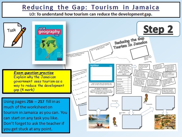
AQA GCSE Geography lesson on reducing the development gap in Malaysia.
****You will need the Oxford GCSE Geography textbook for AQA.
This lesson contains a differentiated a3 worksheet for the pupils to workthrough using the textbook. There is a variety of tasks that the pupils can choose from and some video clips on Jamaica to give the pupils a brief insight into the island.
Included are:-
Starter activity
Video Clips
Differentiated Worksheet.
Hope this helps.
https://www.tes.com/teaching-resources/shop/markthegeographer
AQA GCSE Geography lesson for the new specification Unit 1B: In this lesson we look at what the physical characteristics of tropical rainforests are.
The lesson has a retrieval practice starter quiz on rivers to begin with. We then look at what it is like to be in the rainforest with a short video clip of walking through the forest. We then look at the location of tropical rainforests and the students have a map with some questions of differing difficulty to answer. The students are provided with a worksheet to draw a climate graph of the rainforest with some additional skills questions to answer (works well with a visualiser). The students complete an annotated profile of the rainforest latosol soil, describing and explaining its characteristics. We then look at the nutrient cycle and the students annotate a diagram making sure they eliminate the incorrect word from the annotation. We finish with a GCSE-style practice question with some guidance and structure provided for the students.
Hope this saves you some valuable planning time.
https://www.tes.com/teaching-resources/shop/markthegeographer
AQA GCSE Geography lesson for the 2016 specification Unit 1C: In this lesson we look at the physical and human factors affecting flood risk and storm hydrographs and what factors affect their shape.
We start with a retrieval practice quiz with ten questions. We begin by looking at the definition of flooding and a brief example by considering the floods around Doncaster in 2019 and 2020. There is a video clip for this. We then look at the physical and human factors that affect flooding. The students have a diagram to annotate and locate an appropriate example on the diagram, they then colour code the annotations into physical and human factors. We then explore the components of a hydrograph. The students have a blank graph to label on the various component parts of the graph. We then look at what factors are likely to affect the storm hydrograph. Here the students have a grid to fill in with annotations from the board. They have to locate where the annotation would logically go on their grid. We finish with a 4-mark GCSE style question and there is some tips for students who need it on how to answer it.
Hope this saves you some valuable planning time.
https://www.tes.com/teaching-resources/shop/markthegeographer
AQA GCSE Geography lesson for the new specification Unit 1A: In this lesson we look at monitoring, prediction, planning and protection in regards to tropical storms.
The lesson has a tropical stormed themed retrieval practice starter. We firstly introduce the importance of monitoring to aid prediction with measurements of SST’s. There is a cloze writing exercise on monitoring of hurricanes. A video clip from American tv provides a useful example of how tropical storms are monitored and their paths predicted even on mainstream television. There are some questions for the clip. We then look at protection, specifically storm shelters in Bangladesh, the pupils will have to label the storm shelter and annotate why these features of the storm shelter were needed. We then look at how building in vulnerable areas has made the risks of tropical storms and storm surges more severe. We then look at Bangladesh as a success story of monitoring, predicting, planning and protection, the students have a grid with the actions that have been undertaken by Bangladesh, they have to categorise them accordingly. We finish with a GCSE-style practice question with some guidance and structure provided for the students.
Hope this saves you some valuable planning time.
https://www.tes.com/teaching-resources/shop/markthegeographer
This is a six lesson bundle for the AQA GCSE Geography Specification for Hot Deserts.
Each lesson is roughly one hour long and include a variety of activities, video clips and GCSE practice questions with guidance on how to answer them, The lessons use the examples of the Thar Desert and Badia in Jordan. Lesson titles include:-
Environmental Characteristics
Plant & Animal Adaptations
Opportunities for Development
Challenges of Development
Causes of Desertification
Reducing Desertification
Hope this helps.
https://www.tes.com/teaching-resources/shop/markthegeographer
AQA GCSE Geography lesson for the 2016 specification Unit 1B: In this lesson we look at how ecosystems operate, from small-scale ecosystems to biomes.
We start with a retrieval practice task based around coats. We begin by looking at what the biotic and abiotic components of an ecosystem are.
The students are given an example ecosystem and have to categorise the components according to whether they think they are biotic or abiotic. We then look at different scales of ecosystems and look at trophic levels. The students work out which examples belong with which trophic level . We then explore an example of a food chain, using a small-scale ecosystem (a pond) the students have to work out which creatures belong in which trophic level. We then look at biomass in the food chain and discuss why biomass declines at each level. We finish with a 4-mark GCSE style question and there is some tips for students who need it on how to answer it.
Hope this saves you some valuable planning time.
https://www.tes.com/teaching-resources/shop/markthegeographer
GCSE Geography worksheet on which the pupils create a choropleth map to show the distribution of the numbers of people affected by the tropical storm. It also has some GCSE-style questions for the pupils to answers.
Please feel free to download and adapt.
https://www.tes.com/teaching-resources/shop/markthegeographer