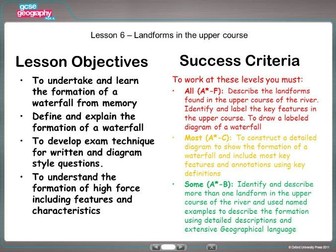
Presentation and card sort activity. Print outs included. Video links included in PowerPoint. Landforms covered: Waterfalls, gorges, interlocking spurs and V shaped valleys. 8 mark question included with card sort answers to create a perfect answer based on the AQA A spec
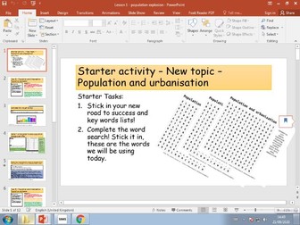
KS3 Urbanisation
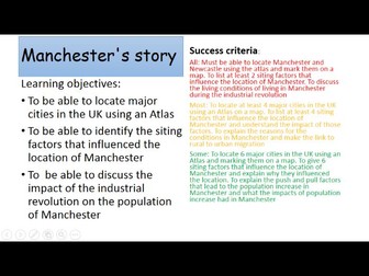
Lesson is a follow up from push and pull factors and why people moved to urban areas in the 1700’s due to the industrial revolution.
Starter: Is your factor a push or pull factor, tell me why. Range of difficulty. White boards
Main:
Locating major cities using an atlas - worksheet differentiated.
What are the siting factors that influence Manchester’s location - Bingo game, grid included. Siting factors on the next slide. Section on worksheet to complete
What were the impacts of urbanisation on Manchester - youtube clip and worksheet to complete. Differentiated based on ability
Chance card for Lower Ability to use throughout the lesson if needed.
Plenary: Quiz
Extension: population growth line graph
Lesson starter: Catch phrase of key words (answers on a white board)
exam style questions and mark scheme. Students are to complete the exam question starter (differentiated)
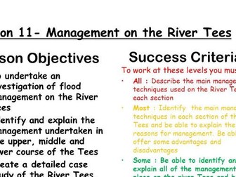
To complete each worksheet there must be 3 stations - upper course (cow green reservoir), middle course (Yarm flood defence scheme and mandale meander cut off ) and lower course (Tees barrage) Card sorts have one copy which is in black and white one colour coded for social, economic and environmental impacts (cow green and tees barrage) The yarm flood defence scheme Is based on newspaper articles
Thinking hats sheet to complete with questions relating to each method of management in the upper middle and lower course. Exam style question to complete at the end.
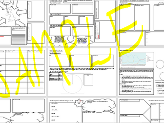
Based on the OCR A Geography GCSE these revision sheets have been designed as a guided self summary sheet allowing students to cover as much as possible in an organised way.
Sheet 1: Uneven development, the factors leading to uneven development and the consequences
Sheet 2: How aid can help or hinder development - Ethiopia
Sheet 3: The role of politics in Ethiopia
Sheet 4: Changes in employment structure, social factors and technological developments. Goat aid and Rostows development model
Sheet 5: Urbanisation - The majority f the worlds population living in urban areas
Sheet 6: Causes and consequences of rapid urbanisation - Rosario, Argentina
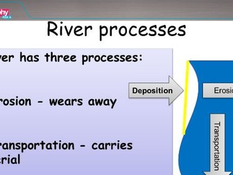
PowerPoint on processes of transpiration for rivers and the coast. Based on teaching both topics together. Can be used separately. OCR spec teaches both together. AQA new spec separate.
Video links clearly marked on icons. Clear diagrams and use of exam style questions with mark schemes.
A follow on from learning the names and the movements of the 4 plate boundaries.
Focus on constructive plate boundaries. Students prior knowledge should be based on hand action for each of the plate boundaries (kung fu plate boundaries)
For this lesson students will focus on constructive plate boundaries. Starter: differentiated teach me tell me cards / taboo cards. 2 minute review (what did you find out)
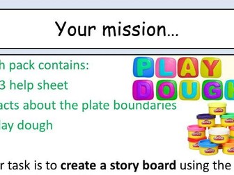
Main: to produce a diagram with detailed annotations of a constructive plate boundary. Video link to exploring the mid Atlantic ridge. Differentiated worksheets. Lesson based on using play dough to construct the diagram can be drawn just as easily.
Plenary: Richard and Judy's you say we pay. Back to the board and describe the key term based on the lesson
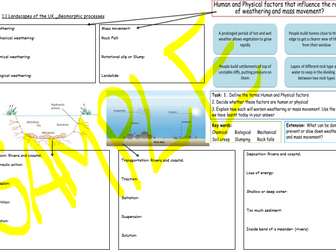
Three sheets to help students to organise their revision making sure they cover as much content as possible.
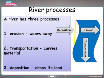
Sheet 1 covers the Geomorphic processes. They should be able to define each geomorphic process including: Erosion, Transportation, deposition, weathering and mass movement.
Sheet 2 covers river landforms in the upper middle and lower course, spaces for diagrams and explanations. Hint included to remind students to discuss geomorphic processes. Section about the Bradshaw model. Definitions stars to remind students of some common features that are missed
Sheet 3 covers coastal landforms of erosion and deposition. Same style as the rivers worksheet. Space for students to explain the formation of a beach. Definitions stars to remind students of some common features that are missed
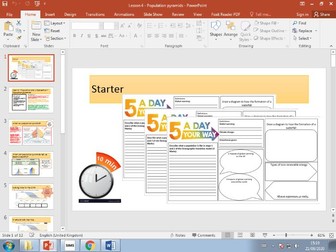
Starter: 5 a day - recap of 5 topics in ks3 - these are rivers, energy, birth rates and death rates in this case.
Clear LO and success criteria
Key term match up task
Development definition - white board activity
Poor countries and rich countries video with work sheet (all at the end of the ppt)
Map task - mark on areas of HIC, EDC and LIC using an atlas
Factors affecting development task and video
Plenary: Describe a map showing distribution of income around the world
Starter: Unscramble the words task
Clear LO and success criteria
India Location task - blank maps included, description
Change in population structure using population pyramids activity
Source and questions activity - new key terms introduced and video
Rostows development model activity on case study sheet and video
Changing industry and the multiplier effect info and source sheet activity
Change in population structure source and activity on case study sheet
TNC’s advantages and disadvantages card sort and complete case study sheet
Import and exports info and activity on case study sheet
Millennium development goals - videos and info to complete case study sheet
Sustainable development goals activity
International aid - key terms and activity for case study sheet
Resources at the end of the ppt to complete throughout the lesson
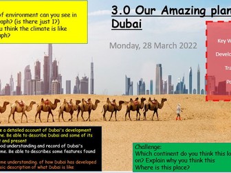
PPT presentation about Dubai’s location and the history of Dubai. Comes with success criteria, key terms, definitions, tasks, worksheets and challenges.
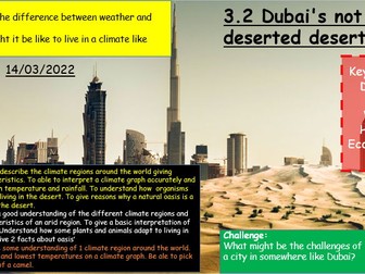
PPT about the desert not being so deserted. Starter: 5 tasks in 5 mins. Success criteria. Climate regions of the world. CLimate graph of the UAE interpretation task. Adapting to living in the desert video and worksheet. Example of an oasis task and video. Plenary,
Tasks, worksheets, key words, challenge
PowerPoint with erosion for both the coasts and water on the land. Includes exam style questions with clear mark schemes to follow. Links to video clips from clicking on the stars. Clear diagrams and easy to follow. Can be taught separately or according the new OCR specification. Same content covered for new AQA specification.
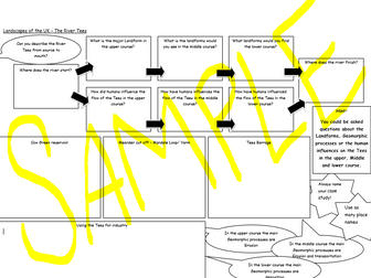
These guided self summary sheets are designed to assist students with revising 4 case studies for rivers and coasts. This will apply to OCR A and AQA exam boards.
The first case study: The river Tees.
Students are encouraged to split the case study into each section of the river (upper. middle and lower course) and include landforms in each section as well as human activity. There are hints and tips about making sure they include case study specific detail and geomorphic processes
Sheet 2: Boscastle/ Carlisle flood.
Includes the causes (human and physical), effects (primary and secondary) and responses (short term and long term) as well as practice questions for students to complete.
Sheet 3: Holderness coast.
Landforms along the Holderness coast, Causes, effects (Social, economic and environmental) and responses (hard and soft engineering).
Sheet 4: Same sheet as above but for the North Norfolk case study.
Please note that these are sheets for the students to fill in they are not resources that are used for teaching. Answers have not been provided. These are a tool to provide for homework or as a revision tool in lesson or study periods.
Starter : Wordsearch
Clear lesson objectives, including success criteria
Video task with differentiated worksheets (on the end of the ppt)
Graph plotting task
exam questions PEEL paragraph task
Plenary: discussion task
Starter activity linked to meanders.
Clear success criteria
Defining what is trade
Describing how Brexit may impact trade.
Trade data using .gov website to explore imports and exports
Lots of data analysis
Exam style questions - discuss
Starter: 5 a day - recap of 5 things students have done in ks3. The DTM, Greenhouse gases, impacts of global warming, waterfalls, renewable/ non renewable energy.
Clear LO and success criteria
What is a population pyramid (general) new key terms and sketch task
Population pyramid for an LIC and a HIC compare and link to birth rates, death rates and total population
card sort the shape of the population pyramid to the correct stage of the DTM
Create 2 population pyramids for a HIC and an LIC using data and graph paper activity
Resources all at the end of the ppt
Based on the OCR A Geography GCSE these series of revision sheets have been created to help students to organise revision and make sure they cover as much content as possible. These can be set for study or for homework.
I have tried to make each sheet so that it links directly to the OCR A revision guide to make it easier for students to follow although some case studies may have been changed to more suit.
contents of revision sheets:
Air masses and the impacts on the UK (diagrams and questions)
Extreme floods in the UK (example questions added)
Using and modifying environments (farming, fishing, wind and fracking)
Energy sources in the UK - renewable energy
Energy sources in the UK - non renewable (pie chart skills activity)
Energy management in the UK - more source information
Sustainable energy solutions
The development of renewable energy
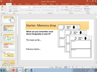
Starter: Memory drop. What you remember from this topic, what you remember from previous topics
Clear LO and success criteria
Think pair share - How can we tell if a country is developed
New Key terms
Demographic transition model - video and blank graph to sketch while watching the video
Add a table describing each stage of the DTM (template included)
Exam style question
Plenary: What would it be like if all countries were in stage 5
Clear success criteria
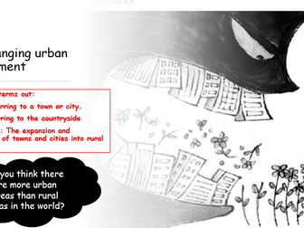
Covers key terms including: Rural, Urban and urbanisation
Describe a graph activity
Timeline of urbanisation card sort activity
links to youtube clips and template of a timeline included
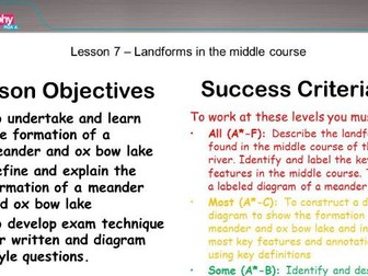
PowerPoint including the middle course of a river. Landforms: Meanders and ox bow lakes. Exam style questions, photograph analysis and video links on icons.
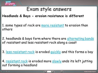
Landforms of erosion. Headlands and bays. Starter recap of the types of erosion. Image analysis. Video link and diagrams. explain the formation. Finished with AQA exam question and mark scheme where students can peer assess or self assess.
 Quick View