Constructive Plate Margins and Shield VolcanoesKS3/ GCSE Geography AQA Tectonic HazardsQuick View
ashley178

Constructive Plate Margins and Shield VolcanoesKS3/ GCSE Geography AQA Tectonic Hazards

(0)
Fully resourced Geography lesson on constructive plate margins and shield volcanoes designed for Year 8 but also suitable for GCSE Geography including AQA Tectonic Hazards. 
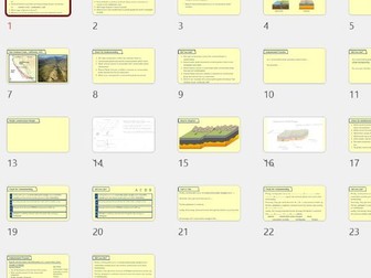
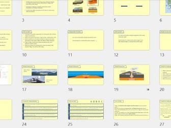
This lesson introduces students to constructive plate boundaries, the formation of shield volcanoes, and associated landforms including mid-ocean ridges and rift valleys. Students explore named examples including the Mid-Atlantic Ridge, East African Rift Valley, Hecla and Katla in Iceland. The lesson uses a clear scaffolded structure moving from retrieval practice and teacher modelling through to independent exam-style extended writing. Includes: Full PowerPoint lesson Two printable worksheets Retrieval starter activity Multiple check for understanding activities Sequencing and cloze tasks Annotated diagram activities Oracy and discussion opportunities GCSE style 4 mark question practice Named examples and case studies Success criteria and key vocabulary support Learning objectives: Identify examples of constructive plate margins Explain how constructive plate boundaries work Describe how shield volcanoes are formed Understand the formation of rift valleys and mid-ocean ridges Suitable for: KS3 Geography GCSE Geography AQA Geography Mixed ability classes Revision lessons
Conservative Plate Margins and Earthquakes KS3 or GCSE Geography AQA Tectonic HazardsQuick View
ashley178

Conservative Plate Margins and Earthquakes KS3 or GCSE Geography AQA Tectonic Hazards

(0)
A fully resourced KS3 or GCSE Geography lesson focused on conservative plate margins and earthquake formation, designed to support students in developing clear, structured exam answers. This lesson guides students from prior knowledge retrieval through to extended writing, using a scaffolded approach that builds confidence and understanding. What’s included: Retrieval starter on key tectonic concepts Clear explanation of conservative plate boundaries Case study: San Andreas Fault, California Step-by-step modelling of earthquake formation Key terminology: focus, seismic waves, friction, convection currents Multiple check-for-understanding (CFU) opportunities Structured writing task for a 4-mark exam question Success criteria to support high-quality answers Learning Objectives: Describe the characteristics of conservative plate margins Explain how earthquakes form at conservative plate boundaries Apply knowledge to a named example Why this lesson works: Strong focus on exam technique and sequencing Built-in scaffolding for lower ability students Opportunities for oracy, modelling, and independent practice Easily adaptable depending on class ability Perfect for AQA GCSE Geography (Tectonic Hazards), but suitable for other exam boards and year groups.
Geography Skills Booster 1: 4-Figure Grid References & Mean (GCSE Prep or Intervention))Quick View
ashley178

Geography Skills Booster 1: 4-Figure Grid References & Mean (GCSE Prep or Intervention))

(0)
A fully resourced, one-hour Geography skills lesson focusing on 4-figure grid references and calculating the mean, designed as a flexible skills booster rather than a fixed curriculum unit. Originally used successfully with Year 9 lower ability classes and Year 8 high ability, this lesson works particularly well as a filler lesson, end-of-year skills refresher, or transition activity to prepare students for GCSE Geography. Even for pupils who do not continue with Geography, the numeracy and data-handling elements strongly support Maths and Science learning. What’s included: Clear, step-by-step teaching slides explaining: How to read 4-figure grid references How to calculate the mean (average) Guided practice and independent tasks Printable worksheet(s) (Word format) for student work Model answers included Exam-style questions taken from genuine past AQA GCSE Geography papers at the end of the lesson Why teachers like it: ✔ Ideal one-hour standalone lesson ✔ Works as a skills booster, intervention, or cover lesson ✔ Builds map skills + maths confidence ✔ Suitable for mixed ability, SEN-friendly pacing ✔ No prior knowledge required ✔ Minimal prep – print and teach Best suited for: Year 8 high ability Year 9 any ability Y10/11 lower ability or intervention GCSE transition / pre-GCSE skills End-of-term or early-finish filler lessons Numeracy support within Geography This lesson is part of a small skills-focused mini-series, each designed to stand alone while reinforcing essential geographical and mathematical skills students need for GCSE success.
Geography Skills Booster Lesson 2 – 6-Figure Grid References, Mode, and Latitude/LongitudeQuick View
ashley178

Geography Skills Booster Lesson 2 – 6-Figure Grid References, Mode, and Latitude/Longitude

(0)
A fully resourced, one-hour Geography skills lesson focusing on 6-figure grid references, mode, and latitude and longitude, designed as a flexible skills booster for KS3 or early GCSE preparation. This lesson has been successfully used with Year 9 lower ability classes and Year 8 high ability, and works particularly well as a standalone filler lesson, skills consolidation session, or transition activity ahead of Year 10. Although geography-focused, the lesson deliberately reinforces core numeracy and data-handling skills, making it valuable even for students who do not continue with GCSE Geography. Skills covered: Reading and interpreting 6-figure grid references With and without interval guides Understanding and calculating mode (including bimodal sets) Identifying and using latitude and longitude Hemispheres, equator, tropics, Arctic/Antarctic circles Writing correct coordinate references What’s included: Clear, step-by-step teaching slides Guided examples and scaffolded practice Independent “in books” tasks Printable worksheet(s) (Word format) Answers included for easy marking or self-assessment Exam-style questions from genuine AQA GCSE Geography papers Why teachers choose this lesson: ✔ Ideal one-hour standalone session ✔ Excellent skills refresher or intervention lesson ✔ Builds map skills + maths confidence ✔ Suitable for mixed ability and lower ability groups ✔ Minimal preparation – print and teach ✔ Strong preparation for GCSE Geography expectations Best suited for: Year 8 high ability Year 9 lower to mixed ability Year 10/11 Intervention GCSE transition / skills bridging End-of-term or early-finish lessons Numeracy support within Geography This lesson is Lesson 2 in a four-lesson Geography Skills Booster bundle, with each lesson designed to work independently or as part of a short skills sequence.
Geography Skills Booster Lesson 4 – Range & Relief (OS Map Height Skills)Quick View
ashley178

Geography Skills Booster Lesson 4 – Range & Relief (OS Map Height Skills)

(0)
A fully resourced, one-hour Geography skills lesson focusing on calculating the range and understanding relief on OS maps, combining numeracy skills with essential physical geography map interpretation. This lesson has been successfully used with Year 9 lower ability classes and Year 8 high ability, and works particularly well as a standalone skills booster, end-of-year filler lesson, or GCSE transition activity. The lesson develops students’ confidence with data handling while introducing and reinforcing key relief concepts needed for GCSE Geography. Skills covered: Calculating the range from data sets Identifying highest and lowest values Applying range calculations to geographical data Understanding relief and height on maps Recognising and interpreting: Colour layering Spot heights Contour lines Interpreting contour spacing to identify steep and gentle slopes Describing patterns of upland and lowland areas using compass directions What’s included: Clear, step-by-step teaching slides Guided examples and model answers Independent “in books” tasks OS map–based practice questions Printable worksheet(s) (Word format) Answers included for easy marking or self-assessment Exam-style practice questions aligned with GCSE Geography expectations Why teachers choose this lesson: ✔ Ideal one-hour standalone lesson ✔ Strong links between Maths and Geography ✔ Develops key map and physical geography skills ✔ Suitable for lower ability, mixed ability, and intervention groups ✔ Minimal preparation – print and teach ✔ Excellent preparation for GCSE map and data questions Best suited for: Year 8 high ability Year 9 all ability Year 10/11 intervention GCSE transition / pre-GCSE skills End-of-term or early-finish lessons Numeracy reinforcement within Geography This lesson is Lesson 4 in a four-lesson Geography Skills Booster series, with each lesson designed to work independently or as part of a short, flexible skills sequence.
Geography Skills Booster Lesson 3 – Median & Scatter Graphs (Correlation SkillsQuick View
ashley178

Geography Skills Booster Lesson 3 – Median & Scatter Graphs (Correlation Skills

(0)
A fully resourced, one-hour Geography skills lesson focusing on calculating the median and drawing and interpreting scatter graphs, with a clear emphasis on exam-style data skills. This lesson has been used successfully with Year 9 lower ability classes and Year 8 high ability, and works particularly well as a standalone skills booster, numeracy-focused geography lesson, or transition activity preparing students for GCSE-style questions. The lesson deliberately strengthens mathematical reasoning and data interpretation, making it valuable even for pupils who do not continue with GCSE Geography. Skills covered: Calculating the median Ordering data correctly Odd and even data sets Interpreting data in geographical contexts Plotting scatter graphs Identifying and describing: Positive correlation Negative correlation No correlation Writing clear exam-style correlation statements Drawing and interpreting a line of best fit What’s included: Clear, step-by-step teaching slides Guided examples with modelled answers Multiple opportunities for independent practice Realistic geography-based data sets Printable worksheet(s) (Word format) Answers included for self-marking or teacher use Exam-style practice questions aligned to GCSE Geography expectations Why teachers choose this lesson: ✔ Ideal one-hour standalone lesson ✔ Builds data-handling and graph skills ✔ Strong links to Maths and Science numeracy ✔ Suitable for lower ability, mixed ability, and intervention groups ✔ Minimal preparation – print and teach ✔ Excellent preparation for GCSE-style data questions Best suited for: Year 8 high ability Year 9 lower to mixed ability Year 10/11 intervention GCSE transition / pre-GCSE skills End-of-term or early-finish lessons Numeracy reinforcement within Geography This lesson is Lesson 3 in a four-lesson Geography Skills Booster series, with each lesson designed to work independently or as part of a short, flexible skills sequence.