Low-lying coast, cliffed coast, skerry coast, mangrove coast, wadden sea coast, barrier-lagoon coast
Suitable for ages 12 and up by Dr. Dietrich Steincke
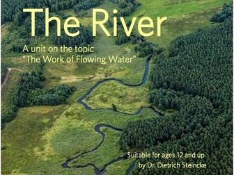
Would you like to introduce your students to the fascinating world of rivers? This resource provides an excellent foundation for clearly explaining the different sections of a river and its characteristic features. Here, you will find everything you need for an engaging lesson:
A clear and accessible introduction to the topic of rivers.
Compelling visuals - including both detailed diagrams and actual photographs - help your students identify the key components of a river.
The material provides a simple explanation of the terms “upper course,” “middle course,” and “lower course” for both you and your students.
Essential technical terms - such as source, mouth, meander, and delta - are clearly defined and illustrated.
A concrete example, the Soča River, demonstrates the theory in practice.
This resource is highly versatile: use it as an introduction, for further exploration, or to review the topic.
Dive into the world of low-lying coastlines with your students! This resource provides a comprehensive and engaging unit for exploring the unique characteristics and formation of these coastal landscapes - perfect for geography lessons. The geographical concepts are explained concisely and in an easy-to-understand way.
What’s included in this resource:
Two worksheets: Students learn about low-lying coastlines through an informative text. They identify key features by labeling a clear, descriptive illustration, effectively linking knowledge with visual imagery.
An answer key: Allows you to quickly and easily check students’ work or guide them through a self-assessment process.
An interactive presentation with a QR code: The presentation includes a QR code that links to a stunning drone video of a low-lying coastline on the island of Sylt - bringing the real world directly into your classroom and bringing the topic to life!
A word search puzzle: A fun way for students to reinforce key terminology related to low-lying coastlines.
A digital matching game: A modern, motivating way to review and deepen what has been learned.
Worksheets designed for tablets and iPads (optimized for digital instruction; provided in color and landscape format)
Are you looking for an engaging and interactive way to cover the topic of valley forms in your geography lessons? This resource helps your students learn key technical terms in a fun way and consolidate their knowledge of geomorphological processes.
This comprehensive resource package provides everything you need for a successful lesson unit:
An engaging word search puzzle containing 9 hidden technical terms related to valley forms and their development. It encourages students to actively interact with the vocabulary.
A detailed answer key for the word search, allowing students to quickly check their own work or saving you time on grading.
Extensive and clear visual materials illustrating various types of valleys, such as gorges, V-shaped valleys, flat-floored valleys, and trough-shaped (U-shaped) valleys. These images help students grasp and distinguish between the different concepts visually.
Additional images that clearly illustrate the processes of valley formation, including related terms such as lateral erosion, vertical erosion, accumulation, and transport.
Dive into the exciting world of coastal landforms with your students! This resource package on “straightened” (or smoothed) coastlines makes a complex geographical topic tangible and easy to understand. Your students will discover how coastlines change over time and the fascinating processes that drive these transformations.
This comprehensive resource provides everything you need for a varied and engaging lesson:
Two worksheets on straightened coastlines:
Worksheet 1 features an informative text and an engaging task. Students read the information carefully and then match the appropriate terms to an illustration - a fun way to reinforce their knowledge.
Worksheet 2 deepens the topic with a clear, descriptive image and a QR code that links to additional content. An answer key is included, making grading quick and easy.
An interactive presentation (accessible via QR code): This presentation adds variety to your lessons and provides visual support for the topic.
A word search puzzle and a digital matching game: These gamified elements provide extra motivation, helping students review and internalize technical terms and concepts in an entertaining way.
Worksheets designed for tablets and iPads (optimized for digital learning; provided in color and landscape format)
Dive into the fascinating world of mangrove coasts with your students! This resource provides an excellent foundation for exploring this unique ecosystem in a vivid and engaging way. Your students will discover the distinctive features of mangroves and come to understand the vital role they play in nature.
What you will find in this resource:
A diverse collection of high-quality images that bring the mangrove coast and its inhabitants to life.
A clear, descriptive diagram (available in both black-and-white and color) that illustrates the structure and various zones of the mangrove ecosystem.
A QR code linking to a drone video, offering an impressive overview of a mangrove landscape - sure to inspire wonder.
Ready-to-use materials designed to captivate your students during lessons.
Worksheets tailored for tablets and iPads (optimized for digital learning; provided in color and landscape format).
Dive into the fascinating world of the tidal flats with your students! This resource helps you teach and reinforce key terms related to this unique ecosystem in a fun, engaging way.
Here’s what else you’ll find in this resource:
Two varied word search puzzles on the topic of “tidal flats” that your students are sure to enjoy.
Detailed answer keys for both puzzles, making grading quick and easy.
A clear list of all the hidden words for the second puzzle - perfect for differentiation.
Illustrative images and QR codes that link to short, informative videos, bringing the Wadden Sea to life.
A versatile resource that can be used flexibly in your lessons - for example, as an introduction, for review, or as homework.
Worksheets designed for tablets and iPads (optimized for digital learning; in color and landscape format).
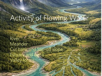
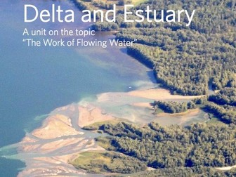
Are you looking for engaging materials to introduce your students to the fascinating landforms of deltas and estuaries? This resource package provides a clear and accessible explanation of the work of flowing water, helping your students understand how rivers shape landscapes and the processes involved.
Tested in the classroom, these materials contain everything you need for a successful lesson unit. This package is part of our series on “The Work of Flowing Water.”
Here is what you will find in this resource:
Worksheet 1: The Transport Capacity of Water
An answer key is included to assist with grading and save you time.
Worksheet 2: The River Delta
Worksheet 3: The Estuary
Worksheets for tablets and iPads (optimized for digital learning; in color and landscape format)
Immerse yourself and your students in the impressive world of glacial landforms!
This resource takes you and your students on a visual journey to fascinating skerry coasts and explains how glacial striations are formed. It provides a clear, illustrative foundation for bringing the traces of the Ice Age to life in your geography lessons.
What this resource includes:
Comprehensive collection of images: Features photographs showcasing the beauty and unique characteristics of skerry coasts, as well as striking examples of glacial striations.
Visual support: The images are perfectly suited for visualizing complex geological processes in a simple and accessible way.
Interactive element: An integrated QR code leads directly to a drone video that makes the dynamics of skerry coasts even more tangible.
Versatile application: Use this material as an introduction, for further exploration, or as a basis for class discussions in secondary-level geography.
Worksheets for tablets and iPads (optimized for digital learning; provided in color and landscape format)
Discover the fascinating world of rocks with your students! This resource takes you on an exciting journey through various types of rocks and how they are formed. It is perfectly suited for bringing the topic of rocks to life in social studies, science, or geography lessons.
What this resource includes:
Comprehensive presentation: An engaging and clearly structured presentation that introduces the most important types of rocks.
A variety of rock types: You will find detailed information and vivid images covering sandstone, limestone, rock salt, volcanic rock, granite, and marble.
The rock cycle: A simple and clear explanation of how rocks are formed, how they change, and how they are part of the Earth’s perpetual cycle.
Visually appealing: Each type of rock is illustrated with high-quality, descriptive images that facilitate learning and capture your students’ attention.
Ready to use: The material is prepared for immediate use in your classroom - no extensive preparation required. It can also be flexibly adapted to suit your specific needs.
Suitable for various grade levels.
Worksheets for tablets and iPads (optimized for digital learning; provided in color and landscape format)
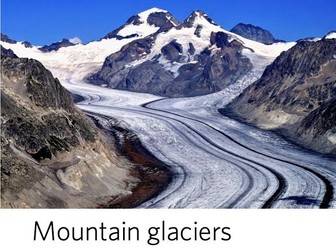
Explore the fascinating world of mountain glaciers with your students! Developed by Dr. Dietrich Steincke and tested in the classroom, this resource makes complex geographical topics easy to understand and ready for immediate use. Your students will dive into how glaciers form, their structure, and their power to shape the landscape.
This comprehensive package provides everything you need for a varied and engaging lesson:
Two worksheets on the topic of mountain glaciers:
Worksheet 1 provides a well-founded introductory text that explains the basics in an accessible way.
Worksheet 2 includes engaging exercises and a detailed illustration for students to label and analyze.
An answer key for quick and easy grading.
A vivid presentation featuring a QR code that links to a drone flight over a glacier- bringing your lesson to life with impressive visuals!
A word search puzzle and a digital matching game to reinforce and consolidate what has been learned in a fun, interactive way.
The worksheets are also available in a color, landscape-oriented format optimized for tablets and iPads - perfect for digital classrooms!
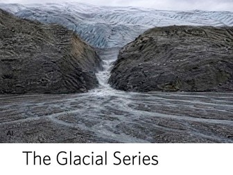
Explore the fascinating world of the ice ages and the formation of our modern-day landscape with your students! This resource on the “glacial series” (the sequence of landforms created by glacial activity) makes the topic vivid and easy to understand.
What you will find in this resource:
Comprehensive explanations of the glacial series, covering its typical components such as ground moraines, terminal moraines, outwash plains, and glacial spillways.
Clear maps and diagrams illustrating the glacial margins during the Weichselian and Saalian glaciations in Germany.
Striking photographs of contemporary glaciers and characteristic glacial landforms that are sure to inspire wonder.
A variety of worksheets with tasks that encourage students to analyze, describe, and understand geological processes.
Detailed answer keys to simplify grading and facilitate quick feedback.
Explore the fascinating world of coastal cliffs with your students! This resource provides a comprehensive introduction to the formation and unique characteristics of these impressive coastal features.
What you will find in this material:
A variety of vivid images of coastal cliffs from different regions around the world
A clearly labeled diagram that explains the individual components of a coastal cliff in simple terms.
Integrated QR codes that link directly to relevant videos, bringing the dynamics of coastal formation to life.
Ready-to-use classroom materials designed to engage and inspire your students.
Worksheets for tablets and iPads (optimized for digital learning; in color and landscape format).
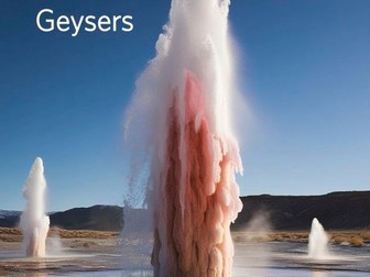
Dive into the fascinating world of geysers with your students! This resource explains this impressive natural phenomenon in a simple and accessible way. It is perfect for geography lessons and is part of our engaging series on volcanism and plate tectonics.
Here is what you and your students can look forward to:
Worksheet 1: The Geyser (Text and Exercises)
An informative reading passage explaining the structure and mechanics of a geyser.
Engaging reading comprehension exercises that require students to match numbers on an illustration to the text and answer questions.
Worksheet 2: The Geyser (Illustration)
A clear illustration of a geyser - ideal for labeling and visualizing the concepts learned.
A practical answer key to make grading easier and save you time.
Presentation with Links
An engaging presentation ready for use directly in your classroom.
Integrated links lead to an interactive word search and a digital matching game, helping students reinforce their knowledge in a fun, playful way.
Worksheets for Tablets and iPads
Optimized for digital learning.
Provided in color and landscape format.
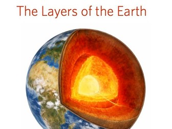
Are you looking for an engaging and accessible way to teach the Earth’s layered structure in your classroom? This resource is explaining complex geographical concepts in a clear, intuitive manner. It is part of a comprehensive series on volcanism and plate tectonics.
This package provides everything you need for a varied and dynamic lesson:
Worksheet 1: The Earth’s Layered Structure (Text and Exercises) – Students read key information about the individual layers of the Earth and then complete a table by matching numbers with specific characteristics to reinforce their understanding.
Worksheet 2: The Earth’s Layered Structure (Illustration) – A clear diagram helps students visualize and label the various layers of the Earth.
Answer Key – Allows students to check their own work or enables you to grade assignments quickly.
Presentation – An engaging slide deck that guides students through the core concepts, serving as a helpful teaching aid.
Word Search – A fun way for students to learn and practice key terminology related to the Earth’s layered structure.
Digital Matching Game – An interactive activity designed to review and deepen understanding of the material in a modern, motivating way.
Worksheets for tablets and iPads (optimized for digital learning; provided in color and landscape format)
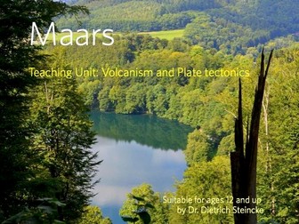
Discover the fascinating world of maars with your students! This resource will help you and your class understand, step by step, how these unique volcanic lakes are formed and explore their key characteristics.
This comprehensive resource package offers an engaging way to learn about the formation of maars. It includes:
A clear and vivid explanation of how maars are formed.
Detailed diagrams illustrating the entire process -from the movement of magma to the creation of the lake.
Striking photographs of actual maars that bring the theory to life.
Ready-to-use classroom materials designed to make the topic exciting and accessible.
Includes worksheets designed for tablets and iPads (optimized for digital learning; provided in color and landscape format).
Explore the fascinating world of plate tectonics with your students! This resource provides a comprehensive and vivid introduction to the dynamic processes that shape our Earth. It will help your learners grasp the fundamentals of plate tectonics and understand the compelling history of continental drift.
What you will find in this resource:
Comprehensive introduction: The material begins with a clear explanation of plate tectonics and its significance for our planet.
Detailed map: Various plate boundaries are clearly illustrated and labeled.
Explanation of key processes: Concepts such as seafloor spreading at mid-ocean ridges and the subduction of tectonic plates are presented in a simple, easy-to-understand way.
Historical context: Your students will learn about Alfred Wegener and his groundbreaking theory of continental drift, tracing the evolution of the continents from Pangea to the present day.
Evidence for the theory: The material highlights key supporting evidence, including the distribution of fossils, the way continents fit together, and geological correlations.
Versatile application: Use the slides or worksheets flexibly in your lessons to make the topic engaging and interactive.
Worksheets for tablets and iPads (optimized for digital learning; in color and landscape format)
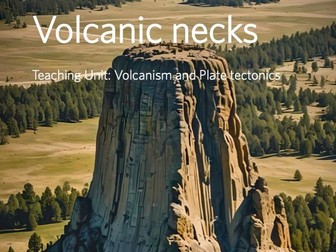
Would you like to introduce your students to the fascinating world of volcanism? With this resource package, you and your students can explore the intriguing formation of a volcanic remnant. You can clearly explain how an active volcano evolves over millions of years into an impressive natural phenomenon - much like Devils Tower. These materials have been tested in the classroom and are ready for immediate use. This comprehensive package provides everything you need for a successful lesson:
A clearly structured text that explains the formation of a volcanic remnant in simple terms.
Two diverse worksheets featuring engaging tasks that encourage critical thinking.
A detailed answer key to make grading easier.
An appealing presentation to provide visual support and deepen understanding of the subject matter.
Worksheets designed for tablets and iPads
Optimized for digital instruction
In color and landscape format
Stratovolcanoes
Shield Volcanoes
Volcanic Necks
Maars
Plate Tectonics
Geysers
The Layers of the Earth
Subduction and Collision (converging plates) Seafloorspreading and Rifting (diverging plates)
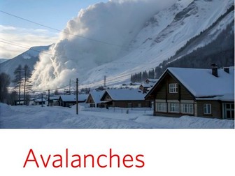
Would you like to introduce your students to the fascinating yet dangerous phenomenon of avalanches? This resource explains avalanches in a simple and accessible way. Students will learn how avalanches form, the different types that exist, and how to stay safe from them.
Here is what you and your students can expect:
Comprehensive worksheets: Three worksheets guide your students through the topic, step by step.
Worksheet 1, “Avalanches”: Includes an informative text and an accompanying video that clearly explains how avalanches form.
Worksheet 2, “Types of Avalanches”: Features an illustration and engaging exercises to help students learn about the various types of avalanches.
Worksheet 3, “Types of Avalanches”: Provides additional text and an illustration to deepen understanding. An answer key is included, allowing for quick and easy grading.
Interactive presentation: An engaging presentation - complete with a QR code - complements the worksheets, making it easy to introduce or review the topic in class.
Digitally optimized: The worksheets are specifically designed for use on tablets and iPads. They are provided in color and in landscape format - perfect for digital learning environments!
Practical and ready to use: Developed from real-world classroom experience, these materials are ready for immediate use, saving you valuable preparation time.
This resource is part of a series on “Natural Hazards.” Be sure to check out our other materials covering volcanoes, earthquakes, and tsunamis. You can also purchase these resources as a convenient bundle.
 Quick View


 Quick View
 Quick View
 Quick View
 Quick View
 Quick View
 Quick View
 Quick View
 Quick View
 Quick View
 Quick View
 Quick View
 Quick View
 Quick View
 Quick View
 Quick View
 Quick View
 Quick View
 Quick View
 Quick View
 Quick View