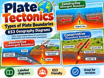
Plate Tectonics – Types of Plate Boundaries | KS3 GeographyQuick View
carben2016

Plate Tectonics – Types of Plate Boundaries | KS3 Geography

(0)
Plate Tectonics – Types of Plate Boundaries | KS3 Geography A clear, colourful plate boundary diagram designed to help KS3 Geography students understand how tectonic plates move and the different landforms and hazards they create. Ideal for Year 9 Geography lessons, revision and supporting students who find plate tectonics difficult to visualise. The diagram covers: Constructive (divergent) boundaries – plates moving apart, allowing magma to rise and new crust to form. Destructive (convergent) boundaries – plates moving towards each other, with subduction producing earthquakes and volcanoes. Collision boundaries – continental plates meeting and forming fold mountains. Conservative (transform) boundaries – plates sliding past each other, causing earthquakes. Key features: Clear diagram showing the direction of plate movement. Straightforward geographical terminology suitable for KS3. Visual explanations of the main tectonic processes. Useful for supporting pupils with lower reading ages and additional learning needs. Suitable for classroom displays, revision and lesson activities. Ideal for: KS3 Geography (Years 8–9) Introducing plate tectonics Revising different types of plate boundary Supporting written descriptions and explanations Visual learning and classroom reference These diagrams provide a useful reference for students learning how plate movement creates earthquakes, volcanoes and mountain ranges. Can also be used to support introductory GCSE Geography lessons.
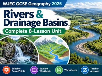
WJEC GCSE Geography 2025 – Rivers & Drainage Basins | Complete 8-Lesson UnitQuick View
carben2016

WJEC GCSE Geography 2025 – Rivers & Drainage Basins | Complete 8-Lesson Unit

(0)
WJEC GCSE Geography (Made for Wales, 2025 Specification) – Drainage Basins and Rivers A complete 8-lesson teaching pack covering rivers and drainage basins for the new WJEC GCSE Geography specification. Includes editable PowerPoints, printable worksheets, differentiated activities and teacher answers. Designed for Year 10 GCSE Geography, this pack provides a structured series of lessons with clear explanations, diagrams, independent tasks and opportunities to practise geographical writing. Lessons included: The global water cycle Drainage basins and their features River erosion, transportation and deposition Changes along a river’s course Waterfalls and gorges Meanders and oxbow lakes How people use rivers Flooding and river management What’s included? 8 editable PowerPoint presentations (57 slides) 21-page student workbook Printable worksheets and supporting reading materials Differentiated activities and sentence starters Labelled geographical diagrams and activities WAGOLL examples to support extended answers Teacher guidance and suggested answers End-of-topic assessment activities Supporting different abilities The activities include accessible reading material, structured questions and writing support for pupils who need additional guidance. More demanding questions encourage confident learners to develop their geographical explanations. Suitable for: WJEC GCSE Geography – first teaching September 2025 Year 10 Geography lessons Mixed-ability GCSE classes Independent revision and consolidation Cover lessons and additional learning support All PowerPoints are editable, allowing teachers to adapt the lessons to their own classes. The resources use a consistent layout, clear instructions and straightforward language to make classroom delivery easier. Specification area: Unit 1 – Topic 1.1, Drainage Basins and Rivers.