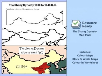
Clear and engaging Shang Dynasty map resource designed especially for Key Stage 2 history and geography lessons.
Whats included:
Colour Maps
Black & White Maps
A colour in map worksheet
Chapter 5 - Night Search
Bring your Roman Britain unit to life with a powerful, story-led chapter that encourages pupils to think deeply about life on the Roman frontier.
History Through Stories – Roman Britain: Chapter 5 is the final narrative journey as characters face important choices in and around the Roman fort. Through a carefully written historical story and linked activities, pupils develop a richer understanding of Roman Britain while strengthening their reading and historical knowledge.
Whats included:
Story Text - Chapter 5
Design Your Legion Standard sheet
Newspaper Report Activity
FREE BONUS: Roman Vocabulary Sheet
Bring Roman Britain to life through an engaging, story-driven history unit designed to build historical knowledge while supporting reading, writing and cross-curricular learning.
History Through Stories: Roman Britain – Chapters 1–5 is a complete mini-unit for Key Stage 2, following a continuous historical narrative set around a Roman fort in Britain. Each chapter introduces new historical content through story and links directly to purposeful classroom activities.
This bundle is ideal for teachers who want to move beyond worksheets and teach history in a compelling, memorable and meaningful way.
The unit supports pupils to understand daily life in Roman Britain, the structure of a Roman fort and the experiences of both Roman soldiers and local people — while strengthening reading comprehension and subject vocabulary.
Chapter 3 – The Road North
Bring Roman Britain vividly to life through story-led learning that supports both historical understanding and key literacy skills.
History Through Stories – Roman Britain: Chapter 3 continues the narrative journey of life in Roman Britain, guiding pupils inside a Roman fort to explore how soldiers and civilians lived and worked. Through an engaging story and carefully linked activities, pupils build secure historical knowledge while strengthening reading and comprehension skills.
Whats included:
Story Text - Chapter 3
Comprehension Question
Roman Roads Activity Sheet (Scaffolded with Answers)
FREE BONUS: Roman Vocabulary Sheet
Chapter 4 - The Fort at the Wall
Immerse your pupils in the world of Roman Britain through an exciting, story-led chapter that deepens historical understanding while developing key reading skills.
History Through Stories – Roman Britain: Chapter 4 continues the narrative journey through Roman Britain at a moment of tension and uncertainty around the fort. Through a carefully written historical story and linked learning activities, pupils explore life on the edge of the Roman frontier while strengthening comprehension and subject knowledge.
Whats included:
Story Text - Chapter 4
English Task - Persuasive Writing
Discussion Task - Loyalty
FREE BONUS: Roman Vocabulary Sheet
Chapter 2 - The Marketplace Clue
Step deeper into Roman Britain through story, dialogue and problem-solving.
History Through Stories – Roman Britain: Chapter 2 continues the narrative journey through a rich historical story, encouraging pupils to explore different perspectives while developing key English and maths skills. Through carefully linked activities, pupils engage with Roman life in a meaningful and memorable way — learning history through story, not just about it.
Designed for** Key Stage 2**, this chapter blends historical understanding with purposeful cross-curricular tasks that can be completed independently or as part of a wider unit.
What’s Included:
Story Text - Chapter 2
English Task – Dialogue Writing (Scaffolded)
Roman Coins Maths Challenge (with Answers)
FREE BONUS: Roman Vocabulary Sheet
Chapter 1 - Inside the Roman Fort
Bring Roman Britain to life through an engaging, story-driven approach that sparks curiosity, deepens understanding, and naturally supports cross-curricular learning.
History Through Stories – Roman Britain: Chapter 1 introduces pupils to life in a Roman fort through a compelling narrative, allowing children to experience history rather than simply read about it. Designed for Key Stage 2, this resource combines historical knowledge, reading comprehension, and independent learning tasks in one clear, easy-to-use pack.
Perfect for teachers who want to teach history in a meaningful, memorable and low-prep way.
What’s Included:
Story Text – Chapter 1
Reading Comprehension Questions (with Answers)
Label the Roman Fort Activity (with Answers)
Roman Fort Information Help Sheet
FREE BONUS: Roman Vocabulary Sheet
Bring the Roman Empire to life in your classroom with this ready-to-use maps pack, designed to save you hours of preparation and give pupils a clear, visual understanding of Rome at its height. Perfect for KS2 history lessons, retrieval practice, or display.
What’s Included:
✔ Blank map of Europe – ideal for introducing geography before focusing on the empire.
✔ Blank 117 AD Roman Empire map – pupils can label and colour territories.
✔ Colour map in map of the Roman Empire Worksheet – engaging pupil activity to reinforce learning.
✔ 3 Full-colour, detailed 117 AD maps – perfect for differentiation teaching and display.
Support your KS2 history lessons on African civilisations with this Kingdom of Benin maps resource pack. Designed to help pupils visualise the geography of West Africa, these maps show the growth and location of the Kingdom of Benin between 900–1300 AD, making the topic more engaging and accessible.
What’s Included:
✔ 2 full-colour maps of the Kingdom of Benin – showing its location and growth in West Africa.
✔ Blank outline map of Benin – perfect for labelling activities.
✔ Blank map of the Gulf of Guinea region – helps pupils understand the wider geographical context.
✔ Colour-in worksheet map – interactive activity for pupils to consolidate learning.
Bring the Viking Age to life with this Danelaw resource pack, designed to help pupils understand where the Vikings settled in England and how their rule shaped the country. Perfect for KS2 history lessons on the Vikings and Anglo-Saxons.
What’s Included:
✔ Blank outline map of the Danelaw – ready for labelling and activities.
✔ Blank UK map – helps pupils build geographical context before focusing on the Danelaw.
✔ Colour-in worksheet map – engaging activity for pupils to visualise Viking control.
✔ Information panel – key dates, figures, and facts presented simply for KS2 learners.
✔ 4 full-colour detailed maps – showing the Danelaw and key settlements, ideal for teaching, display, or retrieval practice.
Bring the world’s first civilisation to life with this Ancient Sumer Map Pack, designed to support KS2 lessons on early civilisations in Mesopotamia. These clear, child-friendly maps help pupils understand where Sumer was located, how it fits into Mesopotamia, and its wider geographical context.
What’s Included:
✔ Highly detailed colour map of Sumer (2100 BC) – perfect for teaching and display.
✔ Jigsaw map activity – engaging puzzle to help pupils build geographical awareness.
✔ Label-the-map worksheet – reinforces knowledge of Sumerian territory and cities.
✔ Blank outline map of Sumer – for independent labelling and retrieval practice.
✔ Blank map of Mesopotamia – shows the wider region and context.
✔ Blank Middle East map – ideal for cross-curricular geography or comparing ancient empires.
Help your pupils understand how the Romans grew from a small Italian power to one of the greatest empires in history with this maps and worksheet pack. Designed for KS2 history, this resource gives children a clear, visual way to explore the rise and spread of the Roman Empire.
What’s Included:
✔ Blank maps (colour-in activity) for 264 BC, 146 BC, 27 BC & 117 AD – perfect for sequencing and showing expansion.
✔ Full-colour maps for 264 BC, 146 BC, 27 BC & 117 AD – ready to project, display, or print.
✔ Blank map of Europe – introduce geography before focusing on the empire.
✔ Rise of the Roman Empire worksheet – helps pupils consolidate learning through labelling and colouring.
✔ Colour map in map of the Roman Empire Worksheet – engaging pupil activity to reinforce learning.
Dive into an exciting journey across Europe with our interactive map! Perfect for young explorers and curious learners, this map allows you to click on each European country to reveal fun facts, key information, and unique details about each nation. Designed for both younger and older children, this immersive resource brings European geography to life, making learning about countries, capitals, and cultures an engaging experience. Whether you’re studying for school or just curious, this map is the perfect way to explore Europe’s diversity and discover what makes each country special!
The story of the Spanish Armada presented through a detailed and accurate map of the route the Armada took. The map is useful to show the historical events of the Armada. A blank map is also provided to children can complete their own version.
In “Mission Control: Secret Agent Behaviour Management Cards,” one student is chosen as a secret agent while the rest of the class remains civilians—unaware of who the agent is. The secret agent’s mission is to have a positive, well-behaved lesson or day, while the civilians work together to create the perfect learning environment. The challenge? No one knows who the agent is, so everyone must be on their best behavior to ensure mission success. This engaging, spy-themed strategy promotes teamwork, responsibility, and a collective focus on maintaining a positive classroom atmosphere.
Make geography simple and engaging with this World & Continents Map Pack. This resource includes both blank and transparent outline maps of the world and the seven continents — perfect for labelling, colouring, displays, or digital activities.
What’s Included:
✔ 7 transparent continent maps – ideal for digital use, worksheets, or displays.
✔ 7 blank continent maps – ready for labelling and colouring activities.
✔ 1 transparent world map – flexible for digital editing or interactive lessons.
✔ 1 blank world map – perfect for printed worksheets, retrieval practice, or cross-curricular activities.
 Quick View
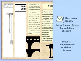 Quick View
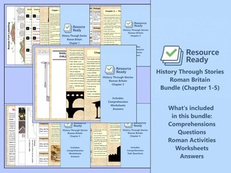 Quick View
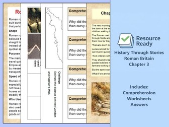 Quick View
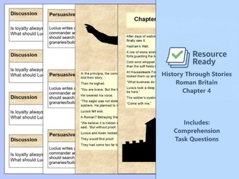 Quick View
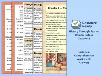 Quick View
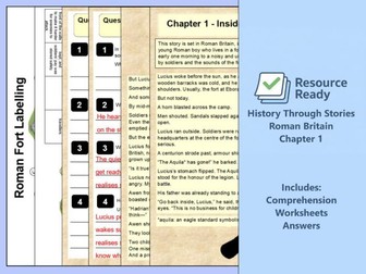 Quick View
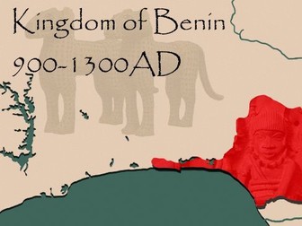 Quick View
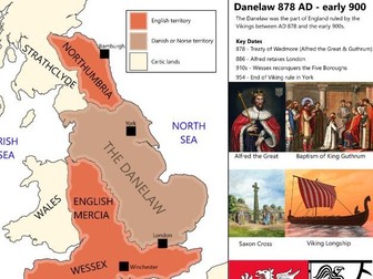 Quick View
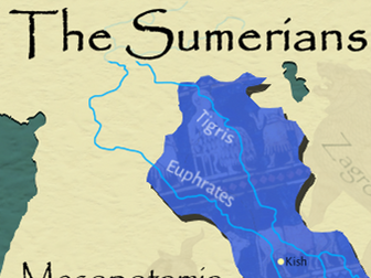 Quick View
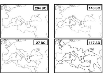 Quick View
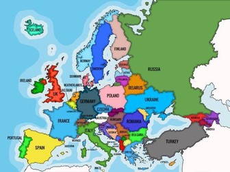 Quick View
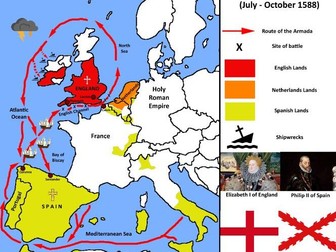 Quick View
 Quick View
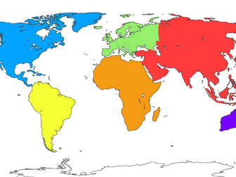 Quick View