Taj Mahal Landmark Research Project | History & Geography WorksheetsQuick View
Wuffyland

Taj Mahal Landmark Research Project | History & Geography Worksheets

(0)
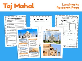
Explore one of the world’s most famous landmarks with this printable Taj Mahal Landmark Research Project! This ready-to-use resource helps students discover the history, location, architecture and cultural significance of the Taj Mahal while developing research, reading, observation and writing skills. Located in Agra, India, the Taj Mahal is a famous white marble mausoleum built during the Mughal period. Through engaging reference pages and guided research activities, students can investigate why the monument was built, what makes its architecture special and why it continues to attract visitors from around the world. What’s included: Taj Mahal informational reference page Landmark location and geographical information Historical background Architectural features Interesting facts Why the Taj Mahal is famous Landmark research questions Guided writing activities Student drawing activity Independent landmark research page Additional photo references Printable black-and-white student worksheets This resource is ideal for famous landmarks studies, India geography lessons, world history, architecture units, Asian studies, cultural heritage projects, UNESCO World Heritage lessons, research skills, social studies, homeschool learning, geography centers, independent research and early-finisher activities. Students can use the reference information to answer research questions, identify important features of the Taj Mahal, explore its history and architecture, and record what they have learned through guided writing and drawing activities. Perfect for learning about the Taj Mahal, Agra, India, Mughal architecture, Shah Jahan, Mumtaz Mahal, white marble architecture, Islamic architecture, Indian history, famous monuments, UNESCO World Heritage Sites, world landmarks, Asian geography, cultural heritage and landmark research projects. File type: Printable PDF Preparation: Print and use
Redwood National and State Parks Research Project | Landmark WorksheetsQuick View
Wuffyland

Redwood National and State Parks Research Project | Landmark Worksheets

(0)
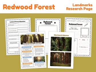
Explore the incredible redwood forests of Northern California with this printable landmark research project! This ready-to-use resource helps students learn about coast redwood trees, forest ecosystems, famous natural landmarks, wildlife and the geography of California’s redwood region while developing research, reading, observation and writing skills. Students can use the informational reference page and photographs to investigate the redwood forest, record important facts, answer research questions and create their own illustrated landmark study. What’s included: Redwood Forest informational reference page Landmark research questions Student research recording page Drawing and observation section Location and geography prompts History and interesting facts Why this landmark is famous Extra photographic reference images Printable independent research activities Students will learn about the location of California’s redwood forests, coast redwood trees, their incredible height and age, forest wildlife, environmental conditions and the importance of protecting ancient forests. This resource is ideal for landmark studies, California geography, U.S. geography, national parks lessons, forest ecosystems, trees and plants units, environmental science, natural wonders, independent research, homeschool learning, classroom centers, early-finisher activities and project-based learning. Perfect for learning about Redwood National and State Parks, California redwoods, coast redwood trees, Northern California, forest ecosystems, ancient trees, national parks, conservation, wildlife habitats and natural landmarks. File type: Printable PDF Preparation: Print and use
Great Barrier Reef Research Project | Landmark Geography WorksheetsQuick View
Wuffyland

Great Barrier Reef Research Project | Landmark Geography Worksheets

(0)
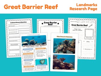
Explore the Great Barrier Reef with this printable Landmark Research Project designed to help students investigate one of the world’s most remarkable natural landmarks. Located along the northeast coast of Australia, the Great Barrier Reef is the world’s largest coral reef ecosystem and is home to an extraordinary variety of marine life. This resource encourages students to research its location, formation, natural features, wildlife, history, importance and conservation. Students can use the included reference page and images to begin their investigation, then complete the research questions, written responses and drawing activities independently or with teacher guidance. What’s included: Great Barrier Reef landmark information page Location and geographical information Formation and natural features Interesting facts Reasons the landmark is famous Visitor and conservation information Landmark research questions Student research recording page Drawing and observation activity History and significance prompts Reference photographs Printable independent research activities The research questions encourage students to investigate: Where the Great Barrier Reef is located How and when it formed Its main natural features Why it is famous Interesting facts about the reef Wildlife and marine species Its history and importance Conservation and environmental challenges This resource is ideal for geography lessons, Australia studies, famous landmarks units, natural wonders projects, coral reef studies, marine ecosystems, ocean habitats, environmental science, independent research, homeschool learning, classroom research centers and early-finisher activities. The Great Barrier Reef stretches for more than 2,300 kilometres along the coast of Queensland and contains thousands of individual reefs, islands and coral cays. Students can explore how this enormous ecosystem supports fish, sea turtles, dugongs, sharks, corals and many other marine organisms. Perfect for learning about the Great Barrier Reef, Queensland, Australia, coral reefs, marine habitats, ocean ecosystems, natural landmarks, UNESCO World Heritage Sites, environmental conservation, marine animals, geography and independent research skills. File type: Printable PDF Preparation: Print and use
Amazon River Landmark Research Project | Geography WorksheetsQuick View
Wuffyland

Amazon River Landmark Research Project | Geography Worksheets

(0)
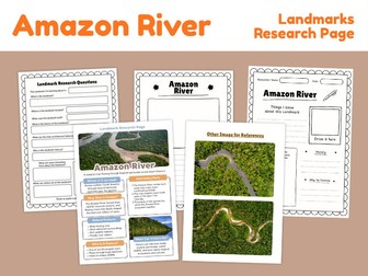
Explore the Amazon River with this printable Landmark Research Project designed to help students investigate one of the world’s most remarkable river systems. This geography resource combines informational reading, visual references, guided research questions, drawing activities and student writing pages to help learners discover where the Amazon River is located, how it was formed, why it is important and what makes it famous. Students can use the included reference pages to gather information independently before completing the research worksheets in their own words. What’s included: Amazon River Landmark Research Page Informational reference page Location and geographical information Interesting facts about the Amazon River Physical and natural features Why the Amazon River is famous Wildlife and ecosystem connections Visitor and exploration information Landmark research questions Student note-taking and writing page Drawing activity Image reference page Printable independent research activities This resource is ideal for world geography lessons, South America studies, famous rivers units, physical geography, landforms and water bodies lessons, rainforest studies, environmental science, independent research, geography centers, homeschool learning, classroom projects, early-finisher activities and report writing. Students will explore the Amazon River’s location in South America, its enormous drainage basin, surrounding rainforest ecosystems, tributaries and importance to people and wildlife. The Amazon carries more water than any other river on Earth and flows through the world’s largest tropical river basin. Its river system connects landscapes across several South American countries before reaching the Atlantic Ocean. Perfect for learning about the Amazon River, Amazon Basin, Amazon Rainforest, South America, Brazil, Peru, Colombia, rivers, tributaries, drainage basins, freshwater ecosystems, tropical rainforests, river wildlife, world landmarks, physical geography and environmental studies. File type: Printable PDF Preparation: Print and use
Antarctica Research Project | Geography Worksheets & Fact PagesQuick View
Wuffyland

Antarctica Research Project | Geography Worksheets & Fact Pages

(0)
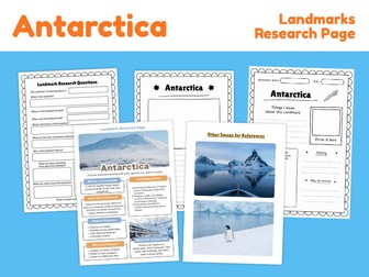
Explore Antarctica with this printable geography research project designed to help students discover the world’s coldest, driest and windiest continent. This student-friendly resource combines informative reference pages with guided research worksheets, making it easy for learners to investigate Antarctica’s location, climate, landscape, wildlife, scientific importance and unique polar environment. Students can use the included fact page and picture references to support independent research, classroom projects, geography centers or cross-curricular learning. What’s included: Antarctica information and reference page Antarctica picture reference page Guided research questions Student research recording page Drawing and illustration space Location and geography prompts Formation and landscape research Climate and temperature questions Wildlife and ecosystem research History and exploration prompts Reasons Antarctica is famous Visitor and scientific research questions Printable independent research activities Students can explore important Antarctica topics including ice sheets, glaciers, mountains, polar deserts, scientific research stations, penguins, seals, extreme weather and the Southern Ocean. This resource is ideal for geography lessons, continent studies, polar regions units, Antarctica projects, Earth science activities, climate studies, habitats and ecosystems, research skills, independent learning, homeschool geography, classroom research projects and early-finisher activities. Use this resource alongside books, approved websites or classroom materials to encourage students to collect information, organize their findings and develop research and writing skills. Perfect for learning about Antarctica, the Antarctic continent, South Pole, Southern Ocean, glaciers, ice sheets, polar climate, Antarctic wildlife, penguins, seals, research stations, scientific exploration, extreme environments and polar geography. File type: Printable PDF Preparation: Print and use
Victoria Falls Landmark Research Project | Geography WorksheetsQuick View
Wuffyland

Victoria Falls Landmark Research Project | Geography Worksheets

(0)
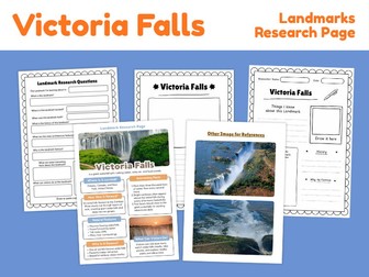
Explore Victoria Falls with this printable landmark research project designed to help students discover one of Africa’s most famous natural landmarks. This geography resource introduces students to Victoria Falls through an informative reference page, visual research materials, guided questions, drawing activities and independent research worksheets. Students can learn where Victoria Falls is located, how it was formed, why it is famous, what makes it geographically important and what visitors can see and experience there. What’s included: Victoria Falls landmark reference page Location and geography information Interesting facts How Victoria Falls was formed Important natural features Why Victoria Falls is famous Visitor information Landmark research questions Guided writing activities Draw and label activity Independent landmark research page Additional image references Printable black-and-white student worksheets This resource is ideal for geography lessons, famous landmarks units, Africa studies, natural wonders projects, waterfalls and landforms lessons, rivers and erosion studies, world geography activities, independent research, homeschool learning, classroom centers and early-finisher activities. Students can use the reference pages to gather information before completing the research questions and writing activities. The open-ended worksheets also encourage students to organize information, develop research skills and present what they have learned in their own words. Perfect for learning about Victoria Falls, the Zambezi River, Zambia, Zimbabwe, waterfalls, erosion, natural landmarks, African geography, UNESCO World Heritage Sites, famous places around the world and natural wonders. File type: Printable PDF Preparation: Print and use
Swiss Alps Landmark Research Project | Geography & Mountain WorksheetsQuick View
Wuffyland

Swiss Alps Landmark Research Project | Geography & Mountain Worksheets

(0)
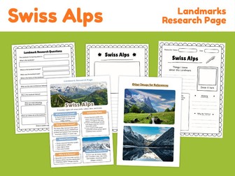
Explore the Swiss Alps with this printable Landmark Research Project designed to help students investigate one of Europe’s most famous mountain regions. This resource combines guided research questions, independent writing activities, visual references and a completed information page to support geography, landmark and natural environment studies. Students can explore where the Swiss Alps are located, how the mountains were formed, important geographical features, climate, glaciers, wildlife, tourism and why this spectacular alpine region is famous around the world. What’s included: Swiss Alps completed research reference page Swiss Alps landmark research questions Independent landmark research worksheet Draw-and-write research page Visual image references Location information Formation and geographical features Mountain landscape information Interesting facts Natural features History and importance Visitor and tourism information Student drawing activity Independent writing prompts This resource is ideal for geography lessons, famous landmarks studies, mountains and landforms units, Switzerland projects, European geography, glaciers, alpine environments, natural wonders, Earth science, homeschool learning, classroom research projects, independent study, geography centers and early-finisher activities. Students can use the completed reference page and images to gather information before completing the guided research questions and their own Swiss Alps research page. Perfect for learning about the Swiss Alps, Switzerland, European Alps, mountains, glaciers, valleys, alpine landscapes, mountain formation, Aletsch Glacier, Jungfrau, Matterhorn, Dufourspitze, alpine wildlife, skiing, hiking, mountaineering and famous natural landmarks. File type: Printable PDF Preparation: Print and use
Ganges River Landmark Research Project | Geography WorksheetsQuick View
Wuffyland

Ganges River Landmark Research Project | Geography Worksheets

(0)
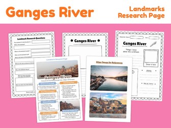
Explore the Ganges River with this printable Landmark Research Project designed to help students discover one of South Asia’s most important rivers through geography, research, writing and visual learning activities. This ready-to-print resource introduces students to the Ganges River, including its location, formation, natural features, cultural importance, interesting facts and the communities found along its course. Students can use the informational reference page and photographs to support independent research before completing the included writing, drawing and research worksheets. What’s included: Ganges River informational reference page Location and geographical information How the Ganges River was formed Important natural features Interesting facts Why the Ganges River is famous What visitors can see Landmark research questions Student research page Drawing and observation activity Additional image references Printable writing worksheets Independent research activities This resource is ideal for geography lessons, India studies, South Asia geography, rivers and water systems units, natural landmarks, world landmarks projects, cultural geography, landforms lessons, classroom research centers, homeschool learning, independent study, social studies and early-finisher activities. Students can explore where the Ganges River is located, learn how rivers shape landscapes, investigate its importance to communities and culture, study major geographical features and organize their findings through guided research questions. Perfect for learning about the Ganges River, Ganga River, India geography, South Asia, Himalayan rivers, river systems, natural landmarks, cultural geography, famous rivers, freshwater geography, world geography, environmental studies and independent research skills. File type: Printable PDF Preparation: Print and use
Vatican City Landmark Research Project | Geography & History WorksheetsQuick View
Wuffyland

Vatican City Landmark Research Project | Geography & History Worksheets

(0)
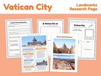
Explore Vatican City with this printable Landmark Research Project designed to help students investigate one of the world’s most famous historic and religious places. This ready-to-use resource introduces students to Vatican City’s location, history, architecture, important buildings and cultural significance while supporting research, reading, writing and observation skills. Students can learn about Vatican City through an illustrated information page, use reference photographs for visual exploration, answer guided research questions and complete independent writing and drawing activities. What’s included: Vatican City Landmark Research Page Illustrated information and reference page Where Vatican City is located Historical background Interesting facts Important architecture and buildings Why Vatican City is famous What visitors can see Landmark Research Questions Independent research worksheet Draw and write activity History and location prompts Image reference page Printable student activity pages Students will explore famous places and features including St. Peter’s Basilica, St. Peter’s Square, the Vatican Museums, the Sistine Chapel and the Apostolic Palace. This resource is ideal for world geography, European geography, famous landmarks studies, world history, cultural studies, architecture lessons, Italy and Rome units, religious history, independent research, homeschool learning, classroom projects, geography centers and early-finisher activities. Use this resource as part of a famous landmarks unit, country study, geography project or independent research activity. Students can gather information, answer guided questions, record important facts and create their own visual response to what they have learned. Perfect for learning about Vatican City, St. Peter’s Basilica, St. Peter’s Square, Vatican Museums, Sistine Chapel, Rome, Italy, European landmarks, famous places, world heritage, architecture, history, culture and geography. File type: Printable PDF Preparation: Print and use
Nile River Research Project | Geography Landmark WorksheetsQuick View
Wuffyland

Nile River Research Project | Geography Landmark Worksheets

(0)
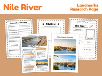
Explore the Nile River with this printable Landmark Research Project designed to help students investigate one of the world’s most important and famous rivers. This engaging geography resource combines fact-filled reference pages, photographs, research questions, drawing activities and student writing pages to support independent learning about the Nile River’s geography, history and importance to people and civilizations. Students can learn where the Nile is located, explore its physical features, discover its major tributaries, investigate its connection to ancient civilizations and understand why the river continues to be important today. What’s included: Nile River fact and reference page Landmark research questions Student research and note-taking page Drawing and writing activity Geography and location information Historical information Interesting Nile River facts Natural features and surrounding landscapes Why the Nile River is famous What visitors can see and experience Photograph reference page Printable independent research activities This resource is ideal for geography lessons, famous landmarks studies, rivers and water bodies units, Ancient Egypt lessons, African geography, world history, ancient civilizations, homeschool learning, independent research, social studies centers, classroom projects and early-finisher activities. The Nile River flows northward through northeastern Africa and is part of a vast river basin shared by several African countries. Students can explore the Nile’s connection to the White Nile and Blue Nile, its journey toward the Mediterranean Sea and its important role in agriculture, transportation, settlement and the development of civilizations. Perfect for learning about the Nile River, Africa, Egypt, Sudan, Uganda, Ethiopia, White Nile, Blue Nile, Mediterranean Sea, river systems, river basins, Ancient Egypt, Nubia, Kingdom of Kush, irrigation, farming, trade, transportation and famous natural landmarks. File type: Printable PDF Preparation: Print and use
Lincoln Memorial Research Project | Landmark Worksheets & Reading ActivityQuick View
Wuffyland

Lincoln Memorial Research Project | Landmark Worksheets & Reading Activity

(0)
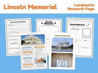
Explore one of the most famous landmarks in the United States with this printable Lincoln Memorial Research Project! This student-friendly resource introduces the Lincoln Memorial in Washington, D.C. through an illustrated information page, visual references, guided research questions and independent writing activities. Students can learn about the memorial’s history, architecture, location, purpose and connection to President Abraham Lincoln while developing research, reading comprehension and informational writing skills. What’s included: Lincoln Memorial illustrated information page Landmark location and background information History of the Lincoln Memorial Interesting facts Architecture and design information Why the landmark is famous What visitors can see and do Landmark reference photographs Guided landmark research questions Student research recording page Drawing and observation activity Independent writing prompts Printable black-and-white worksheets Students can investigate questions such as: Where is the Lincoln Memorial located? When was it built? Who or what does the landmark honor? What are its main architectural features? Why is the Lincoln Memorial famous? What important historical events are connected to the site? What can visitors see when they visit? Perfect for US history lessons, famous landmarks units, Washington D.C. studies, Abraham Lincoln projects, Presidents Day activities, American history, architecture lessons, social studies, geography, independent research, homeschool learning, classroom displays and early-finisher activities. This resource works well as an individual research project, literacy center activity, social studies assignment, homework task or addition to a wider United States landmarks unit. File type: Printable PDF Preparation: Print and use
Times Square Landmark Research Project | New York Geography WorksheetsQuick View
Wuffyland

Times Square Landmark Research Project | New York Geography Worksheets

(0)
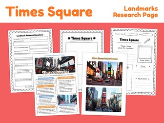
Explore one of New York City’s most famous landmarks with this Times Square Landmark Research Project! This printable resource introduces students to Times Square through an engaging combination of landmark facts, photographs, research questions, writing activities and drawing tasks. Students can discover where Times Square is located, why it became famous, what visitors can see there, important features of the area and interesting facts about this iconic New York City destination. What’s included: Times Square landmark information page Location and geographical information History of Times Square Why Times Square is famous Architecture and visual features Interesting landmark facts Activities and things visitors can do Landmark research questions Guided research worksheet Draw-and-write landmark activity Student research page Photograph reference page Writing and observation activities Print-and-go worksheets This resource is ideal for landmark studies, New York City geography, United States geography, famous places around the world, social studies, geography centers, research projects, travel-themed learning, homeschool lessons, independent study and early-finisher activities. Students can use the included reference material as a starting point before completing the research questions, recording their own findings and creating a visual response about Times Square. Perfect for learning about Times Square, New York City, Manhattan, famous American landmarks, NYC attractions, urban geography, city landmarks, tourism, American culture and landmark research skills. File type: Printable PDF Preparation: Print and use
Great Wall of China Reading Comprehension | Landmark Reading PassagesQuick View
Wuffyland

Great Wall of China Reading Comprehension | Landmark Reading Passages

(0)
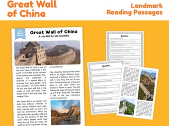
Explore one of the world’s most famous landmarks with this Great Wall of China Reading Comprehension resource! This printable reading activity introduces students to the Great Wall of China through an engaging informational passage covering its history, purpose, construction, geography and important features. Students can read the passage, identify key information and complete comprehension questions to strengthen reading, vocabulary, research and critical-thinking skills. What’s included: Great Wall of China informational reading passage Landmark facts and historical information Geography and location information Information about the wall’s construction and purpose Photographs of the Great Wall of China Reading comprehension questions Written-response activities Student worksheet pages Answer key Print-and-go format Students will learn how the Great Wall developed over different periods of Chinese history, why sections of the wall were built, the materials used in different regions, and how the landscape influenced its construction. This resource is ideal for reading comprehension lessons, informational text practice, world history, geography, China studies, famous landmarks units, ancient civilizations, nonfiction reading, social studies, homeschool learning, independent work, literacy centers, early-finisher activities and cross-curricular lessons. Perfect for learning about the Great Wall of China, China, Chinese history, ancient architecture, world landmarks, defensive structures, mountains, geography, historical construction methods, informational text and reading comprehension. File type: Printable PDF Preparation: Print and use
Colosseum Reading Comprehension | Landmark Reading PassagesQuick View
Wuffyland

Colosseum Reading Comprehension | Landmark Reading Passages

(0)
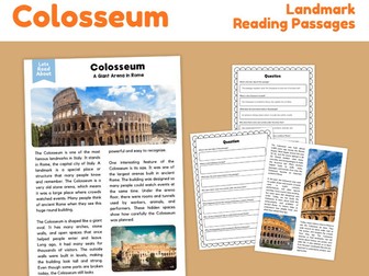
Explore the Colosseum with this engaging landmark reading comprehension resource featuring an informational passage, photographs, comprehension questions and student response activities. Designed for elementary learners, this printable resource helps students learn about one of the most famous landmarks in Rome while developing reading comprehension, vocabulary, history and geography knowledge. Students will discover what the Colosseum is, where it is located, how it was used in ancient Rome, what makes its structure unique and why it remains an important landmark today. What’s included: Colosseum informational reading passage Real landmark photographs Location and historical background Architecture and structure information Ancient Roman entertainment and daily life context Interesting facts about the Colosseum Reading comprehension questions Written response activities Printable student worksheets Answer key This resource is ideal for reading comprehension lessons, famous landmarks units, Ancient Rome studies, world history, geography, architecture, informational text practice, homeschool learning, classroom centers, independent work and early-finisher activities. Students can read the passage independently or with teacher support, identify key details, answer comprehension questions and connect historical information with visual references. Perfect for learning about the Colosseum, Rome, Italy, Ancient Rome, Roman architecture, amphitheaters, gladiators, historical landmarks, famous buildings, world history, geography and informational reading. File type: Printable PDF Preparation: Print and use
Wat Arun Landmark Research Project | Thailand Geography WorksheetsQuick View
Wuffyland

Wat Arun Landmark Research Project | Thailand Geography Worksheets

(0)
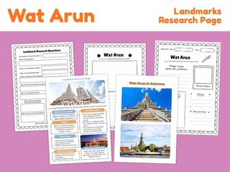
Explore Wat Arun with this printable Landmark Research Project designed to help students discover one of Thailand’s most recognizable cultural and architectural landmarks. Located beside the Chao Phraya River in Bangkok, Wat Arun is known for its tall central prang, colorful decorative details and important place in Thai history and culture. Students can explore key facts about the landmark, examine reference images, answer research questions and record what they learn through writing and drawing activities. What’s included: Wat Arun Landmark Research Page Landmark facts and location information Historical background Architectural features Interesting facts Why the landmark is famous Visitor and cultural information Landmark research questions Student writing activity Draw-the-landmark activity Reference images for visual learning Printable independent research pages This resource is ideal for world geography lessons, Thailand country studies, Asian geography, famous landmarks units, architecture studies, Buddhist temple studies, world cultures, social studies, research projects, homeschool learning, classroom centers and early-finisher activities. Students will learn about Wat Arun’s location in Bangkok, its relationship with the Chao Phraya River, its distinctive central prang, decorative porcelain details and historical importance. This resource can be used alongside Thailand country studies, Asia geography lessons, famous landmarks projects, world architecture units and cultural research activities. Perfect for learning about Wat Arun, Temple of Dawn, Bangkok, Thailand, Chao Phraya River, Thai architecture, Buddhist temples, Southeast Asia, famous landmarks, world geography, architectural design and cultural heritage. File type: Printable PDF Preparation: Print and use
Prambanan Temple Research Project | Landmark Worksheets & Fact PageQuick View
Wuffyland

Prambanan Temple Research Project | Landmark Worksheets & Fact Page

(0)
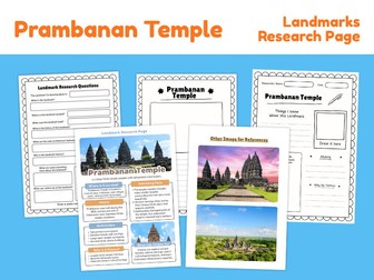
Explore one of Indonesia’s most remarkable cultural landmarks with this printable Prambanan Temple Research Project! This student-friendly resource introduces learners to the history, architecture, cultural importance and fascinating features of Prambanan Temple while encouraging independent research, observation, writing and drawing. Prambanan is a famous Hindu temple complex on the island of Java, Indonesia. Built during the classical period of ancient Java, the temple complex is known for its towering stone architecture, detailed carvings and connections to Hindu traditions and the Ramayana story. What’s included: Prambanan Temple informational fact page Location and historical background Architectural features Interesting facts Why the landmark is famous What visitors can see and do Landmark research questions Guided research worksheet Draw-the-landmark activity Student writing sections Reference photographs for observation Printable black-and-white student pages Students can use the informational page and image references to investigate where Prambanan Temple is located, when it was built, why it is historically important, what architectural features make it unique and what visitors can experience there today. This resource is ideal for world landmarks studies, Indonesia geography lessons, Asian history, Hindu architecture, ancient civilizations, UNESCO World Heritage studies, world cultures, research projects, social studies, homeschool learning, classroom centers, independent research and early-finisher activities. Prambanan Temple was built during the classical period of Java and is especially known for its tall central Shiva temple, Hindu religious architecture and stone reliefs depicting stories from the Ramayana. The wider Prambanan Temple Compounds were inscribed on the UNESCO World Heritage List in 1991. Perfect for learning about Prambanan Temple, Indonesia, Java, Hindu temples, Shiva, Vishnu, Brahma, Ramayana reliefs, ancient architecture, Indonesian history, UNESCO World Heritage Sites, Southeast Asia, famous landmarks and cultural heritage. File type: Printable PDF Preparation: Print and use
Shwedagon Pagoda Research Project | Myanmar Landmark WorksheetsQuick View
Wuffyland

Shwedagon Pagoda Research Project | Myanmar Landmark Worksheets

(0)
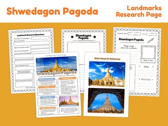
Explore one of Myanmar’s most famous landmarks with this printable Shwedagon Pagoda Research Project! This student-friendly resource introduces learners to Shwedagon Pagoda in Yangon, Myanmar through an informative landmark fact page, visual references, research questions, drawing activities and guided writing pages. Students can explore the pagoda’s location, history, architecture, cultural importance and distinctive design while developing geography, research, reading and writing skills. What’s included: Shwedagon Pagoda landmark information page Location and geographical information History of the landmark Architectural features Interesting facts Why the landmark is famous Visitor information Landmark reference photographs Guided landmark research questions Draw-and-label activity Student research page “Things I Know About This Landmark” worksheet History writing section “Why It Is Famous” writing section Independent drawing and observation activities Perfect for world geography lessons, Myanmar country studies, Asian landmarks units, world landmarks projects, architecture studies, cultural heritage lessons, social studies, homeschool geography, independent research, classroom displays, early-finisher activities and project-based learning. Students can use the reference pages to gather information before completing the research questions and independent writing activities. This resource is designed to encourage students to observe architectural details, locate landmarks geographically, research their historical importance and communicate what they have learned through writing and drawing. Perfect for learning about Shwedagon Pagoda, Yangon, Myanmar, Southeast Asia, Buddhist architecture, pagodas, world landmarks, cultural heritage, famous buildings, Asian geography, architecture and independent research. File type: Printable PDF Preparation: Print and use
Temple of Artemis Research Project | Ancient Landmark WorksheetsQuick View
Wuffyland

Temple of Artemis Research Project | Ancient Landmark Worksheets

(0)
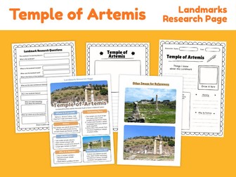
Explore the Temple of Artemis with this printable landmark research resource designed to help students discover the history, location, architecture and importance of one of the Seven Wonders of the Ancient World. Located at Ephesus in present-day Türkiye, the Temple of Artemis was a famous ancient sanctuary dedicated to the goddess Artemis. Students can learn where the temple was located, why it became famous, what made its architecture remarkable and what remains of the site today. This resource combines visual reference pages with guided research and writing activities, making it ideal for geography, history, ancient civilizations and famous landmarks studies. What’s included: Temple of Artemis Landmark Research Page Location and historical background Interesting facts Architecture information Why the landmark became famous What visitors can see today Photo reference page Landmark research questions Student research worksheet Drawing and observation activity Independent writing prompts Printable landmark study pages Perfect for ancient civilizations lessons, Ancient Greece studies, Seven Wonders of the Ancient World units, famous landmarks projects, world history, geography, architecture, homeschool learning, classroom research centers, independent study and early-finisher activities. Students can use the visual reference page to gather information before completing the research questions and writing activities. The worksheets encourage students to identify important facts, explain the landmark’s significance and develop independent research skills. Perfect for learning about the Temple of Artemis, Ephesus, Türkiye, Ancient Greece, Greek mythology, Artemis, ancient architecture, classical temples, Seven Wonders of the Ancient World, archaeological sites and world landmarks. File type: Printable PDF Preparation: Print and use
Machu Picchu Reading Comprehension | Landmark Reading PassagesQuick View
Wuffyland

Machu Picchu Reading Comprehension | Landmark Reading Passages

(0)
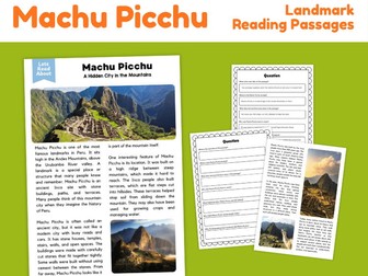
Explore Machu Picchu with this engaging landmark reading comprehension resource! This printable reading passage introduces students to one of the world’s most famous historic landmarks while building reading comprehension, vocabulary, geography and nonfiction reading skills. Students will read about Machu Picchu’s location in the Andes Mountains of Peru, its connection to the Inca civilization, its stone buildings and terraces, how people may have lived there, and why the site remains an important landmark today. What’s included: Machu Picchu nonfiction reading passage Informational text about the landmark Geography and location information Inca history and cultural background Architecture and mountain setting Reading comprehension questions Written-response activities Student-friendly worksheet pages Photograph-supported learning Print-and-go classroom resource Students can practise locating information in a text, identifying key details, answering comprehension questions and learning important facts about a famous landmark at the same time. This resource is ideal for reading comprehension lessons, nonfiction reading practice, world geography, Peru studies, South America units, Inca civilization lessons, famous landmarks, ancient civilizations, social studies, homeschool learning, literacy centers, independent work and early-finisher activities. Topics explored include Machu Picchu, Peru, the Andes Mountains, Inca civilization, stone architecture, terraces, mountain geography, historic landmarks and cultural heritage. Perfect for upper elementary students who are developing confidence with informational texts and written comprehension. File type: Printable PDF Preparation: Print and use
Christ the Redeemer Reading Comprehension | Famous Landmark WorksheetsQuick View
Wuffyland

Christ the Redeemer Reading Comprehension | Famous Landmark Worksheets

(0)
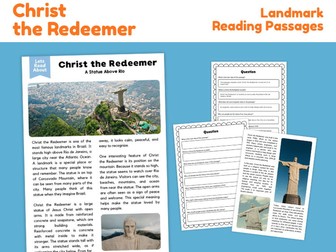
Explore one of the world’s most recognizable landmarks with this Christ the Redeemer Reading Comprehension resource! This printable activity introduces students to Christ the Redeemer in Rio de Janeiro, Brazil through an engaging informational reading passage followed by comprehension questions. Students will learn about the statue’s location, appearance, construction, history, symbolism, and importance while developing reading comprehension, information retrieval, and geography skills. What’s included: Christ the Redeemer informational reading passage Landmark facts and historical information Location and geography connections Photographs to support understanding Reading comprehension questions Written response activities Answer key Printable student worksheets The passage introduces students to Christ the Redeemer, its location on Corcovado Mountain overlooking Rio de Janeiro, its famous outstretched arms, construction materials, historical background, and significance as an important Brazilian landmark. Perfect for reading comprehension lessons, famous landmarks studies, Brazil geography units, South America studies, world geography, informational text practice, social studies, history activities, homeschool learning, independent work, literacy centers, early finishers, and cross-curricular geography and reading lessons. This resource is ideal for helping students practise finding information in nonfiction text, answering comprehension questions, identifying important details, and learning about famous places around the world. Use it as a standalone reading activity or combine it with Brazil, South America, famous landmarks, architecture, world cultures, or geography units. File type: Printable PDF Preparation: Print and use
Sydney Opera House Reading Comprehension | Landmark Passages & QuestionsQuick View
Wuffyland

Sydney Opera House Reading Comprehension | Landmark Passages & Questions

(0)
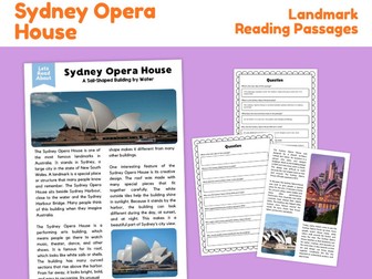
Explore one of Australia’s most famous landmarks with this Sydney Opera House reading comprehension resource! This printable learning pack introduces students to the Sydney Opera House through an accessible informational reading passage, followed by comprehension questions designed to build reading, recall, vocabulary and nonfiction understanding skills. Students will learn about the Sydney Opera House’s location, distinctive sail-shaped design, purpose, history and importance as a world-famous Australian landmark. What’s included: Sydney Opera House informational reading passage Student-friendly nonfiction text Landmark facts and historical information Reading comprehension questions Written response activities Vocabulary and information-retrieval practice Supporting landmark reading page Answer key Printable student worksheets The reading passage introduces students to the Sydney Opera House in Sydney, New South Wales, including its location beside Sydney Harbour, its famous architectural design and its role as a performing arts venue. Students can use the comprehension questions to practise identifying key details, finding information in a text, recalling facts and explaining what they have learned. This resource is ideal for reading comprehension lessons, nonfiction reading practice, Australia geography units, famous landmarks studies, architecture topics, world geography, cultural studies, guided reading, independent work, literacy centers, homeschool learning and early-finisher activities. Perfect for learning about Sydney, Australia, Sydney Harbour, Sydney Opera House, famous buildings, world landmarks, Australian geography, architecture, performing arts, nonfiction reading and informational text. File type: Printable PDF Preparation: Print and use