Contours and Relief: Reading the Shape of the Land | KS3 GeographyQuick View
Anmira

Contours and Relief: Reading the Shape of the Land | KS3 Geography

(0)
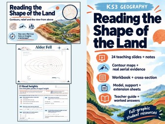
A graphic geography sequence for interpreting contours, comparing maps with genuine aerial photographs and explaining what each representation leaves out. What pupils investigate How can a flat map help us imagine a landscape? Pupils read height and contour intervals, distinguish height from steepness, compare equal rises over different horizontal distances, construct a scaffolded cross-section and match visible features in two real Lake District aerial photographs to an open-data study map. They finish by making an evidence-based claim and acknowledging its limits. Designed for England KS3, with a suggested Year 7 starting point. The sequence supports DfE end-of-key-stage geographical skills expectations; the named module and suggested timing are an independent teaching design, not a nationally prescribed unit or DfE endorsement. Prerequisites include basic map references, scale and height units. Included teaching documents Teaching Slides.pptx: 24 full-graphic slides, each with native PowerPoint speaker notes. Teaching Slides.pdf: a PDF copy of the same 24 slides, not extra lessons. Original Contour Reference Pack.pdf: two pages containing the fictional Alder Fell contour map and separate valley/spur comparison models. Real Landscape Evidence Pack.pdf: three pages, including a genuine OS OpenData-derived study map and two credited aerial photographs of the Keswick, Derwent Water and Bassenthwaite Lake landscape. Student Geography Workbook.pdf: four pages of height, slope, photo/map and evidence-reasoning tasks. Cross Section Scaffold.pdf: one page with an exact-scale plot, nearest-metre crossing table and interpretation questions. Map to Model Sheet.pdf: one page connecting landform models and contour patterns. Support Sheet.pdf: one page of structured support that can replace selected core tasks. Extension Sheet.pdf: one page investigating rise, graphical exaggeration and evidence limits. Teacher Guide and Answers.pdf: teaching sequence, preparation, complete worked answers, acceptable alternatives, assessment guidance, evidence descriptions, slide notes, sources and rights. Suggested use Plan two lessons of roughly 55–60 minutes, adapting the pace to your class. A 104-minute core sequence is suggested. Use the entry questions to identify needs, model the first contour decisions, allow pupils to work with the large reference sheets, then ask them to defend and revise a geographical claim. Optional support and extension are alternatives or additions selected by the teacher, not a requirement to complete every task in one sitting. Great for KS3 geography classes beginning contour and relief interpretation Teachers wanting a coherent map, photograph and cross-section enquiry Small-group intervention using the structured support sheet Home education with adult guidance and the worked answers Revisiting misconceptions about height, steepness, shadows and map/photo evidence.
Grid References, Symbols & Distance | KS3 Geography Map SkillsQuick View
Anmira

Grid References, Symbols & Distance | KS3 Geography Map Skills

(0)
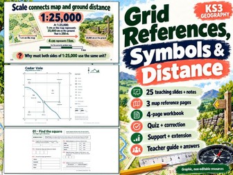
A complete graphic map-skills teaching pack for England KS3. Help pupils move from describing places loosely to reading a named grid, using a map key, giving directions and checking distance calculations. The sequence uses Cedar Vale, an original fictional teaching map, alongside a genuine, licensed Ordnance Survey VectorMap District extract of St Mary’s in the Isles of Scilly. The two maps are clearly distinguished. The OS extract is not an Explorer or Landranger map. WHAT IS INCLUDED 25 fully designed teaching slides in PowerPoint, with native speaker notes on every slide. A PDF copy of the same 25 teaching slides for convenient viewing. These are the same teaching content, not an additional lesson. A three-page landscape map reference pack: exact-scale Cedar Vale, genuine OS map evidence and a blank practice grid. A four-page landscape pupil workbook covering four-figure and six-figure references, symbols, eight-point directions and distance. A two-page baseline quiz and correction resource, with six initial checks and follow-up correction tasks. A one-page support sheet with step-by-step scaffolds. A one-page extension sheet exploring routes, a resized map and an original symbol. A 33-page searchable teacher guide with preparation, lesson sequencing, explanations, model answers, worked calculations, marking criteria, acceptable alternative reasoning, evidence descriptions and sources. WHAT PUPILS PRACTISE Read eastings before northings; distinguish four-figure kilometre cells from six-figure 100-metre cells; use a specific map’s key; describe relative directions; convert between centimetres, metres and kilometres; distinguish a straight-line distance from a marked route; independently check measurements; and explain why a copied map needs its bar scale. TEACHING USE Designed for approximately two 55–60 minute lessons, with diagnostic-led selection and extra practice where needed. Use the baseline checks first, model an example, allow guided practice and return to corrections. The extension tasks can support discussion or further independent work. GREAT FOR KS3 geography classes introducing or revisiting map skills Year 7 transition and mixed-confidence groups Targeted support and deeper reasoning Homeschool learning with adult guidance CURRICULUM CONNECTION Supports England’s KS3 geography expectations for maps, grid references, scale and Ordnance Survey mapping. DfE sets end-of-stage expectations; it does not prescribe this product’s unit sequence or lesson allocation. This is not an endorsed curriculum and is not a claim of one national curriculum across all four UK nations. IMPORTANT FORMAT AND PRINT INFORMATION Student-facing slide artwork and printable pages are graphic, non-editable resources. PowerPoint speaker notes are genuine native notes. Teacher guidance includes searchable text and descriptions of key graphic evidence; the raster pupil materials are not fully screen-reader accessible.
Plan the Rescue Route | KS3 Geography Map Skills LessonQuick View
Anmira

Plan the Rescue Route | KS3 Geography Map Skills Lesson

(0)
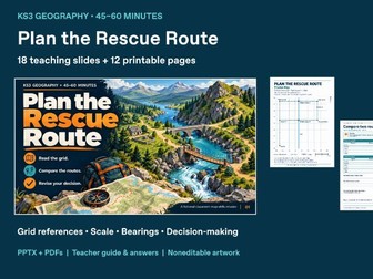
Which route should the team take, and what changes when a bridge closes? Plan the Rescue Route is a 45–60 minute geography lesson designed for Years 7–9. Pupils help a fictional practice team move supplies from Base B to Hut H. They locate features, calculate distances along marked paths, choose a permitted route and explain a revised decision when new information arrives. The sequence moves from retrieval and worked examples to paired route calculations, a decision briefing and an exit check. An optional support sheet provides steps, partial calculations and sentence frames. Five extension questions deepen reasoning about route choices, scale and the limits of a simplified map. SKILLS PRACTISED • Four-figure and six-figure grid references, with eastings before northings • Cardinal directions and simple three-figure compass bearings • Distance calculations using grid intervals and a scale bar • Comparing permitted routes and justifying a decision with evidence • Revising a route after a change in the mission rules WHAT IS INCLUDED • Teaching_Slides.pptx: 18 image-based slides with native PowerPoint speaker notes • Teaching_Slides.pdf: PDF copy of the same 18 slides • Mission_Map.pdf: 1 A4 fictional grid map • Student_Mission_Workbook.pdf: 3 A4 pupil pages • Support_Sheet.pdf: 1 A4 scaffold sheet • Extension_Sheet.pdf: 1 A4 challenge sheet with 5 questions • Teacher_Guide.pdf: 6 A4 pages covering preparation, lesson sequence, teaching guidance and answers • Read_Me.txt and File_Manifest.json: file guidance and integrity information There are 30 unique teaching pages/slides: 18 slides plus 12 A4 pages. The slide PDF repeats the PowerPoint content and is not an additional 18-slide lesson. PREPARATION Read the Teacher Guide, print the Mission Map and three-page workbook for each pupil or pair, and display the slides. Select the optional support or extension sheet to suit prior knowledge. Pupils need a pencil; they do not need an online account or their own device. Use grid intervals or the scale bar for distances and keep the map’s proportions when printing. FORMAT AND ACCESSIBILITY This is a fixed-layout graphic edition. Slide teaching text, diagrams and PDF page text are flattened into images and cannot be edited as individual text or shape objects. The PowerPoint speaker notes remain native text. No editable Word worksheets or SVG source files are included. The image-based teaching pages are not selectable or reflowable text and are not supplied as a screen-reader-ready edition. Please check the previews and your learners’ accessibility needs before purchasing. The A4 PDFs are intended for printing; the slide files are intended for classroom display.
Where in the World Are We? KS3 Geography Maps & Location SkillsQuick View
Anmira

Where in the World Are We? KS3 Geography Maps & Location Skills

(0)
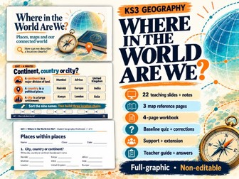
Build a clearer world-location framework with this graphic KS3 Geography pack. Pupils distinguish cities, countries and continents, connect their school locality with the wider world, revisit continents and oceans, and begin using latitude and longitude with care. The sequence introduces Africa, Asia, Russia and the Middle East through selected place examples. It also asks pupils to choose useful map evidence, compare a globe with a flat world map, and explain corrections to their starting ideas. What is included • 22 full-graphic teaching slides in PowerPoint, with native speaker notes on every slide, plus a PDF viewing copy of the same slides. • A 3-page landscape Map Reference Pack: blank diagnostic outline, labelled continents and oceans, and a 30-degree coordinate-practice map. • A 4-page Student Geography Workbook with varied place-classification, map-correction, atlas-evidence and coordinate tasks. • A 2-page Baseline Quiz and Correction Sheet with ten diagnostic questions and space to explain revised answers. • A 1-page Support Sheet with vocabulary, world-name banks, sentence support and coordinate reminders. • A 1-page Extension Sheet with tool-choice reasoning, coordinate transfer and misconception repair. • A 37-page Teacher Guide and complete answers, including lesson sequence, preparation, all slide transcripts, misconceptions, acceptable alternatives, assessment criteria and source information. Teaching focus • City, country, continent and region • Local, national and global geographical extent • Seven continents and five oceans • England and the wider United Kingdom • Orientation to Africa, Asia, Russia and the Middle East • Atlas evidence and globe/flat-map comparisons • Latitude, longitude and hemisphere notation • Reflection on diagnostic answers and evidence-based corrections Suggested use Plan for two 45–50-minute lessons, adapting the route to your class. Collect the independent diagnostic first, then release the reference map and support material as needed. Use a second pen colour to make corrections visible. A current classroom atlas and a globe are recommended for the atlas/globe activities. The teacher supplies the actual school and locality names. The resource does not collect pupils’ home addresses. Printing the 3-page map pack at A4 landscape provides a larger working area than a small workbook inset. Great for • England KS3 Geography introductory and transition teaching • Year 7 locational-knowledge review and diagnostic assessment • Mixed starting points, with separate support and extension • Paired atlas work and whole-class discussion • Home education with an adult and access to an atlas/globe • Targeted retrieval when pupils need to revisit location vocabulary or coordinates Curriculum scope Supports introductory England KS3 locational knowledge and map, atlas and globe use. Continents, oceans, UK countries and latitude/longitude consolidate prior primary learning.
School Microclimate Fieldwork | Where Should We Put a Bench?Quick View
Anmira

School Microclimate Fieldwork | Where Should We Put a Bench?

(0)
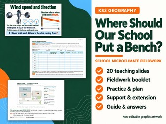
Turn a school-ground decision into a geographical enquiry. Pupils compare microclimates, map observations and recommend a bench location using evidence and a clear limitation. This Year 7 / KS3 pack includes both first-hand investigation materials and a separate simulated practice activity. WHAT IS INCLUDED • 20 PowerPoint teaching slides with native teacher notes, plus a PDF of the same slides • Four-page fieldwork booklet with planning, blank observation records, point mapping and recommendation prompts • Two-page simulated practice with nine matched-time records, calculations and reasoning • One-page fictional school plan with north and graphic scale • One-page support sheet and one-page extension sheet • 27-page teacher guide and complete answer key with preparation, worked examples, assessment criteria and safety/access prompts LEARNING AND PRACTICE Pupils consider shade, shelter, surfaces and intended use. They plan fair comparisons, record measurements consistently, calculate means and ranges, map evidence and justify a recommendation. Questions distinguish observations from possible explanations and ask what further evidence would improve a decision. The field investigation has a 15-point rubric; simulated practice has 22 marks. There is no single compulsory bench location: the criteria reward evidence, trade-offs and appropriate uncertainty. CLASSROOM USE Allow two lessons or a double lesson plus analysis time. Teachers select suitable sites, equipment and observation intervals. Simulated data are clearly labelled and support rehearsal or postponed fieldwork; they do not count as pupils’ own observations. Schools remain responsible for safety, access, supervision and permissions. GREAT FOR England KS3 microclimates; local fieldwork; data handling; evidence-based recommendations; guided group work; and adult-supervised home education with an adapted local setting. FORMAT PowerPoint and printable PDFs. Graphic slide and pupil-page text is not separately editable; speaker notes are native. The PDF deck repeats the PowerPoint content. Pupil PDFs use A4 landscape pages.
Weather and Climate: Instruments, Data and Weather Diary | KS3 GeographyQuick View
Anmira

Weather and Climate: Instruments, Data and Weather Diary | KS3 Geography

(0)
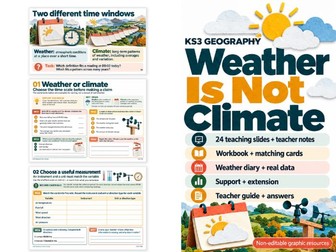
Help pupils distinguish daily weather from long-term climate, choose suitable instruments and units, and evaluate the reliability of observations. This Year 7 / KS3 geography pack combines illustrated teaching, real evidence and practical enquiry. WHAT IS INCLUDED • 24 PowerPoint teaching slides with native teacher notes, plus a PDF of the same slides • Four-page weather and climate workbook • One page of 15 shuffled instrument, variable/unit and method matching cards • One-page weather diary with five blank observation rows • One-page support sheet and one-page extension sheet • One-page Rothamsted weather and climate evidence sheet • Teacher guide and complete answer key with worked calculations and teaching guidance LEARNING AND PRACTICE Pupils identify weather variables, match instruments and units, describe data, calculate a mean and range, and explain how observation methods affect reliability. Questions explore changing observation times, missing readings and poorly positioned instruments. Authentic Rothamsted evidence pairs daily maximum temperatures from 1–7 October 2025 with 1991–2020 climate normals. Pupils learn why a short weather record cannot establish a long-term climate pattern. CLASSROOM USE Use across approximately two lessons, with diary observations between or afterwards. Keep the evidence sheet beside the data questions. Pupils without equipment can analyse the supplied evidence and evaluate methods. Local observations require adult supervision, safe conditions and school arrangements. GREAT FOR England KS3 weather and climate teaching; paired matching; retrieval; guided small-group work; and home education with adult support. FORMAT PowerPoint and printable PDFs. Graphic slide and pupil-page text is not separately editable; speaker notes are native. The PDF deck repeats the PowerPoint content. Sources and reuse credits are included.
Rainfall Types: Relief, Convectional & Frontal Rain | KS3 GeographyQuick View
Anmira

Rainfall Types: Relief, Convectional & Frontal Rain | KS3 Geography

(0)
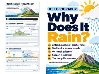
Help pupils explain how rising air can lead to rain, then compare relief, convectional and frontal rainfall. This Year 7 / KS3 geography pack develops causal explanations through illustrated models, sequencing, diagram annotation and real UK evidence. WHAT IS INCLUDED • 22 PowerPoint teaching slides with native teacher notes, plus a PDF of the same slides • Four-page rainfall workbook • One page of six shuffled rain-process sequence cards • One-page vocabulary and explanation support sheet • One-page extension sheet • One-page UK relief-rainfall evidence sheet • Teacher guide and complete answer key with worked answers, misconceptions and assessment guidance LEARNING AND PRACTICE Pupils connect rising air, expansion, cooling and condensation; distinguish water vapour from cloud droplets; and recognise that clouds do not always produce rain at the ground. Separate warm-front and cold-front models help pupils compare the triggers for uplift. Tasks include ordering processes, labelling a simplified mountain diagram, repairing misconceptions and explaining a fictional forecast. Published 1991–2020 Met Office rainfall averages for Cwmystwyth and Shawbury support discussion of relief and the limits of a two-location comparison. Diagrams are schematics, not measured terrain profiles. CLASSROOM USE Use across approximately two lessons after introducing weather variables and changes of state. Pair the cards with workbook sequencing, provide the support frame where needed, and select extension questions for evaluating evidence and comparison methods. GREAT FOR England KS3 weather and climate; paired discussion; diagram-based explanations; retrieval and consolidation; small-group support; and home education with adult guidance. FORMAT PowerPoint and printable PDFs. Graphic slide and pupil-page text is not separately editable; speaker notes are native. The PDF deck repeats the PowerPoint content. Full sources and credits are supplied. The fictional forecast is a teaching activity, not current weather advice.
Climate Graphs & Climate Controls | KS3 Geography Teaching ResourcesQuick View
Anmira

Climate Graphs & Climate Controls | KS3 Geography Teaching Resources

(0)
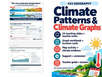
Teach pupils to read, construct and explain climate graphs using Heathrow, Winnipeg and Kigali. This Year 7 / KS3 geography pack links graph skills to latitude, altitude and ocean influence, helping pupils support comparisons with numerical evidence. WHAT IS INCLUDED • 24 PowerPoint teaching slides with native teacher notes, plus a PDF of the same slides • Four-page graph-construction and comparison workbook • One-page climate-location cards with Heathrow construction data • One-page map-overlay activity • One-page graphing support sheet and one-page extension sheet • Three-page climate evidence set with monthly data and a completed graph for each location • Teacher guide and complete answer key with worked calculations and assessment guidance LEARNING AND PRACTICE Pupils interpret precipitation bars and temperature lines, use two labelled axes, read negative temperatures, calculate annual temperature range and total monthly precipitation. They construct a Heathrow climate graph, compare the three locations and explain why latitude alone cannot account for every climate difference. All three locations use consistent 1991–2020 NASA POWER/MERRA-2 gridded estimates. These are clearly identified as model-based climate estimates rather than observed airport measurements. Source notes explain units, rounding and limitations. CLASSROOM USE Allow approximately two lessons, adapting the sequence to prior graphing experience. Keep the completed Heathrow graph hidden during independent construction. Use the support sheet as an alternative scaffold and the extension tasks to examine graph scales and causal claims. GREAT FOR England KS3 climate teaching; geographical numeracy; evidence-based comparison paragraphs; targeted graphing support; retrieval; and adult-guided home education. FORMAT PowerPoint and printable PDFs. Graphic slide and pupil-page text is not separately editable; speaker notes are native. The PDF deck repeats the PowerPoint content. Print complete A4 pages in their supplied orientations. Sources and reuse credits are included.