Map Skills: Keys, Compass Directions and Rotated Maps (Ages 7–9)
On a turned map, north points right: is the pond still east of the hut? This printable sequence develops keys, compass directions and map purpose.
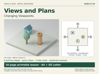
One fictional park appears as a digital model, overhead view and simple plans. Children compare these representations. Suggested ages 7–9, after the four main compass directions have been introduced. This practises explaining map evidence after the four compass points are known.
Five activity sheets develop the reasoning:
Complete a key, count symbols and compare a model object with its simplified symbol.
Read a map after a quarter turn. Distinguish left/right on the paper from a compass direction between places.
Choose a map for finding seats or counting trees, and challenge an inference from a missing symbol.
Find exactly three errors in a map that explicitly promises the same objects, positions and orientation as the reference.
Invent a bench symbol and design a map for finding all three seats. Explain deliberate omissions and check a partner’s map.
A separate quick check uses a different garden with north pointing left. Four help cards support reading a key, aligning north, identifying the purpose and comparing evidence. Three explained answer pages include typical misconceptions and criteria for accepting different correct drawings. The check supports discussion, not standardized assessment.
Each 15-page PDF contains a title page, adult preparation notes, a model/key reference, five activity sheets, the new-garden check, one page of four help cards, three answer pages, sources/credits and the complete font notice. A4 and US Letter are included as alternative paper sizes: they repeat the same activities, so print one format.
A pencil and the printed reference page are sufficient; a ruler is optional. No digital device or cutting is required. Symbols differ by shape; colour adds a clue. These are static PDFs, without editable worksheet templates or fillable fields. All places and map symbols are fictional. There are no scale, distance, grid-reference, eight-point compass or real-world navigation tasks. This is a focused four-direction reasoning sequence, not a complete KS2 mapping unit.
Repetition: the five pupil sheets, park and new-garden check repeat Swale & Sign’s German “Ein Park. Mehrere Karten.” lesson. Separate English adult notes and four help cards add support; they do not create a new exercise set for owners of the German lesson. A4 and Letter are two formats, not two different packs. This map lesson uses different tasks and a different model from our “Changing Viewpoints” mathematics lesson.
AI disclosure: text, tasks, maps, answers, layout and original digital model images were generated using OpenAI Codex. Model images were rendered in Blender. Geometry, answers and both PDF layouts have been checked digitally. No classroom, screen-reader or physical-printer test is claimed.