How Hardware and Software Work TogetherQuick View
zeecko

How Hardware and Software Work Together

(0)
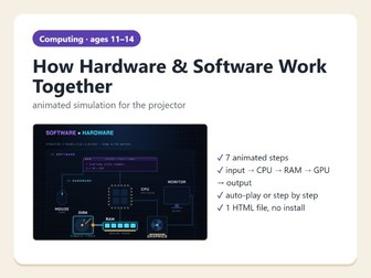
Animated step-by-step simulation for the projector: what happens inside a computer when you double-click a picture – from the mouse click to the image on the monitor. Perfect starter or plenary on hardware, software and input – process – output. What the simulation shows (7 steps) System ready – software (programs) vs hardware (physical parts) Input – a double-click with the mouse Software → hardware – the program gives the processor an instruction Disk → RAM – the file is copied into working memory The processor (CPU) calculates The graphics card (GPU) draws the image Output – the image appears on the monitor Features animated data packets travel between the components Next / Back buttons, arrow keys or automatic playback short explanation for every step, large text for the projector one HTML file – opens in any browser, nothing to install, no account, no data sent anywhere What is included (ZIP file) Teacher guide with suggested questions (PDF) Simulation (HTML) About 5–10 minutes. Suitable for ages 11–14 (KS3 computing). Designed and classroom-tested by a computing teacher, created with the help of AI tools. All graphics are original.
Africa Blank Map: Landforms, Seas & RiversQuick View
zeecko

Africa Blank Map: Landforms, Seas & Rivers

(0)
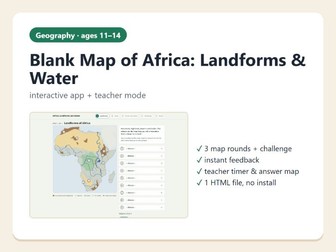
Interactive, self-marking blank map of Africa for tablets or computers: pupils label landforms, seas and oceans, rivers and lakes, then take a final challenge. Teacher mode included. What the app does Round 1 – landforms (9 places): Atlas, Sahara, Ethiopian Highlands, Kilimanjaro, Congo Basin, Kalahari, Namib, Drakensberg, East African Rift Round 2 – seas and oceans (10 places): oceans, seas, gulfs, the Strait of Gibraltar, the Suez Canal and Madagascar Round 3 – rivers and lakes (10 places): Nile, Congo, Niger, Zambezi, Orange and the great lakes Final challenge (8 questions): why Africa looks the way it does – volcanoes and the rift, High and Low Africa, why rivers are hard to navigate, the Nile, Congo, Lake Chad and Victoria Falls; every question has an optional hint instant feedback – wrong answers are corrected on the map; the result page shows points and a percentage teacher mode: answer map for the projector, countdown timer, 20-minute lesson plan and a discussion question with a model answer one HTML file – opens in any browser, works on tablets and PCs, nothing to install, no account, no data sent anywhere What is included (ZIP file) Teacher guide (PDF) Africa blank map app (HTML) About 20 minutes. Great as a lesson starter, revision before a test or a homework task. Suitable for ages 11–14 (KS3). Designed and classroom-tested by a geography teacher, created with the help of AI tools. Map data: Natural Earth (public domain); facts checked against Encyclopaedia Britannica and NASA Earth Observatory.
Africa & World Population Geography Team QuizQuick View
zeecko

Africa & World Population Geography Team Quiz

(0)
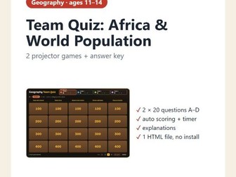
Two ready-made team quiz games for the projector or interactive whiteboard: Africa physical geography and world population, with auto scoring, a timer and an answer key. What the game does 2 games × 5 categories × 4 questions (100–400 points), multiple choice A–D Africa – physical geography: seas and oceans, mountains, deserts and basins, rivers and lakes, maps and atlas skills World population: how many of us, where we live, births and deaths, migration, languages and religions 2–5 teams, all teams vote at once with colour cards (A red, B yellow, C green, D blue) points are added automatically, 30-second countdown the correct answer and a short explanation after every question teacher mode with the full answer key on screen one HTML file – double-click to open in any browser, nothing to install, no account, no data sent anywhere What is included Teacher guide and full answer key (PDF) Geography Team Quiz (HTML) Great for revision lessons, end of topic, cover lessons or the last lesson before a holiday. 20 questions take about 15–20 minutes. Suitable for ages 11–14 (KS3). Created with the help of AI tools; facts checked against Encyclopaedia Britannica, UN population data and a school atlas.