The pupils have to identify the locations of the 15 longest rivers in the world using an atlas to help them. Well designed and child-friendly, this was a good activity that I would use again next year.
This activity looks at the location of famous volcanoes with the pupils having to locate them on a map using their lines of latitude and longitude. It is a colourful, child-friendly design. We did it in A4 which worked well although I can see how A3 would work well too.
In this activity, the pupils learn the difference between the British Isles, Great Britain and the United Kingdom. They then go on to use an atlas to help them name the major countries, cities and seas in the UK. It makes for a good lesson when learning about the geography of the UK.
A quick, fun activity which I used to give my class something to do during morning registration. It matched their geography topic and fitted into the 15 minute slot nicely.
This activity looked at the water cycle first and then went on to look at how people have changed the water cycle. It made for a good lesson and with discussion, it took 50 minutes. The activity is colourful and child friendly and comes complete with an answer key.
This activity was a great one for developing use of an 8 point compass whilst also looking at the UK and cities in the UK. It is child friendly and colourful and there was still time in the lesson for the pupils to mark their friend's work.
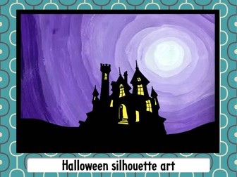
This Halloween silhouette art idea comes complete with PowerPoint for teaching and templates to help make pupils work look great. It can be used later in a writing lesson or just to make the classroom look great.
These activities will help you to teach all about the topic of earthquakes. They will help the pupils make connections between the world they observe around them and the concepts and skills covered in the geography curriculum.
These high-quality geography worksheets are well designed to appeal to a young audience. For added convenience for the teacher, they come complete with teacher notes and answers.
A comprehensive range of earthquake worksheets to support 16 different earthquake activities to help learning all about earthquakes. They come complete with teacher notes and answer keys. The activities look at:
Locating earthquakes using latitude and longitude,
Tohoku 2011 fact file,
Earthquake crossword,
Earthquake vocabulary,
Formation of a tsunami,
How do earthquakes occur,
How do tectonic plates move,
The Mercalli scale
Overview
This three-lesson Emotional Intelligence Activity Pack is designed to help pupils aged 10–14 develop essential social-emotional learning skills through engaging, age-appropriate activities. Perfect for use in PSHE, SEL, form time, well-being sessions, pastoral support, or citizenship lessons.
Each standalone lesson includes a beautifully designed worksheet and a full set of teacher notes, allowing any teacher to deliver the content with confidence. No prior training or prep required.
What’s Included?
3 Complete Lessons:
Lesson 1 – Understanding Myself (Self-awareness)
Lesson 2 – Empathy in Action (Social awareness)
Lesson 3 – Managing Emotions (Self-regulation)
Printable or digital activity sheets for each lesson
Detailed teacher notes with suggested timings, modelling tips, discussion prompts, differentiation strategies, and extension ideas
Fully scaffolded for a range of learners (ideal for Years 6–9 / Grades 5–8)
Why Teachers Love It
Clear learning outcomes tied to emotional literacy
Thoughtful, real-world scenarios and calming strategies
Encourages pupil reflection, class discussion, and self-expression
Designed by an experienced teacher with 30 years in the classroom
Ready to use—ideal for busy educators!
Perfect For:
PSHE or SEL curriculum
Upper Key Stage 2 / Lower Key Stage 3 (UK)
Grades 5–8 (US)
Well-being days, transition support, or pastoral interventions
Teachers new to emotional intelligence or looking to refresh their materials
(A3 size & Buildable A1 size)
Bring grammar to life with this high-impact, comic-inspired classroom poster designed to help pupils clearly understand the Progressive Tense and the Perfect Tense. Bold visuals, dynamic characters, and simple explanations make this an ideal display for Years 5–8, intervention groups, or EAL learners.
This resource is supplied in two formats:
✓ A3 poster (ready to print)
✓ Four A3 quarters that can be trimmed and joined to create a large classroom display, perfect for the front wall or literacy area. For extra durability, each quarter can be laminated before assembly.
The poster includes:
Clear definitions of the Progressive (“in progress”) and Perfect (“finished”) tenses
Simple formulas for each tense
Memorable visual cues and “big clues” pupils can use in their own writing
Present, past, and future examples for both tenses
A quick reminder strip to support independent working and editing
Designed in a bright, energetic, comic-book style that engages pupils and makes tricky grammar feel accessible and fun—without overwhelming them.
Perfect for:
• Year 5–6 grammar lessons
• KS3 recap or intervention groups
• Literacy walls and learning displays
• Individual revision or home learning packs
This is the ideal resource for teachers who want clarity + visual appeal + pupil engagement all in one poster.
This fun and colourful activity is good for developing the pupil's awareness of the major cities in the UK including their names and how to spell them. Good for when you have some time to spare.
This well designed and child friendly classroom poster depicts all the planets in our solar system.
It can be printed in A4 size or A3 size. It comes in 9 sheets of paper which can be laminated and stuck together. The colourful, cartoon style artwork accurately depicts the appearance of the different planets. Planets not illustrated to scale.
In this lesson, pupils develop their understanding of the different ways in which we can describe characters. The pupils look at a character description of a person describing them through:
their appearance,
their character
their actions
their thoughts
their movements
the subtext
The pupils then go on to describe a character in similar ways. There are three different characters for the pupils to describe. Their is an extension activity where the pupils go on to develop their ideas into a piece of narrative writing including adverbial phrases in their writing.
The lesson comes complete with a PowerPoint and activity sheet. Both are well designed and child friendly.
In this lesson, we look at using online mapping software tools to locate mountain ranges on maps.
Lesson intro:
10 second challenge - How many synonyms for mountain can you come up with.
Look at the Himalayas from space, come up with a suitable definition for the term mountain range.
Main activity:
Looking at using online software to locate mountain ranges on maps.
Plenary:
Self-assessment activity & recap on learning from the lesson.
This lesson comes complete with:
Activity worksheets.
PowerPoint.
Success criteria.
Teacher notes.
Answers.
A comprehensive range of volcano worksheets to support 18 different volcano activities to help learning all about volcanoes. They come complete with a detailed answer key. The activities look at:
* Locating volcanoes using latitude and longitude.
* Looking inside our earth.
* Identifying parts of a volcano.
* Making a volcano model.
* Types of volcano.
* Compare and contrast.
* Building up volcano vocabulary.
* Creating an A-Z of volcano words.
* What happens in a volcanic eruption?
* The effects of a volcanic eruption.
* The responses to a volcanic eruption.
* Volcano word search.
* Volcano crossword.
Also included is a comprehensive list of volcano learning objectives to help you with your planning.
This worksheet pack is also available in a bundle with earthquake worksheets saving 25% on both packs.
Or, it can be bought as part of a volcano teaching pack complete with PowerPoints, assessment and class displays.
We purposely set out to design Geoography worksheets and activities that are both visually appealing to pupils and effective learning tools for teachers. This comprehensive set of 40 activities covers map skills for all pupils aged 7-11. It comes complete with answer keys to speed up your day.
Activities covered in these pages are:
• marking information on a map
• interpreting aerial photographs
• following routes on maps
• using alpha-numeric grid references (using map of Mexico)
• Identifying map symbols
• Showing direction on a map (UK / USA / Japan / Australia versions)
• Using an atlas (or online map) to identify key geographical features
• creating a map of an imaginary area
• Identifying and naming major rivers (World / UK / India / Canada versions)
• Identifying world’s largest islands on a map
• Identify features on an aerial photo from a map of the same area
• Identifying the continents
• Identifying countries from their outlines
• Self assessment (aged 7-9)
• Depict a globe as a flat surface
• Using Longitude and latitude
• Four figure grid references (Canada version)
• Six figure grid references
• Make a 3D map (complete with 4 templates)
• Describing landscapes using geographical vocabulary
• Drawing field sketches
• Drawing a pictorial map
• Mark on a map - EU country
• Make a cross section of a map
• Make a choropleth map (Indian rainfall)
• Self-assessment (aged 9-11)
This is a good colourful, child friendly activity. I liked this activity because it asks the pupils to label a volcano diagram but then it also goes on to ask the pupils to write a definition for each part they labelled. I set this for homework with the pupils having to use their textbooks and the internet to find the definitions.
This is a list of 40 different 11 plus interview questions classified into 7 different question styles. These questions were faced by pupils sitting senior school entrance interviews during January 2016 having successfully passed the entrance exam.
This lesson looks at the difficulty of depicting a globe onto a flat surface and involves the pupils making a globe.
It starts of with a quick picture quiz - which map projection is better? all answers in the PowerPoint.
It then goes on to see if pupils can peel an orange and make a rectangle out of the peel (this could be a teacher demonstration or just shown through the use of photos).
It then looks at the problems of the Mercator map projection and looks at the different factors that map creators have to try to balance when creating a map projection.
The pupils then go on to make a globe of the world at night.
There are possible extension activities where the pupils print off a cube shaped globe of the world and / or they turn a photo into a globe.
These lesson comes complete with:
Globe template,
Pupil worksheet
PowerPoint
teacher notes
These worksheets provide some classroom based activities that help develop the pupils' awareness of resilience. They look at identifying what is resilient and what is not. They go on to looking at the language used with becoming more resilient and ask the pupils to carry out a self evaluation of what resilient traits they have and which ones they do not. I have taught these activities with both year 4 and year 6 classes and they worked well.
This activity looks at the weapons that an Anglo Saxon warrior would use. It asks the pupils to sort the weapons into those used for attack and those used for defence. The pupils then write short sentences explaining how they would be used. There is a writing frame for the less able. Then, we look at Anglo Saxon fighting tactics with pupils imagining what it would be like to be an Anglo Saxon warrior. For an extension activity, or for a homework, there is also an activity looking at Anglo-Saxon artefacts. This activity comes complete with a PowerPoint to support the teaching and learning whilst using this activity.
This activity is also available as part of a bundle to help you save money.
 Quick View
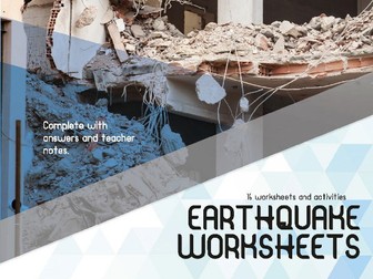 Quick View
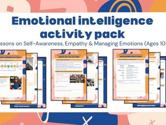 Quick View
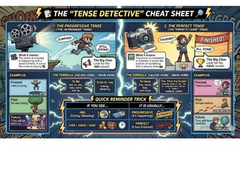 Quick View
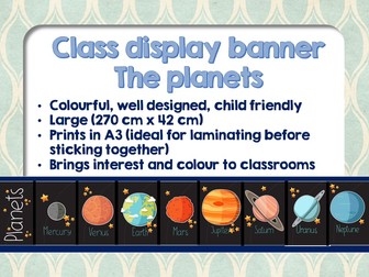 Quick View
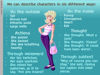 Quick View
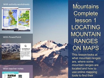 Quick View
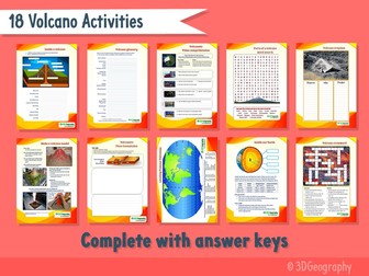 Quick View
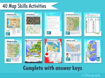 Quick View
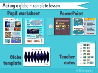 Quick View