 Quick View
Locating the world's famous volcanoes - KS2
This lesson is designed for KS2 students. It can be taught as a stand alone lesson but is also available as part of two wider units, both of which are available on TES:
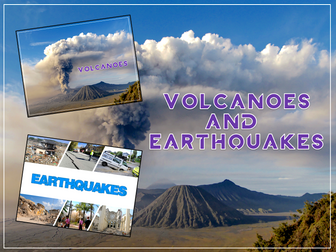
-Volcanoes
-Volcanoes & Earthquakes
First the presentation introduces some of the world’s most famous volcanoes and classes them as active, dormant or extinct.
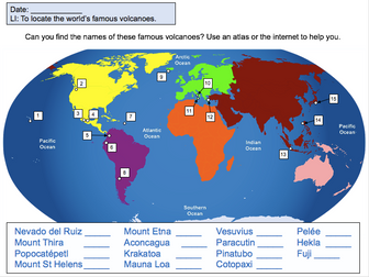
The activity then challenges students to locate volcanoes using an atlas or the internet (e.g. Google maps). Alternatively, a map of famous world volcanoes is also provided.
Easier – Students locate volcanoes using the map of famous volcanoes (writing numbers).
Medium – Students locate volcanoes using the map of famous volcanoes (writing volcano names).
Harder – Students locate volcanoes using an atlas.
(N.B. It is recommended you check the atlas has the relevant maps prior doing the activity.)
If you like this resource, we would appreciate a review! We will happily send you a free resource in return for a review or useful suggestions/feedback. Contact us at ed@teachitforward.co.uk.