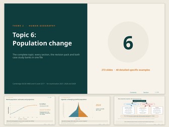
A comprehensive, editable 272-slide PowerPoint covering population change, population structures and migration. Bring together teaching explanations, student activities, worked examples and revision in one resource, with linked contents to help you select material for your lessons.
Topics covered:
Population growth and decline, birth and death rates, natural increase and net migration
The demographic transition model and population policies
Population pyramids, dependency ratios, youthful and ageing populations
Migration causes, impacts and management, including Mexico to the USA
Includes retrieval starters, calculation and graph-interpretation tasks, discussion activities, answer slides, exam-style practice, model answers and revision checklists. Two case-study banks provide 40 examples for comparison and extension. Teacher guidance and external video links with viewing prompts support lesson planning.
Developed for IGCSE and O Level geography teaching, with editable content that can be adapted to your GCSE course.
You receive one complete PowerPoint file. Activities and answers are included on slides; separate printable worksheets are not included. Linked videos require internet access. Practice questions and suggested answers are teacher-written, rather than official examination-board materials.
Eight slides providing the detailed specific example of a river basin
required by Cambridge IGCSE Geography (0460) and O Level (2217).
· Sketch map of the basin, with the two main tributaries, three cities
and the delta
· The Mississippi basin in numbers, for quoting in exam answers
· Why the Mississippi floods: physical and human causes
· Managing the Mississippi: levees, spillways, channel works and whether
they have worked
· Retrieval practice and check-and-correct
A case study students can actually recall under exam conditions, with
the specific figures examiners look for. Includes an embedded video link.
Fully editable.
Twenty-one slides on erosion, transport, deposition and downstream change
for Cambridge IGCSE Geography (0460) and O Level (2217).
· Upper, middle and lower course: recognising each
· Four processes of erosion: hydraulic action, abrasion, attrition, solution
· Four processes of transport: traction, saltation, suspension, solution
· Why deposition happens and where
· The long profile and the changing valley cross profile
· How the river changes downstream, as a full comparison table
· The Bradshaw model, with the five variables that increase and the
three that decrease
· Pothole formation
· Exam practice with mark guidance
Includes original diagrams, field photography and embedded video links.
Fully editable.
Twenty-two slides on river hazards, opportunities and management for
Cambridge IGCSE Geography (0460) and O Level (2217), including a full
flood event case study.
· Physical and human causes of river flooding
· Social, economic and environmental impacts
· Boscastle 2004: causes, effects, response, and whether the scheme
was worth it
· Why people live and work beside rivers despite the risk
· Hard versus soft engineering, compared directly
· Eight management strategies within a single catchment
· Floodplain zoning and what it does and does not achieve
· River restoration: the Drau, Austria
· How to evaluate a management strategy and reach a judgement
Includes original diagrams, field photography and embedded video links
including BBC news coverage of Boscastle. Fully editable.
Twenty-four slides on upper and lower course landforms for Cambridge
IGCSE Geography (0460) and O Level (2217). The largest section of the
topic, and the one most heavily examined.
· Upper course: V-shaped valleys and interlocking spurs
· Waterfall and gorge formation, as a three-stage sequence
· Meander formation and the cross section that earns the marks
· Oxbow lake formation, stage by stage
· Lower course: floodplains, levees, deltas and estuaries
· Why the coarsest load is dropped first
· A landform revision grid to complete from memory
· Exam practice with mark guidance
Includes original diagrams, field photographs of real waterfalls, gorges,
meanders and deltas, and embedded video links. Fully editable.
Twenty slides covering the drainage basin system and storm hydrographs
for Cambridge IGCSE Geography (0460) and O Level (2217).
· The drainage basin as an open system: inputs, stores, flows, outputs
· Interception, infiltration, percolation, throughflow, groundwater flow
· The watershed and the basin boundary
· Key vocabulary, with a labelling task
· Reading a storm hydrograph: peak discharge, lag time, rising and
falling limbs
· Flashy versus subdued hydrographs and what causes the difference
· Factors that shorten lag time and raise the peak
· Retrieval practice and check-and-correct
Includes original diagrams, field photography and embedded video links.
Section divider with learning objectives. Fully editable.
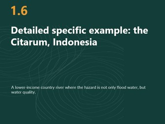
Seven slides providing a contrasting river basin case study for Cambridge
IGCSE Geography (0460) and O Level (2217), covering pollution and
management in a lower-income country.
· Sketch map of the basin, with the three dams, the textile belt and
the city
· The Citarum basin in numbers, for quoting in exam answers
· Causes, impacts and responses: industrial pollution, waste, and the
clean-up programme
· Retrieval practice and check-and-correct
A strong contrast to the Mississippi, and useful for comparison
questions. Includes an embedded video link. Fully editable.
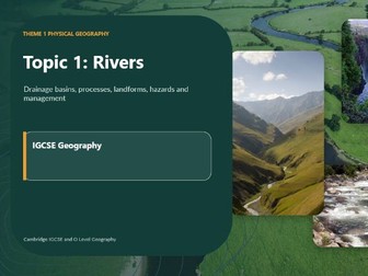
A complete, ready-to-teach unit on rivers and hydrology for Cambridge IGCSE and O Level Geography. 119 slides covering the full topic from the drainage basin system through to river management, built to be taught straight from the screen with no additional preparation.
Everything in this resource is original. The diagrams are newly created, the photographs are my own from fieldwork, and the case studies are written specifically for this unit. Nothing is lifted from a textbook, so you can display it, print it and adapt it without copyright worry.
WHAT IS INCLUDED
119 slides organised into clear numbered sections, each with its own divider slide
Original diagrams: the drainage basin system, drainage basin processes in cross section, the long profile, valley cross profiles, waterfall formation and retreat, meander plan view and cross section, oxbow lake sequence, levee and floodplain formation, delta types, the Bradshaw model and the flood hydrograph
Original field photographs throughout, including a confluence, a waterfall on hard rock, a gorge, deposition on the inside of a bend, an estuary at low water, a large dam and reservoir, and communities living on a river
Written case studies covering flooding, flood management and river restoration
A curated video bank: a dedicated library slide of hyperlinked clips, plus inline WATCH buttons placed at the point in the lesson where each clip belongs, so you never have to break off and search
Practice questions built into the unit, in Cambridge command-word style, for use as lesson tasks, plenaries or homework
TOPICS COVERED
The drainage basin system and the hydrological cycle. Inputs, stores, flows and outputs. Watersheds, tributaries and confluences. River processes: erosion, transport and deposition. The long profile and changes downstream. Upper, middle and lower course characteristics. Landforms including V-shaped valleys, interlocking spurs, waterfalls, gorges, meanders, oxbow lakes, floodplains, levees, estuaries and deltas. Causes of flooding, both physical and human. Flood impacts on people and property. Hard and soft engineering. River restoration. Why people live and work beside rivers.
WHO IT IS FOR
Written for Cambridge IGCSE (0460) and O Level (2217) Geography, and equally usable for Edexcel and AQA GCSE rivers units, IB MYP, and as a stretch resource for able Year 9 classes. Suitable for international schools and UK settings alike.
FORMAT
PowerPoint (.pptx), fully editable. Consistent house style throughout so you can add your own slides without the deck falling apart. Works in PowerPoint, Google Slides and Keynote.
Written and photographed by a Geography specialist with over twenty years of international classroom experience, Fellow of the Royal Geographical Society.


 Quick View