GCSE World Population - Urban Issues and Challenges Lesson 01Quick View
ssearing

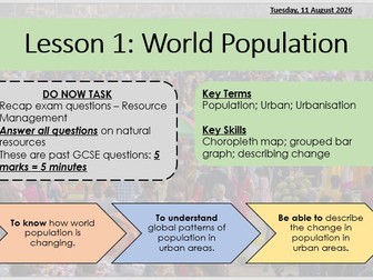
GCSE World Population - Urban Issues and Challenges Lesson 01

(0)
AQA GCSE Geography - Urban Issues and Challenges Learning aims / objectives: To know how world population is changing. To understand global patterns of population in urban areas. Be able to describe the change in population in urban areas. Introductory lesson to topic focusing on how global population has changed over time, and how urban population varies around the world. Provided in lesson is PowerPoint, workbook pages with space to complete all tasks, and separate resource sheet for colour handouts. Lesson includes: Exam practice starter to recall knowledge from previous topic (Resource Management) Key words - definitions and dual coding to aid knowledge recall A variety of resources - video, choropleth map, bar graph, line graph - to help develop geographical skills Extension questions to encourage thinking beyond the GCSE specification and link with A-Level specification Exam practice to apply knowledge in exam context and develop exam technique
GCSE Geography Statistical Skills - Percentages and Percentage ChangeQuick View
ssearing

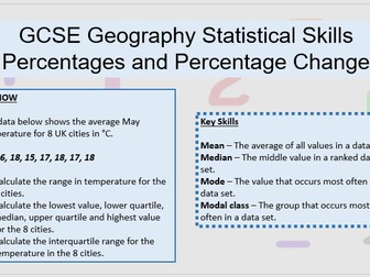
GCSE Geography Statistical Skills - Percentages and Percentage Change

(0)
Lesson to practice essential statistical skills of percentages and percentage change. Developed as part of a series of skills lessons to improve geographical skills essential across all 3 AQA GCSE papers (also applicable for other exam boards) and fieldwork. PowerPoint and corresponding workbook provided. Developed to be used alongside past exam questions on these statistical skills - not included in resource as can be obtained from exam board websites to suit needs of classes and / or curriculum time. Breaks down each of the statistical skills providing: a step by step method for calculating each statistical skill advantages and disadvantages of each statistical skill to develop understanding worked example independent practice all answers provided on PowerPoint
GCSE Geography Statistical SkillsQuick View
ssearing

GCSE Geography Statistical Skills

3 Resources
Series of 3 lessons to develop statistical skills essential for all 3 AQA GCSE Geography papers, and fieldwork. Also relevant for other exam boards, and can be adapted to use for KS3 and A-Level classes. Lessons developed to deepen understanding of each statistical skill and it’s application in geography. All examples are using realistic data related to a range of both human and physical topics in AQA GCSE specification. Lesson 1 - Mean, Median, Mode and Modal Class Lesson 2 - Total, Range, Quartiles, and Interquartile Range Lesson 3 - Percentages and Percentage Change PowerPoint and corresponding workbook provided for each individual lesson. Developed to be used alongside past exam questions on these statistical skills - not included in resource as can be obtained from exam board websites to suit needs of classes and / or curriculum time. Breaks down each of the statistical skills providing: a step by step method for calculating each statistical skill advantages and disadvantages of each statistical skill to develop understanding worked example independent practice all answers provided on PowerPoint
GCSE Geography Statistical Skills - Total, Range, Quartiles and Interquartile RangeQuick View
ssearing

GCSE Geography Statistical Skills - Total, Range, Quartiles and Interquartile Range

(0)
Lesson to practice essential statistical skills of total, range, quartiles and interquartile range. Developed as part of a series of skills lessons to improve geographical skills essential across all 3 AQA GCSE papers (also applicable for other exam boards) and fieldwork. PowerPoint and corresponding workbook provided. Developed to be used alongside past exam questions on these statistical skills - not included in resource as can be obtained from exam board websites to suit needs of classes and / or curriculum time. Breaks down each of the statistical skills providing: a step by step method for calculating each statistical skill advantages and disadvantages of each statistical skill to develop understanding worked example independent practice using realistic data related to specification and comparable to past and potential exam questions data used is realistic data for the exam specification and comparable to past and potential exam questions
GCSE Geography Statistical Skills - Mean, Median, Mode and Modal ClassQuick View
ssearing

GCSE Geography Statistical Skills - Mean, Median, Mode and Modal Class

(0)
Lesson to practice essential statistical skills of mean, median, mode and modal class. Developed as part of a series of skills lessons to improve geographical skills essential across all 3 AQA GCSE papers (also applicable for other exam boards) and fieldwork. PowerPoint and corresponding workbook provided. Developed to be used alongside past exam questions on these statistical skills - not included in resource as can be obtained from exam board websites to suit needs of classes and / or curriculum time. Breaks down each of the statistical skills providing: a step by step method for calculating each statistical skill advantages and disadvantages of each statistical skill to develop understanding worked example independent practice
Migration - Why do people move? (Push and pull factors)Quick View
ssearing

Migration - Why do people move? (Push and pull factors)

(0)
KS3 lesson (designed for Y7 mixed ability curriculum) on migration, focussing on push and pull factors. Differentiated learning objectives and extension tasks provided. Workbook pages and handout will need to be printed. PowerPoint, leson handout and workbook pages for entire lesson. Learning objectives: To know examples of push and pull factors. To understand reasons why people leave some places and move to other places. To be able to evaluate the different reasons for migration. Key terminology: Economic Environmental Migration Pull factor Push factor Social Tasks: Do now / starter task - cartoon interpretation to introduce push and pull factors. Main task 1 - dual coding drawing images to represent new key terminology. Main task 2 - diamond 9 of push and pull factors, categorising as economic, environmental and social. Extension task 1- complete paragraphs justifying choices for diamond 9. Main task 3 - identifying push a pull factors from ‘real life’ examples. Extension task 2 - poster to advertise pull factors of local area.
2024 UK General ElectionQuick View
ssearing

2024 UK General Election

(0)
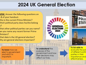
Lesson designed to use as a KS3 geography lesson, but suitable for KS4 and to use in other subjects. Focus on manifestos in key policy areas for main 5 parties in England - Conservatives, Labour, Lib Dems, Greens, and Reform. PowerPoint and short workbook included. Tiered learning objectives to differentiate to suit all abilitities: To know how we elect a government and why it is important. To understand the purpose of the government and how their decisions may affect our lives. To be able to evaluate the policies of different political parties in their importance and effectiveness. Extensive key word list to for all terminology election based. Lesson struture: Starter to judge prior knowledge of elections and UK government. Overview of how general elections work in the UK and the results of the 2019 general election. Introduction to types of tax and why tax is a hot topic in general elections. Introduction to leaders of key polictical parties in England and the UK. Policy ranking task from manifestos of Conservatives, Labour, Lib Dems, Greens, and Reform. Students will be asked to rank policies for these parties in the categories of economy, education, health, immigration, crime, environment, and defence. This is done ‘blind’ so students can judge which party they most align to without bias, with which parties the policies belong to revelaed afterwards. Extension task of extented writing focusing on expaning why their top ranked policies are important and why they will be beneficial for people living in the UK.
Atlas Skills - From Atlas to the AtlasQuick View
ssearing

Atlas Skills - From Atlas to the Atlas

(0)
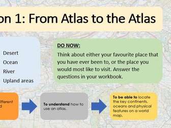
Introductory lesson for key locational knowledge and atlas skills. Suitable for Y7 or KS2. PowerPoint and lesson handout / worksheet provided. Will need atlases to complete lesson. Differentiated learning aims: To know the different continents and oceans. To understand how to use an atlas. To be able to locate the key continents, oceans and physical features on a world map. Starter task: Questions on their favourite place. Main task: Using an atlas to locate and name key locations e.g. continents, oceans, rivers. Extension: Using the atlas index to find obscure capital cities and locate their country and continent. Includes ‘famous geographer’ information to make cross curricular links between Atlas from Greek mythology and the atlases we use today. Resource will need adjusting so page numbers are correct for atlases being used.
Map Symbols BingoQuick View
ssearing

Map Symbols Bingo

(0)
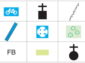
Bingo game for Ordnance Survey 1:25,000 map symbols. Suitable to use as a plenary activity, or just a bit of fun. 32 3x3 unique bingo cards 52 different map symbols used calling cards to easily draw and check answers when bingo is called
Map Skills Self Reflection / Rag RatingQuick View
ssearing

Map Skills Self Reflection / Rag Rating

(0)
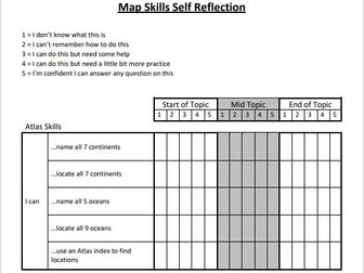
Self reflection sheet for KS3 map skills broken down by topic for students to rate themselves on their knowledge and confidence of aspects of the topic. Designed to use at the start of the topic to assess prior knowledge, half way through the topic to assess progress and gaps in knowledge, at at the end of the topic to aid revision or end of topic assessment. Self reflection covers atlas skills, map symbols, compass points, longitude and latitude, grid references, scale, relief and GIS. For rating: 1 = I don’t know what this is 2 = I can’t remember how to do this 3 = I can do this but need some help 4 = I can do this but need a little bit more practice 5 = I’m confident I can answer any question on this