Asia Map to Fill in and Learn – Blank Map with Countries and BordersQuick View
WorldMaps

Asia Map to Fill in and Learn – Blank Map with Countries and Borders

(0)
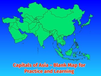
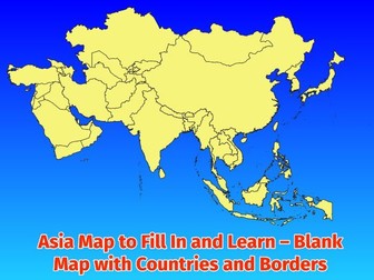
Asia Map to Fill In and Learn Blank Map with Countries and Borders for Students Do you want your students to learn Asian geography in a playful and effective way? This map package helps them become familiar with the countries and borders of the continent of Europe and consolidate their knowledge. Included: Blank map of Asia showing all countries and clear borders Solution with country names for easy self ‑ checking Versatile material suitable for different grade levels Encourages independent learning and strengthens geographic orientation Skills students will gain: Deepened knowledge of countries and their exact positions Improved geographic orientation and understanding of borders Independent learning through the included solution map Practice in map reading and interpretation
Capitals of Asia – Blank Map for Practice and LearningQuick View
WorldMaps

Capitals of Asia – Blank Map for Practice and Learning

(0)
Capitals of Asia – Blank Map for Practice and Learning This teaching resource offers a clear and student‑friendly way to learn and consolidate the capitals of Asia. With a blank map, students can work independently, check their knowledge, and strengthen their geographic orientation. What’s included: Blank map of Asia with all country borders – perfect for writing in the capitals Solution table with all countries and capitals for easy self‑checking PDF format – ready to print for classroom, homework, or homeschooling Versatile use: as worksheet, quiz, or learning game Suitable for different grade levels and learning stages Skills students will gain: Deepened knowledge of countries and capitals Improved geographic orientation through active map work Independent learning supported by the clear solution table Practice in map reading and application of knowledge in a playful way
Capitals of Africa – Blank Map for Practice and LearningQuick View
WorldMaps

Capitals of Africa – Blank Map for Practice and Learning

(0)
Capitals of Africa – Blank Map for Practice and Learning This teaching resource offers a clear and student‑friendly way to learn and consolidate the capitals of Africa. With a blank map, students can work independently, check their knowledge, and strengthen their geographic orientation. What’s included: Blank map of Africa with all country borders – perfect for writing in the capitals Solution table with all countries and capitals for easy self‑checking PDF format – ready to print for classroom, homework, or homeschooling Versatile use: as worksheet, quiz, or learning game Suitable for different grade levels and learning stages Skills students will gain: Deepened knowledge of countries and capitals Improved geographic orientation through active map work Independent learning supported by the clear solution table Practice in map reading and application of knowledge in a playful way
Africa Map to Fill In and Learn – Blank Map with Countries and BordersQuick View
WorldMaps

Africa Map to Fill In and Learn – Blank Map with Countries and Borders

(0)
Africa Map to Fill In and Learn Blank Map with Countries and Borders for Students Do you want your students to learn African geography in a playful and effective way? This map package helps them become familiar with the countries and borders of the continent of Africa and consolidate their knowledge. Included: Blank map of Africa showing all countries and clear borders Solution with country names for easy self ‑ checking Versatile material suitable for different grade levels Encourages independent learning and strengthens geographic orientation Skills students will gain: Deepened knowledge of countries and their exact positions Improved geographic orientation and understanding of borders Independent learning through the included solution map Practice in map reading and interpretation
Capitals of Europe – Blank Map for Practice and LearningQuick View
WorldMaps

Capitals of Europe – Blank Map for Practice and Learning

(0)
Capitals of Europe – Blank Map for Practice and Learning This teaching resource offers a clear and student‑friendly way to learn and consolidate the capitals of Europe. With a blank map, students can work independently, check their knowledge, and strengthen their geographic orientation. What’s included: Blank map of Europe with all country borders – perfect for writing in the capitals Solution table with all countries and capitals for easy self‑checking PDF format – ready to print for classroom, homework, or homeschooling Versatile use: as worksheet, quiz, or learning game Suitable for different grade levels and learning stages Skills students will gain: Deepened knowledge of countries and capitals Improved geographic orientation through active map work Independent learning supported by the clear solution table Practice in map reading and application of knowledge in a playful way
Europe Map to Fill In and Learn – Blank Map with Countries and BordersQuick View
WorldMaps

Europe Map to Fill In and Learn – Blank Map with Countries and Borders

(0)
Europe Map to Fill In and Learn Blank Map with Countries and Borders for Students Do you want your students to learn European geography in a playful and effective way? This map package helps them become familiar with the countries and borders of the continent of Europe and consolidate their knowledge. Included: Blank map of Europe showing all countries and clear borders Solution with country names for easy self ‑ checking Versatile material suitable for different grade levels Encourages independent learning and strengthens geographic orientation Skills students will gain: Deepened knowledge of countries and their exact positions Improved geographic orientation and understanding of borders Independent learning through the included solution map Practice in map reading and interpretation