 Quick View
ANCIENT EGYPT GEOGRAPHY AND THE RIVER NILE – COMPLETE TEACHING RESOURCE BUNDLE
Explore how the River Nile and Egypt’s geography shaped the development of ancient Egyptian civilisation.
This comprehensive teaching bundle combines illustrated lessons, printable worksheets, interactive notebook activities, historical images, task cards, digital classroom games and assessment materials.
Suitable for KS3 History, ancient civilisations topics and introductory World History lessons.
Click here to view PREVIEW of this bundle:
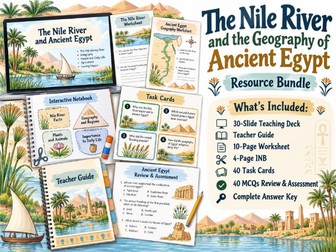
WHAT’S INCLUDED
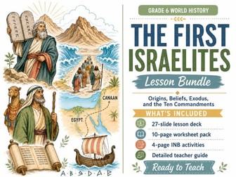
30-Slide Illustrated Teaching Presentation
30 Slide-by-Slide Teacher Notes
Comprehensive Teacher Guide with Historical Background
10-Page Printable Worksheet Pack
4-Page Interactive Notebook Activities
40 Printable Task Cards (10 Pages)
Interactive HTML Task Card Drawing Game
40 Multiple-Choice Questions Review and Assessment Pack
HTML Slideshow of 40 Multiple-Choice Questions
Collection of 20 Historical Images
Complete Answer Key
TEACHING PRESENTATION AND TEACHER SUPPORT
The 30-slide presentation introduces the geography of ancient Egypt, focusing on the Nile Valley, Nile Delta, Upper and Lower Egypt, annual flooding, agricultural seasons, irrigation, deserts, cataracts, transportation and trade.
Students investigate how Egypt’s natural environment influenced settlement patterns, food production, economic development and connections with neighbouring societies.
The presentation includes quick-review activities and an exit ticket.
The accompanying slide-by-slide notes provide historical explanations, discussion questions, teaching guidance and suggested transitions.
The comprehensive Teacher Guide includes classroom implementation strategies and extended historical background information to support lesson planning and delivery.
WORKSHEETS AND INTERACTIVE NOTEBOOK
The 10-page worksheet pack features a variety of activities, including reading comprehension, vocabulary, matching, sequencing, multiple-choice questions, cause-and-effect exercises, historical reasoning and written responses.
The four-page interactive notebook includes black-and-white cut-and-paste activities with shapes inspired by the lesson. Students complete individual notes before cutting them out and adding them to their notebooks. No folding or complicated assembly is required.
Both resources are suitable for independent work, classroom practice, homework and revision.
TASK CARDS AND DIGITAL DRAWING GAME
The collection includes 40 illustrated task cards arranged across 10 printable pages.
Students complete geographical challenges, historical scenarios, problem-solving activities and evidence-based questions exploring the relationship between the Nile and ancient Egyptian civilisation.
An additional HTML Task Card Drawing Game offers an interactive alternative for classroom projection and group activities.
REVIEW AND ASSESSMENT
The assessment pack includes 40 multiple-choice questions covering the main geographical and historical concepts taught throughout the lesson.
COMPLETE ANSWER KEY