Being A Geographer / Map skills / What is Geography - Year 7 KS3Quick View
Geogteacher123Geogteacher123

Being A Geographer / Map skills / What is Geography - Year 7 KS3

(0)
A fully resourced scheme of work titled Being A Geographer designed for Year 7 as a bridging unit between KS2 and KS3, covering a number of the geographical skills-based requirements for Key Stage 3 National Curriculum. The topic covers the content for atlas maps, OS maps, mental maps etc and a consideration of the different ‘strands’ of Geography. Each lesson has a clear Key Learning Question and is fully resourced with a: • PowerPoint presentation, worksheets, and activity sheets • Silent Starter activity e.g. low stakes quiz / retrieval practice • ‘Topic/Road map’ placing the lesson into context • ‘Silent and Sustained’ task to allow students time to demonstrate K+U and apply what they have learnt • Home-learning tasks Every 5-6 lessons, there is a planned ‘Learning Checkpoint’ – 10-minute formative assessment designed to check progress. At the end of the topic, there is a planned revision lesson, followed by a summative assessment that is ramped in difficulty (with accompanying mark scheme). The final lesson in the topic is a ‘Reflection lesson’ where students complete a KS3-friendly ‘exam wrapper- ‘style sheet to evaluate their own performance – and think about areas for improvements going into the next topic.
Where are the world's countries, continents and oceans? (part 1 of 2 lessons)Quick View
Geogteacher123Geogteacher123

Where are the world's countries, continents and oceans? (part 1 of 2 lessons)

(0)
KS3 Geography - “It’s Your Planet” Lesson 2: Where are the world’s countries, continents and oceans? (part 1 of 2 lessons) Fully-resourced lesson that includes: • Starter activity - Either a GEOG your memory (retrieval practice) task or self-assessment of home-learning task set previously • Main tasks 1-2: Building up a world map to show the continents and oceans • Main task 3: Atlas skills - adding the names of selected countries to the world map. • Silent and Sustained task: 10 short questions that require students to apply their learning from the world map activities. • Home Learning task: ‘Continents and Oceans’ consolidation activities plus extension - opportunity for further research.
GCSE Geography - Rivers Fieldwork Write Up Booklet (AQA, Edexcel + OCR)Quick View
Geogteacher123Geogteacher123

GCSE Geography - Rivers Fieldwork Write Up Booklet (AQA, Edexcel + OCR)

(0)
This booklet is aimed for those students following the Pearson Edexcel GCSE (9-1) Geography A specification- but can easily be adapted for AQA or OCR The booklet supports the post-field trip write up by students - and can be used in class or set as an extended piece of home learning. It covers each step of the the ‘route to enquiry’ and will help prepare students for their Paper 3 examination. There is a PDF version - and also a Word-version so that you can tweak it to suit you own fieldwork requirements i.e. adaptable for different specifications.
Leeds Case Study - Site, Situation and Population (Major UK city) - GCSE Changing CitiesQuick View
Geogteacher123Geogteacher123

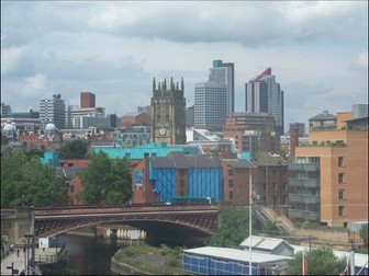
Leeds Case Study - Site, Situation and Population (Major UK city) - GCSE Changing Cities

(0)
Edexcel A - Paper 2 : Changing Cities This is the first lesson of the depth study of a major UK case study (the city of Leeds). The lesson is fully resourced with editable worksheets and learning materials. Structured lesson with clear KLQ (Key Learning Question), starter activity, student tasks, maths skills activities and SAS (silent and sustained) task in the form of practice exam questions Based upon the Edexcel A specification, but suitable for any GCSE Geography specification that requires a case study of a UK city.
How does climate, soils and altitude influence the distribution of large-scale ecosystems?Quick View
Geogteacher123Geogteacher123

How does climate, soils and altitude influence the distribution of large-scale ecosystems?

(0)
GCSE Geography - Edexcel A “Ecosystems, Biodiversity and Management” Lesson 2: How does climate, soils and altitude influence the distribution of large-scale ecosystems? Fully-resourced lesson that includes: • Silent starter activity - map interpretation activity • Main task 1: Completion of a mind map about how different physical factors affect the distribution of large-scale ecosystems • Main task 2: Photo/Fact-file carousel activity where students work in pairs/independently to complete an information table • Silent and Sustained task: Exam-style ‘maths’ questions linked to climate data for a Tropical Rainforest, followed by the setting of a home learning task that requires studesnts to compare climate graphs for different forest biomes.
Dynamic Landscapes (rivers, coasts, glaciation) - Scheme of Work for KS3 / Year 7-9Quick View
Geogteacher123Geogteacher123

Dynamic Landscapes (rivers, coasts, glaciation) - Scheme of Work for KS3 / Year 7-9

(0)
A fully resourced scheme of work titled Dynamic Landscapes designed for Year 7 (KS3) – and the lessons reflect the requirements for Key Stage 3 National Curriculum. The topic covers the NC core content for Coasts, Rivers and Glaciation (we currently deliver KS3 over 2 years, which means that we have re-written these topics so that all 3 can be covered in one half-term). Each lesson has a clear Key Learning Question and is fully resourced with a: • PowerPoint presentation, worksheets, and activity sheets • Silent Starter activity e.g. low stakes quiz / retrieval practice • ‘Road map’ placing the lesson into context • ‘Silent and Sustained’ task to allow students time to demonstrate K+U and apply what they have learnt • Home-learning tasks Every 5-6 lessons, there is a planned ‘Learning Checkpoint’ – 10-minute formative assessment designed to check progress. At the end of the topic, there is a planned revision lesson, followed by a summative assessment that is ramped in difficulty (with accompanying mark scheme). The final lesson in the topic is a ‘Reflection lesson’ where students complete a KS3-friendly ‘exam wrapper- ‘style sheet to evaluate their own performance – and think about areas for improvements going into the next topic.
Kagan Structures - manage matsQuick View
Geogteacher123Geogteacher123

Kagan Structures - manage mats

(0)
A set of 8 manage mats (for a class of up to 32 students). Each mat has a different combination of colours, letters and numbers to facilitate the selection f different groupings of students.
Geography Intent StatementQuick View
Geogteacher123Geogteacher123

Geography Intent Statement

(0)
Curriculum intent statement for Geography - fits on one side of A4. This resource is written for an 11-16 secondary with a 3-year KS4, but can easily be tweaked to suit an 11-18 institution and/or 2-year KS4. It is divided up into ‘curriculum vision’ and ‘curriculum rationale’, with footnotes of links to key documentation (e.g. D of E’s National Curriculum and the GCSE specification).
It's My Planet - Fully Resourced Scheme of Learning for KS3 / Year 7 GeographyQuick View
Geogteacher123Geogteacher123

It's My Planet - Fully Resourced Scheme of Learning for KS3 / Year 7 Geography

(0)
A fully resourced scheme of work titled ‘It’s My Planet’ designed for Year 7 (KS3) – and the lessons reflect the requirements for Key Stage 3 National Curriculum. The topic begins with a sequence of lessons where students learn about what Geography is – and where the world’s continents, countries and cities are located (using various geographical skills, including atlas skills and longitude / latitude). Students then complete a series of mini case-studies, learning about different parts of the world – developing their understanding for the subject. Each lesson has a clear Key Learning Question and is fully resourced with a: • PowerPoint presentation, worksheets, and activity sheets • Silent Starter activity e.g. low stakes quiz / retrieval practice • ‘Road map’ placing the lesson into context • ‘Silent and Sustained’ task to allow students time to demonstrate K+U and apply what they have learnt • Home-learning task Every 5-6 lessons, there is a planned ‘Learning Checkpoint’ – 10-minute formative assessment designed to check progress. At the end of the topic, there is a planned revision lesson, followed by a summative assessment that is ramped in difficulty (with accompanying mark scheme). The final lesson in the topic is a ‘Reflection lesson’ where students complete a KS3-friendly ‘exam wrapper- ‘style sheet to evaluate their own performance – and think about areas for improvements going into the next topic.
Ecosystems, Biodiversity and Management - Where are the world's large-scal eecosystems?Quick View
Geogteacher123Geogteacher123

Ecosystems, Biodiversity and Management - Where are the world's large-scal eecosystems?

(0)
GCSE Geography - Edexcel A “Ecosystems, Biodiversity and Management” Lesson 1: Where are the world’s large-scale ecosystems and what are they like? Fully-resourced lesson that includes: Silent starter activity - key word match-up Main task 1: Describing a choropleth map that show sthe global distribution of large-scale ecosystems (differentiated - ‘fill in the gaps’ sheet included) Main task 2: Create a factfile about each large-scale ecosystem Silent and Sustained task to apply learning: 3 x exam-style questions (+answers / students to self- or peer-asses)
Where are the world's countries, continents and oceans? (lesson 2 of 2)Quick View
Geogteacher123Geogteacher123

Where are the world's countries, continents and oceans? (lesson 2 of 2)

(0)
KS3 Geography - “It’s My Planet” Lesson 3: Where are the world’s countries, continents and oceans? (lesson 2 of 2) Fully-resourced lesson that includes: • Silent starter activity - RAG-rated retrieval quiz or self-assess Home Learning • Teacher-led introduction into latitude and longitude • Main task 1: Check on understanding (using mini-whiteboards) • Main task 2: Students use an atlas to locate 24 countries using lines of latitude and longitude • Silent and Sustained task: application of K+U (self- or peer-marking) • New Home Learning set - atlas skills crossword