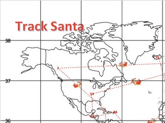
An atlas based activity which can be used as a Christmas themed lesson from KS2 - KS4. Comes with an A3 map of the world with numbers on to track where Santa has been. Students have to track where Santa has been and complete the answer sheet - a fun filled lesson for all students without being another Christmas Quiz!
Answer sheet also attached - this is all based on the Collins Atlas.
Includes students finding: Country, capital city, population, grid reference & flags.
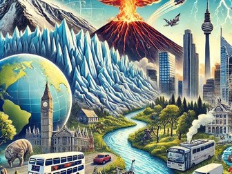
Complete Tropical Rainforests sequence of lessons for Unit 1, Section B of the AQA GCSE. The case study is Brazil.
The lessons included are detailed below.
Physical Characteristics of Rainforests
Adaptation and Biodiversity in Rainforests
Deforestation in Brazil: Introduction
Deforestation in Brazil: Causes
Deforestation in Brazil: Impacts
The Value of Tropical Rainforests
Sustainable Management of Tropical Rainforests
Hope this saves you some valuable planning time.
https://www.tes.com/teaching-resources/shop/markthegeographer
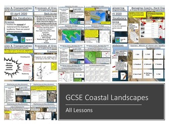
A bundle of all my coasts lessons prepared for the AQA specification, but still useful for other specifications.
Lesson titles in order are:
Types of Waves
Weathering and Mass Movement
Processes of Erosion and Transportation
Headlands and Bays
Wave Cut-Notches & Platforms, Stacks, Stumps and Arches
Longshore Drift and Deposition
Beaches and Sand Dunes
Spits and Bars
Coastal Landforms at Swanage
Hard Engineering
Soft Engineering
Managed Retreat
Coastal Management at Lyme Regis
https://www.tes.com/teaching-resources/shop/markthegeographer
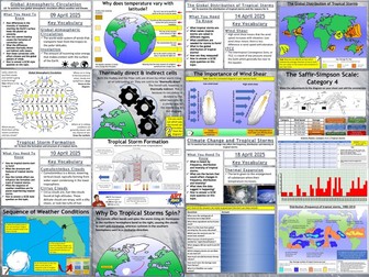
Complete Weather Hazards sequence of lessons for Unit 1, Section A of the AQA GCSE. Cyclone Idai is the case study tropical storm and Somerset Levels is the example of extreme weather in the UK.
The lessons included are detailed below.
Global Atmospheric Circulation
The Global Distribution of Tropical Storms
The Formation of Tropical Storms
Climate Change and Tropical Storms
Cyclone Idai: A Tropical storm
Reducing the Effects of Tropical Storms
Extreme Weather In The UK
The Somerset Levels Floods: 2014
Hope this saves you some valuable planning time.
https://www.tes.com/teaching-resources/shop/markthegeographer
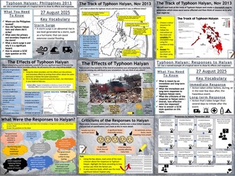
AQA GCSE Geography lesson for the new specification Unit 1A: In this lesson we look at a case study of Typhoon Haiyan.
The bundle contains two lessons.
**1. Typhon Haiyan 2013: Causes and effects. **We start with a short exercise where the students look at a photograph of destruction in Tacloban and list as many hazards and effects as they can think of. We then briefly look at the events of Typhoon Haiyan before writing a short paragraph describing its location. We then look at the causes and the students study a map of SST’s and then go on to annotate a map showing the track of the typhoon throughout the course of its life. We then look at the effects. The students complete a choropleth map (colouring by numbers) that shows the numbers of people affected and answer some questions regarding the map. We then watch a short clip of the effects and then annotate a photograph of the damage looking for primary and secondary effects. We finish with a GCSE-style practice question, using the same
photograph and there is some guidance and structure provided for the students.
**2. The Responses to Typhoon Haiyan. **There is a short, multi-choice retrieval practice starter before we begin based o the content learned last lesson. We start with the photograph we used in lesson 1, this time the students answer a question regarding immediate responses and what types of responses they think were undertaken in the wake of the typhoon. We then look at the actual responses and the students complete a worksheet that sorts them into immediate and long-term responses (some students will put them into chronological order). Following this we look at some of the criticisms of the responses and the students complete a highlighter activity to determine which were the most significant failings in the responses. We then tackle a 9-mark question and there is some guidance on the structure of their answers to help the students complete this.
Hope this saves you some valuable planning time.
https://www.tes.com/teaching-resources/shop/markthegeographer
A double sided A3 revision sheet to capture knowledge of the Rivers unit as part of Section C (Physical Landscapes) in the GCSE AQA (8035) Geography course.
Side 1 - processes, upper, middle, lower course landforms and formation
Side 2 - causes of flooding, impacts of flooding, flood management and hydrographs.
Can easily be used as a standalone resource or from using resources such as textbooks, revision guides and exercise book notes.
KS3 Geography Cover Work Worksheets | Independent Learning Tasks | Physical & Human Geography
This ready-to-use KS3 Geography cover work pack includes engaging and curriculum-aligned worksheets across a wide range of physical and human geography topics. Ai was used to help make these resources. Each worksheet is designed for independent learning, making it ideal for cover lessons, homework, revision, or distance learning — especially useful for non-specialist delivery.
Each worksheet includes:
Key knowledge from the KS3 geography curriculum
Retrieval tasks to reinforce prior learning
Short-answer and extended-response questions
Key vocabulary with definitions and usage support
Clear instructions for fully independent use
Printable and editable formats (Word/Google Docs)
Covers major KS3 geography topics including:
Weather and Climate
Rivers and Coasts
Natural Hazards
Population and Urbanisation
Development and Global Inequality
Resource Management and Sustainability
Map Skills and Fieldwork Techniques
These worksheets help students develop geographical knowledge, vocabulary, and key skills — supporting them in making connections between places, processes, and environments.
KS3 Geography, cover work, independent learning, geography worksheets, physical geography, human geography, retrieval, revision, homework, map skills, urbanisation, sustainability, weather and climate, rivers and coasts, editable resources
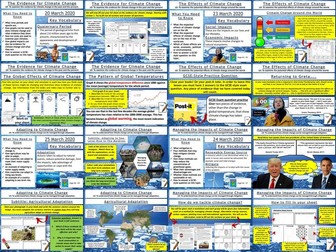
This bundle features all 6 lessons from the AQA GCSE Geography Unit 1A section on climate change. Each lesson has a variety of differentiated activities, exam questions with guidance, video clips and worksheets ready to photocopy or print.
The order of the lessons is:-
The Evidence for Climate Change
The Natural Causes of Climate Change
The Human Causes of Climate Change
The Effects of Climate Change
Managing the Impacts of Climate Change
Adapting To Climate Change
I hope this saves you valuable planning time.
https://www.tes.com/teaching-resources/shop/markthegeographer
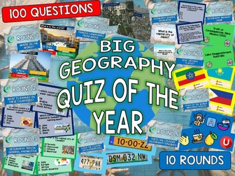
100 QUESTIONS!
10 rounds!
Brand new questions and rounds
ROUND 1: Where in the world?
ROUND 2: What is banned in these countries?
ROUND 3: Geography Trivia (General Knowledge- Multiple Choice)
ROUND 4: Guess the country car numberplates
ROUND 5: Guess the country Geography Dingbats
ROUND 6: Flags of the world (Multiple Choice)
ROUND 7: Real or Fake Places?
ROUND 8: Geography Memory Game (Video Fact Recall)
ROUND 9: Geography General Knowledge (Open Answer)
Round 10: Famous Landmarks from above
You can use this over multiple lessons or as one big end of term/year quiz!
6 festive rounds of 10 questions each.
Rounds include:
Festive UK place names, true or false?
Who are Santa’s neighbours?
Which countries have snow this Christmas?
Find the hidden country in the festive sentence?
Who sells Christmas to the UK?
World Christmas traditions, true or false?
All answers provided and incorporated into the interactive powerpoint.
Student answer sheet for all six rounds also included.
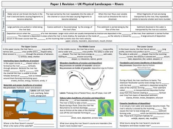
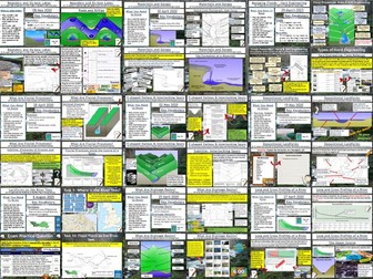
Complete sequence of lessons for the AQA GCSE Geography Unit 1, section C. The case study example of a river is the River Tees in North-East England and the example for flood management is Banbury.
Included are the lessons in this suggested sequence.
Drainage Basins
Long and Cross Profiles of a River
Erosion and Transportation
V-Shaped Valleys and Interlocking Spurs
Waterfalls and Gorges
Meanders and Oxbow Lakes
Depositional Landforms
Factors Increasing Flood Risk
Hard Engineering
Soft Engineering
Managing Floods at Banbury
Landforms of the River Tees
Investigating Rivers is a Geography unit suitable for KS2 (Y4-6).
The planning overview and topic title page can be downloaded for free here. Lessons include:
L1 - Understanding the water cycle
L2 - Identifying features of a river system
L3 - Identifying characteristics of the three stages of a river
L4 - Investigating features of the River Thames
L5 - Thinking about the different ways we use water
L6 - Understanding the impacts of floods and droughts
Each lesson includes a presentation and differentiated activities/worksheets.
If you like this resource, we would appreciate a review! We will happily send you a free resource in return for a review or useful suggestions/feedback. Contact us at ed@teachitforward.co.uk.
Complete sequence of lessons for Unit 2, Section B (The Development Gap) of the AQA GCSE. Jamaica is the case study for tourism.
The lessons included are detailed below.
What is the Development Gap?
Measuring Development
The Demographic Transition Model
Changing Population Structures
Wealth and Health
Migration
Foreign Investment and Industrial Development
Aid and Intermediate Technology
Fair Trade
Debt Relief and Microfinance
Tourism in Jamaica
Hope this saves you some valuable planning time.
https://www.tes.com/teaching-resources/shop/markthegeographer
Tropical Rainforests is a Geography unit designed for students in KS2 (Y3-6).
The planning overview, topic title page and a knowledge organiser can be downloaded for free here. Lessons include:
L1 – Locating tropical rainforests on a world map
L2 – Identifying tropical rainforest animals
L3 – Investigating the layers of a tropical rainforest
L4 – Exploring the Amazon rainforest
L5 – Understanding the impact of deforestation on the Amazon
L6 – Investigating how deforestation affects an Amazon tribe
L7 - Thinking of ways to help save tropical rainforests
Each lesson includes a presentation and differentiated activities/worksheets. A knowledge organiser is also included. All resources are compatible with both Microsoft Office and Google Workspace.
If you like this resource, we would appreciate a review! We will happily send you a free resource in return for a review or useful suggestions/feedback. Contact us at ed@teachitforward.co.uk.
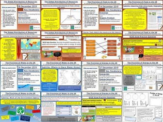
AQA GCSE Geography lessons for the Resource Management Section Unit 2C. All lessons are fully resourced, differentiated with a variety of activities and practice questions.
Lessons included are.
The Global Distribution of Resources
Provision of Food in the UK
Provision of Water in the UK
The Provision of Energy in the UK
I hope this saves you some valuable planning time.
https://www.tes.com/teaching-resources/shop/markthegeographer
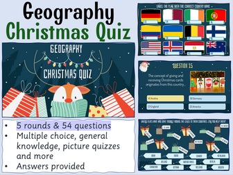
Celebrate Christmas this winter with your secondary Geography students with this 54 question xmas quiz for 2024 themed around the event complete with answers in both quick and question by question format. This resource is 54 question Xmas quiz spread across 5 different rounds. It is created on Microsoft Powerpoint and suitable for KS3 and KS4 secondary students.
Whats included?
Within this resource there are 54 questions spanning 5 rounds. A mixture of multiple choice, general knowledge and picture quiz questions. Topics range from Christmas traditions from around the world, flag picture round, capital city and country matchups, Christmas themed Geographical knowledge in addition to skyline picture round.Your learners will have so much fun engaging with this quiz.
Delivery and timings
The answers can then shared as a class by going through each question individually (ensure you are in present mode for the correct answer to colour yellow and the transitions to work) for students to peer or self mark. Additionally, answers to each individual question can be found on the notes section of each individual PowerPoint slide.
If you choose to deliver this in a single session - it could take upto (but not in excess of) an hour to complete depending on how much thinking time you decide to give your students. However, the rounds have been sectioned off within the Powerpoint so that you could potentially delivered a round or two at a time with your classes or tutor groups over the period of a week or two.
I really hope you enjoy this quiz activity. If you get the time, please leave a review - for a limited time I am offering a FREE copy of my Christmas Dingbats resource for every review left. So please leave your email address in the review so I can be sure to get this across to you!
Looking for more Christmas resources?
Check out this Christmas anagram worksheet activity
Humanities Christmas Quiz
Christmas Quiz
Christmas Dingbats resource
FREE Seek and Find Christmas resource
#geography #christmas #christmasquiz #xmas #xmasquiz #geographyquiz
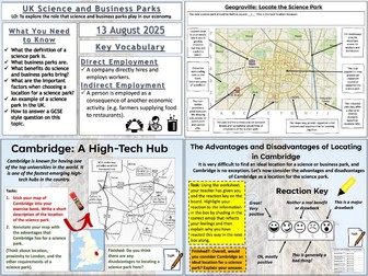
AQA GCSE Geography lesson for the new specification Unit 2B: In this lesson we examine the role that science and business parks play in our economy.
The lesson starts with a quick retrieval practice quiz. We then look at what a science park is and the students complete a cloze exercise whilst writing a short paragraph about science parks. We then consider a business park and the students have to work out the correct reasons for business parks locating on the outskirts of urban areas. The students then complete a decision making exercise called ‘Geograville: Where Should The Science Park Go?’. They annotate all the advantages the city has for a science park and then chose a suitable location and justify this. We then look at Cambridge. The students again annotate a map of the advantages of the location. They then complete an emoji exercise about the benefits and drawbacks of locating in Cambridge. We then finish with a GCSE-style practice question with some guidance.
Hope this saves you some valuable planning time.
https://www.tes.com/teaching-resources/shop/markthegeographer
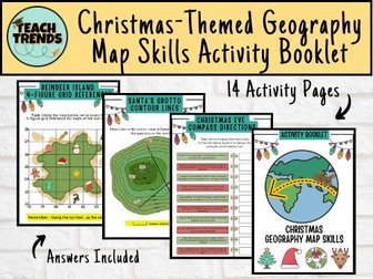
Are you ready to turn this holiday season into a global adventure for your young explorers? Introducing our enchanting Christmas-themed geography map skills activity booklet, specially crafted for curious minds aged 10-14!
Festive Learning Fun: Transform geography lessons into a holiday celebration! Each activity is designed to weave Christmas magic into essential map skills, making learning both educational and joyous.
Engaging and Age-Appropriate: Tailored for 9-12 year olds, our activities strike the perfect balance between challenge and entertainment. Watch as your child hones their map-reading skills while embracing the holiday spirit.
Santa’s Global Adventure: Follow Santa’s journey around the world! From the North Pole to bustling cities and exotic landmarks, each activity unveils a new destination, fostering cultural awareness and geographical knowledge.
Map Skills Included:
Grid References
Scale & Distance
Compass Directions
Contour Lines
Time Zones
A total of 14 activity pages with answers included.
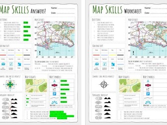
Up to date worksheet for map skills for any Geography curriculum and Key Stage.
Includes:
4fig grid references
6fig grid references
direction
compass
scale
map symbols
and more
9 rounds with 100 questions on countries, flags, catchphrase puzzles, country outlines, animal geography,silly UK place names, European capitals famous landmarks, silly UK place names true or false and hidden countries. Each round has the answers provided as well as blank templates for student answer sheets.
The quiz is designed to be accessible by students of all abilities, with some more straight forward questions and others set o challenge the most able.
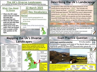
AQA GCSE Geography lesson for the 2016 specification Unit 1C. In this lesson we look at the Uk’s diverse landsacpes. It is the first lesson in Section C: The Physical Landscapes of the UK.
We start with a collection of photos of different landscapes in the UK to highlight the diversity of landscapes we have. We then complete a short cloze exercise paragraph on the different landscapes in the UK. The main task of the lesson involves using an atlas to complete the map on the A3 worksheet. Firstly the students colour the map according to the relief using colouring by numbers. They then locate the major upland / lowland areas of the UK using the descriptions in the boxes and their atlas. They can also locate some of the major rivers. There are also some extension questions using the information in the boxes. They then answer a 4-mark practice question using photos. There is some guidance on structure and points to use to help the students with this.
Hope this saves you some valuable planning time.
https://www.tes.com/teaching-resources/shop/markthegeographer
 Quick View