 Quick View
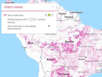
Discover deforestation using Global Forest Watch, GIS
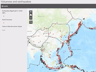
Complete lesson and project about deforestation using Global Forest Watch. Including a lesson plan, practice material and project description.
Order of project/lesson:
1. Introduce forest decline
2. Explore Global Forest Watch
3. Practice Using Global Forest Watch
4. Apply learned skills to present/write about problems in chosen area
5. Receive feedback from other group and give feedback
Background information about how to teach with GIS is included.