
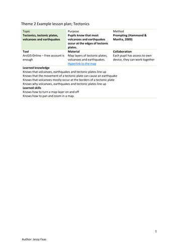
A short lesson about tectonics using ArcGIS Online - no licence needed. Students learn and see for themselves that most earthquakes occur at the edges of tectonic plates.
No real GIS knowledge needed, you have to be able to handle a computer and know how to pan and zoom and turn on/off layers on a map.
Background information about how to teach with GIS is included.
No real GIS knowledge needed, you have to be able to handle a computer and know how to pan and zoom and turn on/off layers on a map.
Background information about how to teach with GIS is included.
Something went wrong, please try again later.
This resource hasn't been reviewed yet
To ensure quality for our reviews, only customers who have purchased this resource can review it
Report this resourceto let us know if it violates our terms and conditions.
Our customer service team will review your report and will be in touch.
£3.50