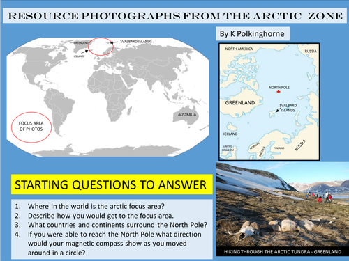

It's a cold and quite remote region. It is probably quite distant from your students. This unit is designed to assist teachers in Year 2 Geography-world geographical divisions. It provides maps, a graph and photographs of the Arctic zone (Svalbard and Greenland). Pages can be displayed on a whiteboard for student viewing and discussion. Basic questions are set so that students can gain an understanding of this environment. Maps allow conclusion of the relative location of the arctic region from the location of your students. Photographs/maps can be displayed and discussed. This is a standalone unit.
Something went wrong, please try again later.
This resource hasn't been reviewed yet
To ensure quality for our reviews, only customers who have downloaded this resource can review it
Report this resourceto let us know if it violates our terms and conditions.
Our customer service team will review your report and will be in touch.
£0.00