
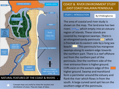
Study 1 in this series provides map and photograph evidence of a coastal region which includes an estuary, river inflows, and coastal landform variety with depositional features of beach and spit plus erosional features of cliff and wave cut platform. The aim is to help students recognise that the environment does contain a variety of identifiable features that do have inter connections. This unit is designed for use at Secondary levels in the study of landforms. Project the maps and diagrams and examine the physical geography of the area and understand why the landforms exist.
Something went wrong, please try again later.
This resource hasn't been reviewed yet
To ensure quality for our reviews, only customers who have downloaded this resource can review it
Report this resourceto let us know if it violates our terms and conditions.
Our customer service team will review your report and will be in touch.
£0.00