
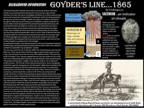
This is a follow up unit on Goyder's Line. It crosses the curriculum disciplines of colonial history and environmental Geography. Resources of map, photograph and graph are used to support the events that relate to the expansion of colonial farming frontiers north of Goyder's Line and onto the Willochra Plain. It touches issue of farming sustainability and the role of Colonial Government. It supports the relevance of Goyder's Line. This unit has a place in Unit 1 (sustainability) and Unit 3 (Land cover change/climate change) Senior Geography. This Line was ignored and even ridiculed by early farmers who moved beyond the Line encouraged by a Colonial Government wishing to encourage the extension of farming.
Something went wrong, please try again later.
This resource hasn't been reviewed yet
To ensure quality for our reviews, only customers who have downloaded this resource can review it
Report this resourceto let us know if it violates our terms and conditions.
Our customer service team will review your report and will be in touch.
£0.00