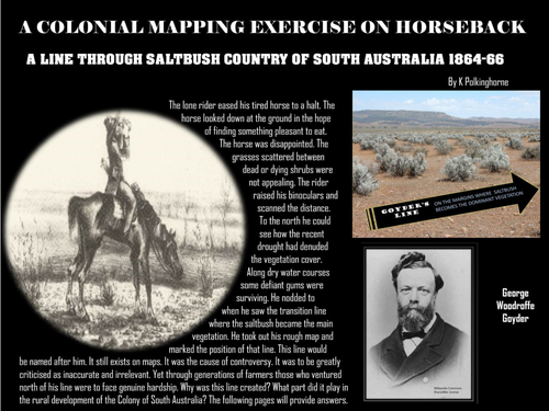


This unit has a focus on an important line drawn across the map of South Australia. It proved to be a useful line but it was a controversial line. The maps we have today have been drawn over time. Some have been produced by navigators from the decks of ships. Some have been drawn by explorers as they trekked across land. Here is a line on a map that was mainly produced by observations made during journeys on horseback. Just imagine how much harder it was to produce this line without the benefit of background statistics on environmental issues such as climate, soil types and vegetation patterns. Put into the context of history this line on the map has proved to be a remarkable achievement - though at the time it was considered insignificant. Why was this Line required? How was it developed? Why is it still featured on maps of South Australia? This study will answer these questions.
Something went wrong, please try again later.
This resource hasn't been reviewed yet
To ensure quality for our reviews, only customers who have downloaded this resource can review it
Report this resourceto let us know if it violates our terms and conditions.
Our customer service team will review your report and will be in touch.
£0.00