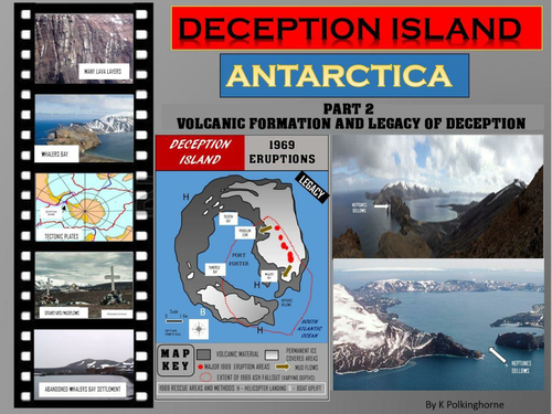

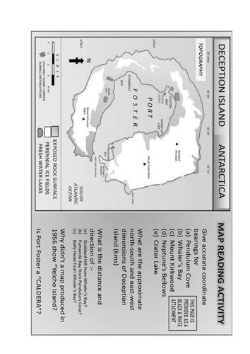
This unit can stand alone as a study of volcanic activity. It also leads on from part 1 which took students onto the island and recognised aspects of its volcanic origin. Through labelled diagrams the evolution of the islands through multiple volcanic intrusions is shown. Set questions provide an opportunity for teachers to check the level of student understanding. The final 2 pages - one in colour and one black and white copy- are provided as a map activity. The volcanic legacy explains why this island threatens human survival for those scientists in the research stations. You can follow this theme through to the final stage 3 title which deals with hazards, 1967 & 1969 eruptions shown on prepared maps. These lead to the evacuation and abandonment of permanent research settlements. Deception Island provides cross-curricula studies in geography of place/environment; history of settlements and hazard/disaster study. It appeals to students from junior to more senior levels.
Something went wrong, please try again later.
This resource hasn't been reviewed yet
To ensure quality for our reviews, only customers who have downloaded this resource can review it
Report this resourceto let us know if it violates our terms and conditions.
Our customer service team will review your report and will be in touch.
£0.00