
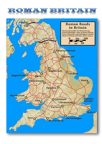
A map of Roman Britain showing the road network & major cities along with a compass marked with the 8 cardinal & inter-cardinal directions.
Questions focus on the direction required to travel between specified points or which point is reached by travelling in a specified direction.
Questions focus on the direction required to travel between specified points or which point is reached by travelling in a specified direction.
Something went wrong, please try again later.
This resource hasn't been reviewed yet
To ensure quality for our reviews, only customers who have downloaded this resource can review it
Report this resourceto let us know if it violates our terms and conditions.
Our customer service team will review your report and will be in touch.
$0.00