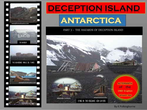

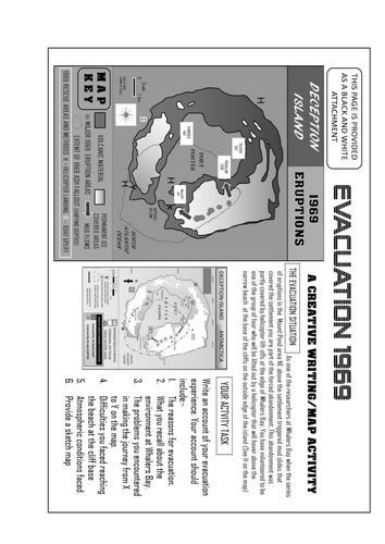
This is the final of 3 units on remote Deception Island in Antarctica. If your have a focus on islands, disasters or volcanic landforms this unit will provide useful resource material. In the 1960's the volcanic activity beneath the island and the ice covered slopes re-activated twice. On both occasions this activity placed research scientists on two of the Research bases in the path of considerable danger. Clear maps of 1967 and 1969 show the origin and the consequences of the volcanic activity. The 1969 eruptions caused the abandonment of two of the Research Stations. In addition, the remoteness and environment of the island proved to be a challenge for the necessary evacuation. By using maps, description and photographs students can "walk into" this disaster. The final page provides a map/description activity for students to work through the process of evacuation. Despite the difficulties no one died in the evacuation. Be prepared for danger and risk!
Something went wrong, please try again later.
This resource hasn't been reviewed yet
To ensure quality for our reviews, only customers who have downloaded this resource can review it
Report this resourceto let us know if it violates our terms and conditions.
Our customer service team will review your report and will be in touch.
£0.00