
This resource is a worksheet with a clear outline of a world map, on which children are challenged to draw key world rivers on. This can be used in a Water topic or to simply develop geographical knowledge / map reading skills.
Using atlases and/or Google Maps, the children will locate each river, match it to the area on their map and try to accurately draw it on and label it.
The rivers children are challenged to locate are:
1. Mississippi 4. Thames 7. Nile
2. Danube 5. Huang Ho 8. Niger
3. Ganges 6. Amazon
Using atlases and/or Google Maps, the children will locate each river, match it to the area on their map and try to accurately draw it on and label it.
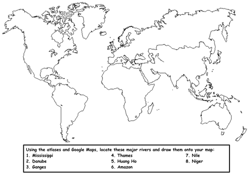
The rivers children are challenged to locate are:
1. Mississippi 4. Thames 7. Nile
2. Danube 5. Huang Ho 8. Niger
3. Ganges 6. Amazon
Something went wrong, please try again later.
This was exactly what I needed for my kids to locate and draw in rivers of the world. It's a Word doc, so I was able to add additional rivers to the worksheet.
Report this resourceto let us know if it violates our terms and conditions.
Our customer service team will review your report and will be in touch.
£0.00