
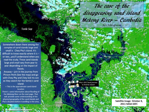
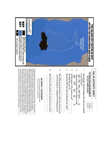

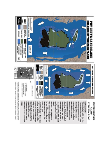
Rivers erode, transport load and deposit material. This is a study of a situation which illustrates the interrelationship between the Mekong River and the need for human adaptation the changing situations. To make the situation clearer this unit has a focus one one small sand island about 100 kilometres north of Phnom Penh - the Cambodian capital. Annual flooding from the Mekong River is embedded in the farming calendar and under normal flood levels farmers look forward to the time when flood waters cover some of their land. It brings the gift of added soil nutrients in the layers of sand and silt left on their land as the waters recede. However, for reasons explained, 2006 and 2011 brought more intense floods. The local farmers were given flood warnings as the Mekong floods entered the sand island areas. Many were evacuated and despite warnings there were casualties and significant damage. Join farmer Phy as he travels back to his sand island 6 years after the 2011 and see via maps what 2011 did to his sand island and his way of life. The attachment maps and the fill-in activity page are provided. Your students may well enjoy the journey to the island - but hopefully they will gain some understanding of farmer Phy's disappointment.
Something went wrong, please try again later.
This resource hasn't been reviewed yet
To ensure quality for our reviews, only customers who have downloaded this resource can review it
Report this resourceto let us know if it violates our terms and conditions.
Our customer service team will review your report and will be in touch.
£0.00