
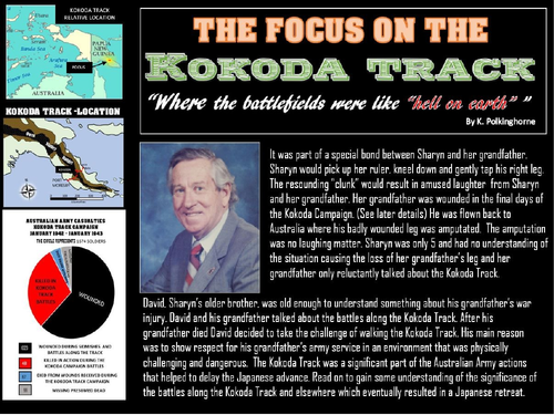
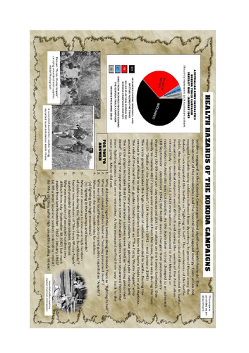
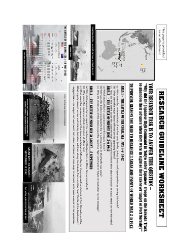
The Kokoda Track is a tourist challenging tourist attraction today. Passing through the Owen Stanley Ranges this Track was chosen by Japanese military commanders as the route for their proposed attack and planned control of Port Moresby. Projects and discuss the information provided an maps, diagrams and text to discover why the Kokoda Track became the locations of battles between Japanese troops and the Allied forces of Australia/United States. Become aware of the inhospitable environment endured by combat troops. Find out why, on the point of attacking Port Moresby the Japanese forces were ordered to withdraw. Use the selection of attachments to provide colour or black and white copies for students. Take part in the research worksheet providing a guideline for reasons for the Japanese withdrawal. If you want more visual material you can use the second unit entitled “Walking along the Kokoda Track in 2006”.
Something went wrong, please try again later.
This was a magnificent creation that can be used efficiently by students. MANY MANY THANKS. Lisa
Great information and easy to follow
Report this resourceto let us know if it violates our terms and conditions.
Our customer service team will review your report and will be in touch.
£0.00