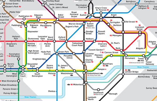
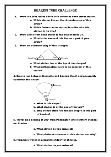

Bearings, scale measures, drawing triangles and sectors accurately are all used in this challenge based on a London tube map.
Students have to answer general knowledge questions along the route based on the tube stations they land on. The powerpoint is a set of slides with the constructions drawn on.
Something went wrong, please try again later.
I have the same question as SuzyW16 - as this map is not drawn to scale, how do you calculate the distance please?
Brilliant resource! I think Q1 should read diameter not radius and we used a scale of 3.8 miles : 1 cm.
I like this but I can't see a scale on the map, so when they have to draw a bearing for 31miles, they don't know how long to draw the line in cm.
Y10 will have the time of their lives :)
Great resource. Thanks
Report this resourceto let us know if it violates our terms and conditions.
Our customer service team will review your report and will be in touch.
£0.00